
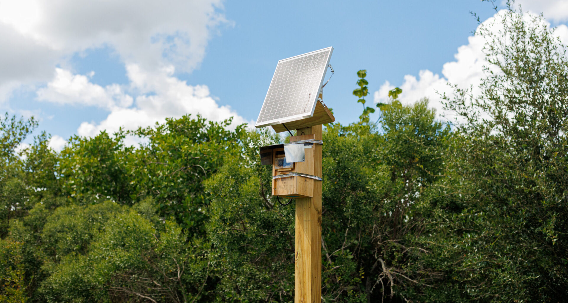
 The 37 cameras, developed by USF professor Barnali Dixon, take a photo every 15 minutes to collect data on water levels in common flood areas.
ORACLE PHOTO/JEANELLE HENDERSON
In 2023, researchers from the USF St. Pete began developing technologies to monitor floods, including cameras and an app.
Flooding in St. Petersburg is a recurring problem that usually happens over the summer and fall, as it is often caused by hurricanes and summer thunderstorms, according to the National Severe Storms Laboratory.
The water may take minutes, days or weeks to go away, and the flooding can damage homes, roads and property, according to the National Severe Storms Laboratory.
Trying to address this disaster, USF professor Barnali Dixon and her team developed static cameras to monitor flooding and collect data on water levels in Pinellas County.
Earlier this month, a camera was installed in Perry Bay View Park near Clam Bayou, according to Bay News 9.
Alec Colarusso, a PhD student at USF St. Pete working on the research, said the team chose that spot after the city of St. Petersburg recommended installing a camera there.
“It’s usually a nice coastal low-lying area,” Colarusso said. “There are flood protections in place, but most of the time they don’t always ideally work as well.”
Colarusso said the cameras they use are a Raspberry Pi — which is a small, low-power computer that can be programmed to control devices and perform specific tasks, according to the Raspberry Pi website.
“Think of your desktop, the computer you’re on right now, just very, very small. So it has limited capacity,” Colarusso said.
The team programs this computer to use a camera to take a photo every 15 minutes, and when it is not taking a picture, it is in a low-power mode.
“This allows us to be completely off the grid, so we can use solar and batteries, and take as many pictures as we need to ensure we’re getting constant coverage of that,” Colarusso said.
These cameras each take about 96 photos a day and operate 24 hours.
“Our goal over here is to collect people’s lived experience as a photograph, then use machine learning algorithms to make data out of it, so we can further validate and calibrate maps and models,” Dixon said.
Related: USF professor finds home elevation key to reducing flood damage in Tampa
The project includes a neighborhood reporting web app called Flood Report — Dixon calls it “WAZE for flooding”.
She said residents upload a real-time photo of flooding, warning others in the community to avoid that area, just like the traffic app Waze, according to the USF Newsroom.
Waze is a navigation app that provides real-time directions, traffic updates and road information based on users’ reports, according to the Waze Website.
Dixon said the pictures taken are used to cross-check the data from the Flood Report app and extract flood height using AI in order to have quality control of the data.
“These cameras [are] helping them see what is going on in their backyard, and especially the app, because [the] app actually helps neighbors help another neighbor,” Dixon said.
The project has 37 cameras feeding information to the Flood Report App, all placed around Pinellas County in flood-prone areas, according to USF St. Petersburg.
The camera locations were chosen using past flooding data and hurricane high watermarks with indications from flood managers from Pinellas County, cities and municipalities, according to USF St. Petersburg.
Dixon said another camera is waiting for contract approval to be installed in Riviera Bay.
Related: USF researchers develop app to monitor flooding during hurricanes
In 2023, Dixon received a $1.5 million National Science Foundation grant to conduct the research.
The U.S. National Science Foundation is an independent federal agency that funds research in science and engineering, according to the U.S. National Science Foundation.
However, this contract will not last long.
“The contract is going to be ending in 2026, and then the city and county hopefully will assume the operating costs for those cameras,” Dixon said.
Colarusso said the funding was very helpful in the beginning of the project as prototyping is labor-intensive.
“So we are able to keep the cameras running, even though we’re losing out on funding,” Colarusso said. “Most of that was just startup costs.”
Yet, Dixon said they are still waiting on funding to know if they will be able to add cameras in other counties.
Now that almost all the cameras are installed, Colarusso said he is looking forward to the point where they will be able to better serve the community beyond just data collection.
“Well, with the cameras, we now do have that information, and we’re better able to understand the flood depth and extent at these different locations, so that can improve flood forecasting and just knowledge of where flooding is,” Colarusso said.