
JACKSONVILLE, Fla. — Here’s what the First Alert Weather Team said you can expect for the First Alert Weather forecast:
Sunday was warm & even a bit humid with sun & cloudsRain & storms are pushing through SE GA this eveningA cold front plunges through tonightWhile there may be an isolated shower as the front passes through tonight, most spots stay dryTemps fall into the 40s by sunrise MondayMonday stays sunny, but it will be 20-30 degrees cooler than SundayTuesday morning drops to freezing, while Wednesday morning will be near freezing tooFrost looks patchy and isolated early Tuesday, but more widespread early WednesdayWe are not forecasting frost or freezes for the beaches of NE FLThe cold doesn’t last long – we’re well above freezing Thursday morningWe will be warm, near 80 degrees, next weekendWe’ll be keeping an eye on the next potential cold front and chance for rain next Sunday
WATCH THE FORECAST | DOWNLOAD THE APPS
Tropics:
Follow Action News Jax Meteorologists on Twitter for updates:
Mike Buresh | Garrett Bedenbaugh | Corey Simma | Trevor Gibbs
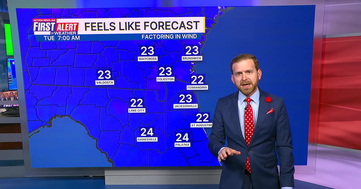
First Alert 7-day Forecast:TONIGHT: Shower/Storm Early, then Clearing. Dropping temps. Low: 46TOMORROW: Sunny, Windy & Cool. High: 59TUE: AM Inland Freeze, Sunny & Cool. 32/56WED: AM Frost & Freeze, Sunny. 33/69THU: Sunny. 44/74FRI: Mostly Sunny. 47/74SAT: Mostly to Partly Sunny. 48/77SUN: Partly Cloudy, A Few Storms. 55/78
ALLERGY TRACKER: See what the pollen counts look like in our area