
JACKSONVILLE, Fla. – The rest of the day will be clear and pleasant with temperatures in the 70s and 80s.
Tonight will be mostly clear and cool with temperatures in the 50s and 60s.
Coastal flooding will be possible through early this week around high tide, especially along the Saint Johns River.
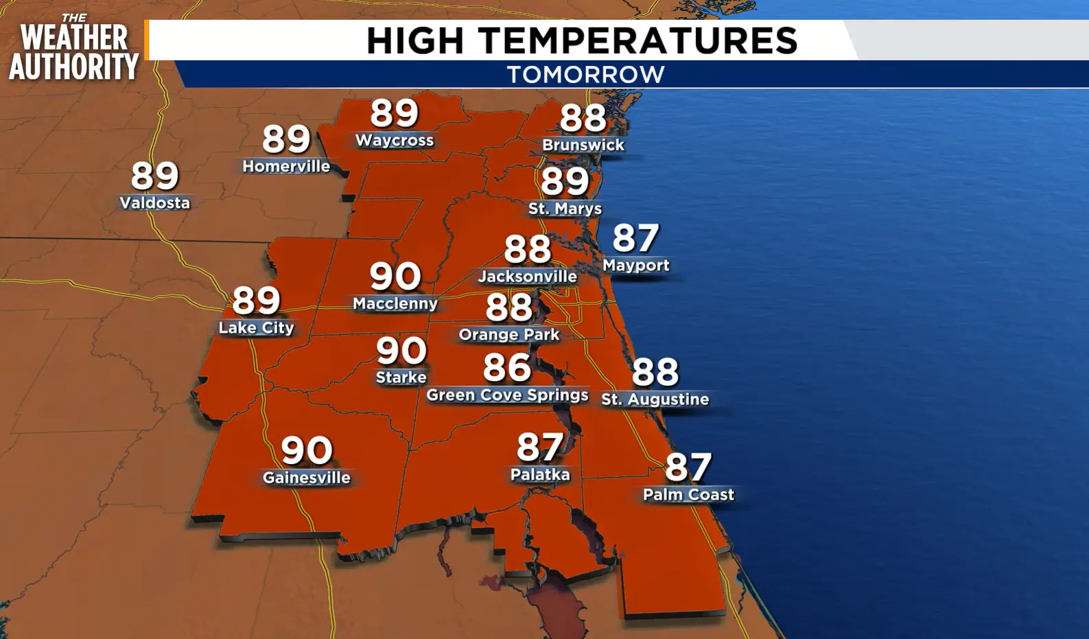 Monday’s forecast.
A strong area of low pressure near New England will continue to push drier air into our region early this week. This will keep temperatures in the mid to upper 80s with low humidity.
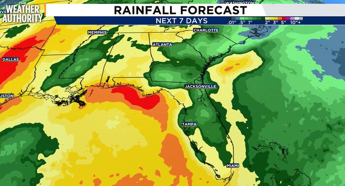
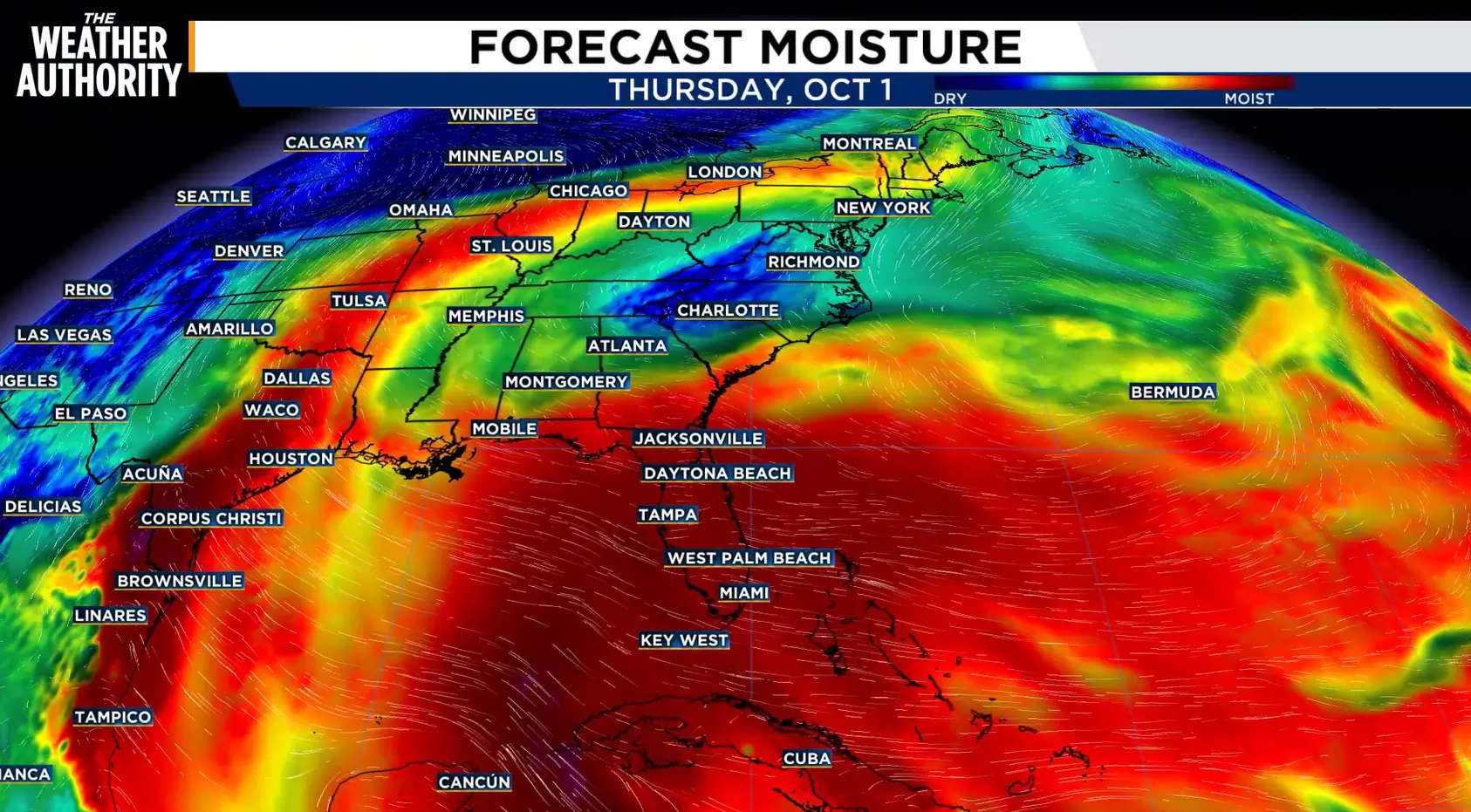 Humidity will build later this week along with higher rain and storm coverage.
Humidity will build later this week along with an increase in rain and storm coverage into the upcoming weekend.
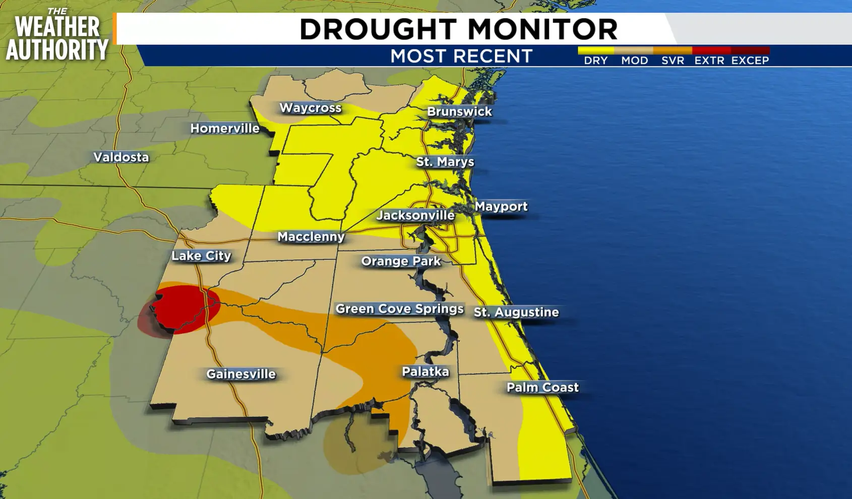 The latest drought monitor.
Regarding the drought, the latest drought monitor reflects improvement across our area. Several areas have been downgraded to the lowest category (abnormally dry).
TONIGHT: Mostly Clear. & Mild. Low 64.
MONDAY: Sun & Clouds. High 88, Low 67.
TUESDAY: Sun & Clouds. High 89, Low 70.
WEDNESDAY: Sun & Clouds. Mainly Dry. High 88, Low 71.
THURSDAY: Sun & Clouds. Scattered Rain & Storms. High 86, Low 72.
FRIDAY: Sun & Clouds. Scattered Rain & Storms. High 87, Low 73.
Copyright 2026 by WJXT News4JAX – All rights reserved.