
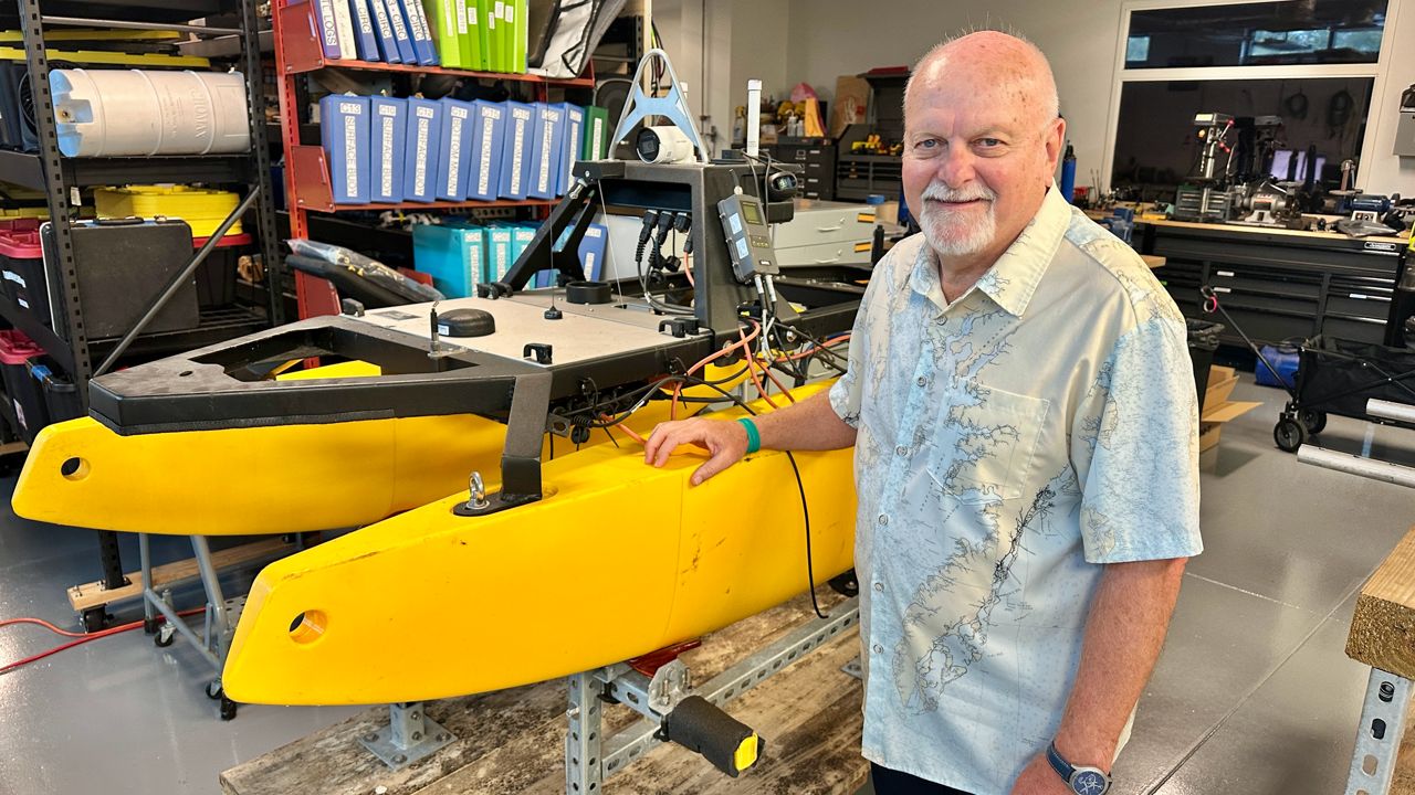
ST. PETERSBURG, Fla. — The University of South Florida’s College of Marine Science has been awarded an $8.5 million NOAA grant to expand its Tampa Bay seafloor mapping program for five more years, according to Professor Steven Murawski.
“We were able to convince NOAA that we should stay in business,” he said. “In spite of the fact that they knew that facilities were damaged (from a fire). They had enough confidence in us to actually do this.”
Accurate seafloor maps are vital for safe maritime transportation, storm surge forecasting and the region’s ocean economy. Professor Murawski is also director of the Center for Ocean Mapping and Innovative Technologies, or COMIT, and said the new funding comes as the program’s previous money ran out on Wednesday.
Murawski said the grant will allow researchers to continue their innovative work, which includes fusing various technologies.
“The data we get from airplanes, the data we get from satellites every day, plus the high-resolution information we get from mapping sonars and use AI to help sort of fill in the blanks,” he said. “Particularly in shallow water.”
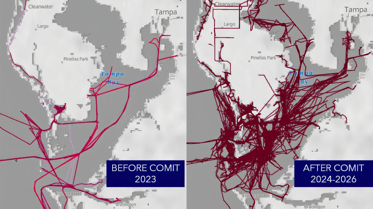
The left map shows how much of the seafloor was mapped before the COMIT program began. The right shows how much has been mapped in the past two years under the program. (USF College of Marine Science / Florida Flood Hub)
The program uses tools including a fully computerized, autonomous shallow-water robot developed to help map the Tampa Bay seafloor. Murawski said the work has direct implications for shipping safety and efficiency. He said 40 percent of the gas used in Florida comes through the Port of Tampa.
“The navigation imperative here is very high,” Murawski said. “We’ve got millions of tourists that go on cruise ships out of the Port of Tampa. You’ve also got a tremendous amount of material moving through the Port of Tampa, through Port Manatee, for example.”
COMIT Assistant Director Sherryl Gilbert said the program is also adding USF’s College of Engineering and College of AI and Cybersecurity. Gilbert said students involved in the program will receive cutting-edge training.
“We have the expertise in-house to kind of train the new workforce coming up,” Gilbert said. “They have field experience, data experience. And so we’re really trying to kind of push the needle for education moving forward.”
Murawski said better seafloor maps also improve storm surge projections during hurricanes.
“The shape of the bottom, like from an old map versus a new map, changes the tides, it changes the currents,” Murawski said. “It changes the amount of water that comes ashore.”
Researchers also update the maps after major storms because the Tampa Bay seafloor can change significantly. Murawski said some estimates show Hurricane Helene moved one-million tons of sand onto the beach.
Researchers have also enlisted citizens with boats to help map the Bay. Data loggers attached to those boats send back GPS positions and sonar soundings.
COMIT was first launched in 2020, with a $9 million award from NOAA.