
The Brief
A cold front will drop temperatures in Orlando and across Central Florida Monday night into Tuesday morning.
Orlando could set new daily records for cold temperatures.
How cold will it get? The low temperatures are expected to dip into the 30s and 40s in some spots.
ORLANDO, Fla. – A cold front arrives in Orlando and Central Florida on Monday, bringing with it arctic air that will drop temperatures to potentially near-freezing or below breezing in some spots for the next 48 hours.
Here is the forecast, timeline for when the coldest air arrives, and when it’s expected to warm up again.
Monday’s forecast: Cold air arrives in Orlando
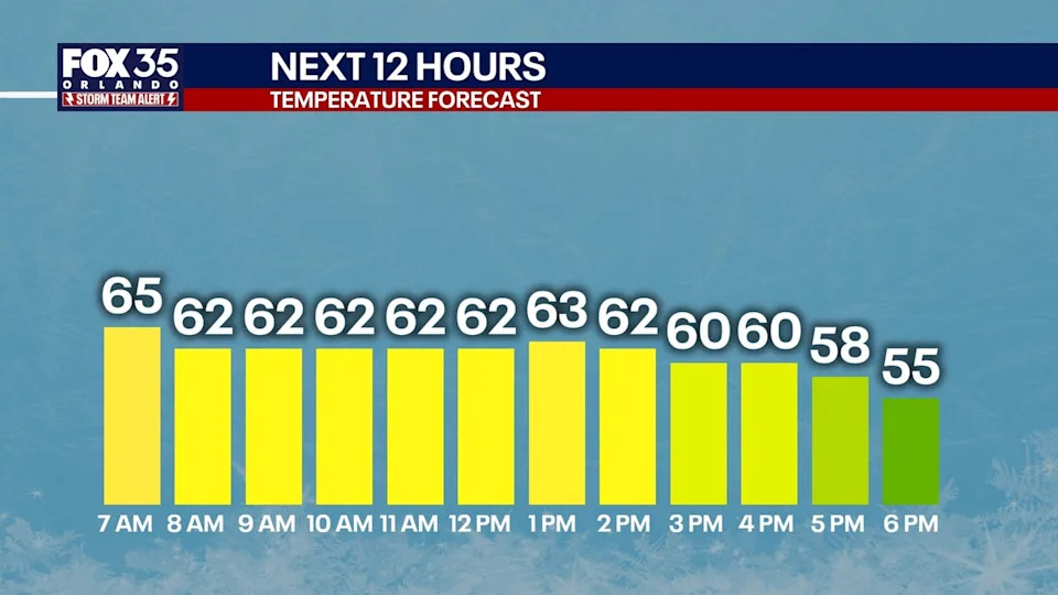
On Monday, temperatures will start in the 70s and drop to the 60s by the afternoon. Temperatures will then dip into the 30s and 40s Monday night and into Tuesday morning in Orlando and across the metro.
Winds will also increase to 25-30 mph.
 Timeline: Here is when the coldest air arrives
The coldest air of the season so far arrives tonight. This is when temperatures will plunge into the 30s. The coldest of the temperatures will take place just before sunrise on Tuesday morning, likely between 6 a.m. and 7 a.m.
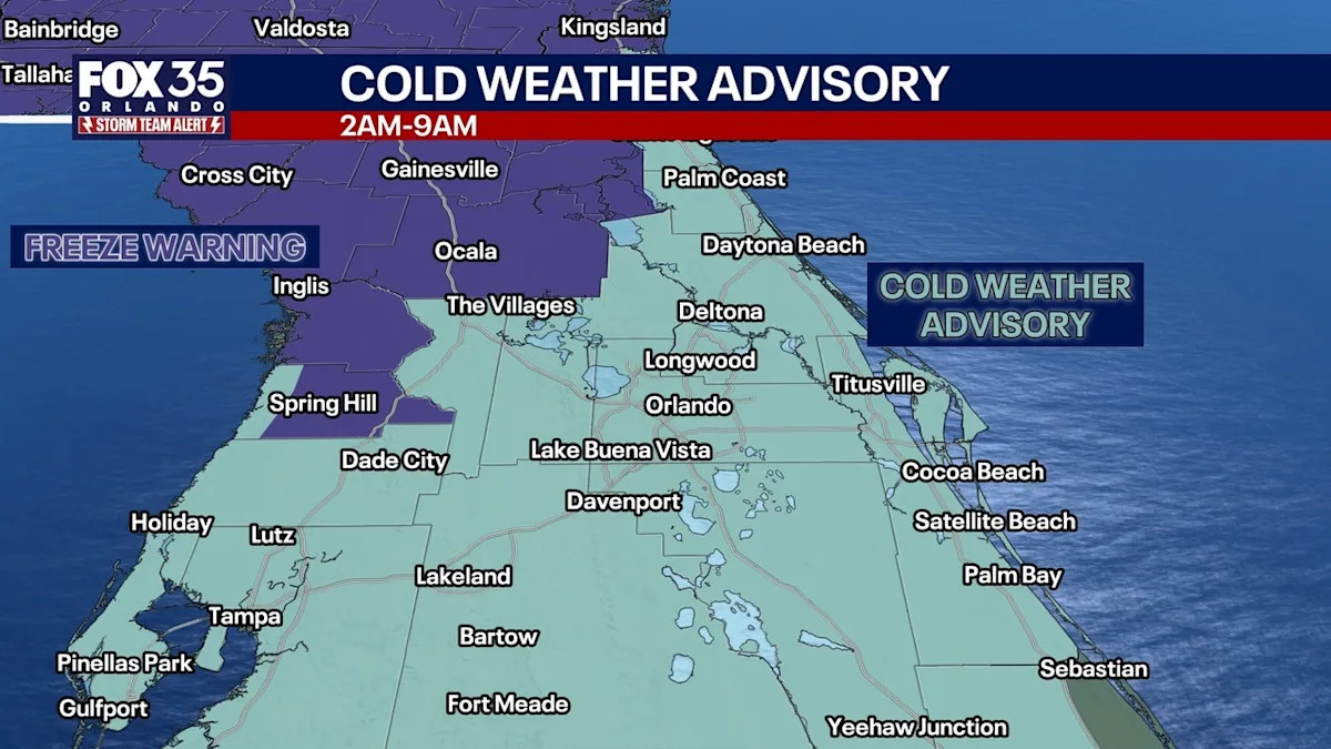
A cold weather advisory has been issued for Orlando and Central Florida for Tuesday morning, between 2 a.m. and 9 a.m. Marion County will be under a freeze warning from 2 a.m. – 8 a.m.
Where will the coldest air be?
The areas where it will be the coldest will be Marion County (Ocala) and Northern Sumter County (The Villages), where temperatures could actually dip to or below the freezing mark, which is 31-32°.
In Orlando and Central Florida, temperatures are expected to fall into the 30s and 40s. The entire region will see gusty winds up to 30 mph, which will mean wind chills in the 20s and 30s.
Records at risk of being broken
By the numbers
The Orlando area is expected to break daily temperature records on Tuesday:
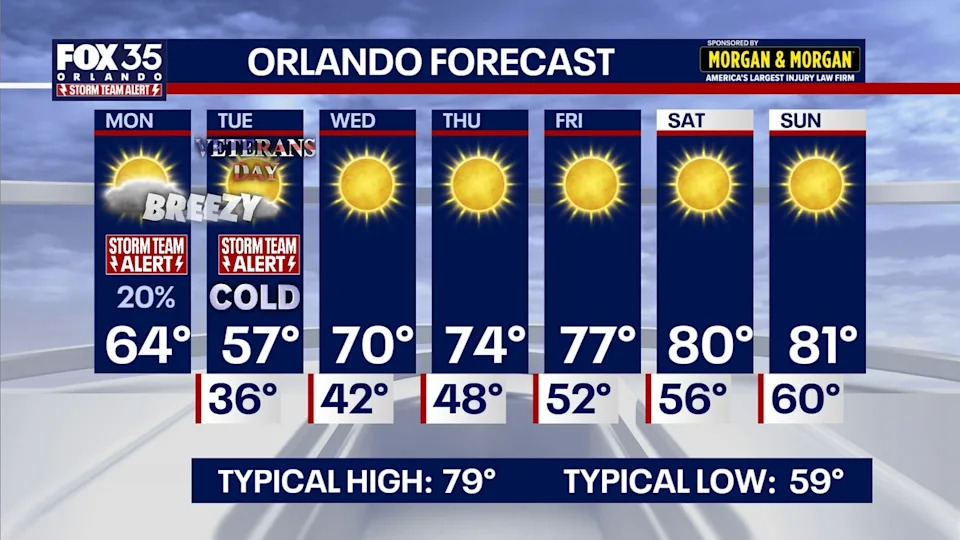
Record cold high: 61° (1913) – Our forecast high: 57°
Record cold low: 39° (1932) – Our forecast low: 36°
How long will the cold air last? When will it warm up again?
Weather whiplash continues this week across Central Florida. Afternoon highs tomorrow won’t make it out of the 50s! Orlando’s high temperature of 57° will be around 22 degrees below our average high of 79°.
Thankfully, the cold snap won’t last too long as temperatures will rebound steadily throughout the rest of this week. Wednesday’s temperatures will still remain cool, with lows starting the day in the 30s and 40s before climbing into the upper 60s and low 70s for highs.
The warming trend will carry into the weekend, with gorgeous weather starting Thursday and Friday with temperatures peaking around the mid 70s and then the low 80s for Saturday and Sunday. Sunshine will be plentiful between now and then with clear skies overhead.
The Source
This story was written based off information shared by the FOX 35 Storm Team.