
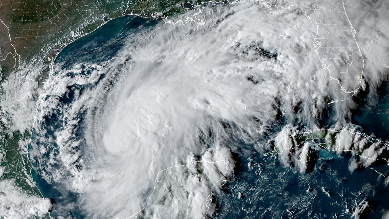
Tropical Storm Isaias, the ninth named storm of the Atlantic hurricane season, is quickly getting stronger in the Gulf and could become the season’s first hurricane by Thursday.
Isaias has sustained winds of 70 mph and is moving east-northeast at 9 mph. It is forecast to turn north on Thursday, a few hundred miles off the Louisiana and Mississippi coasts. Near-record warm Gulf waters are expected to fuel rapid strengthening before the storm makes landfall somewhere along the northern Gulf Coast.
Timing
The official track from the National Hurricane Center points to landfall between Mississippi and the Florida Panhandle late Friday or early Saturday. Heavy rain and strong winds are expected to spread inland through Saturday and Sunday.
Before landfall, the Gulf Coast faces a growing threat of storm surge flooding, high surf and dangerous rip currents, along with heavy rain and isolated tornadoes.
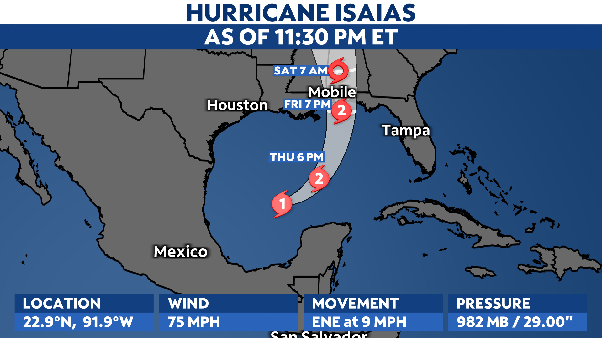
The cone of uncertainty displays where the center of a storm could be located. It does not predict what areas may feel the storm’s impact. Anyone outside, but near the cone, should be on alert and make storm preparations.
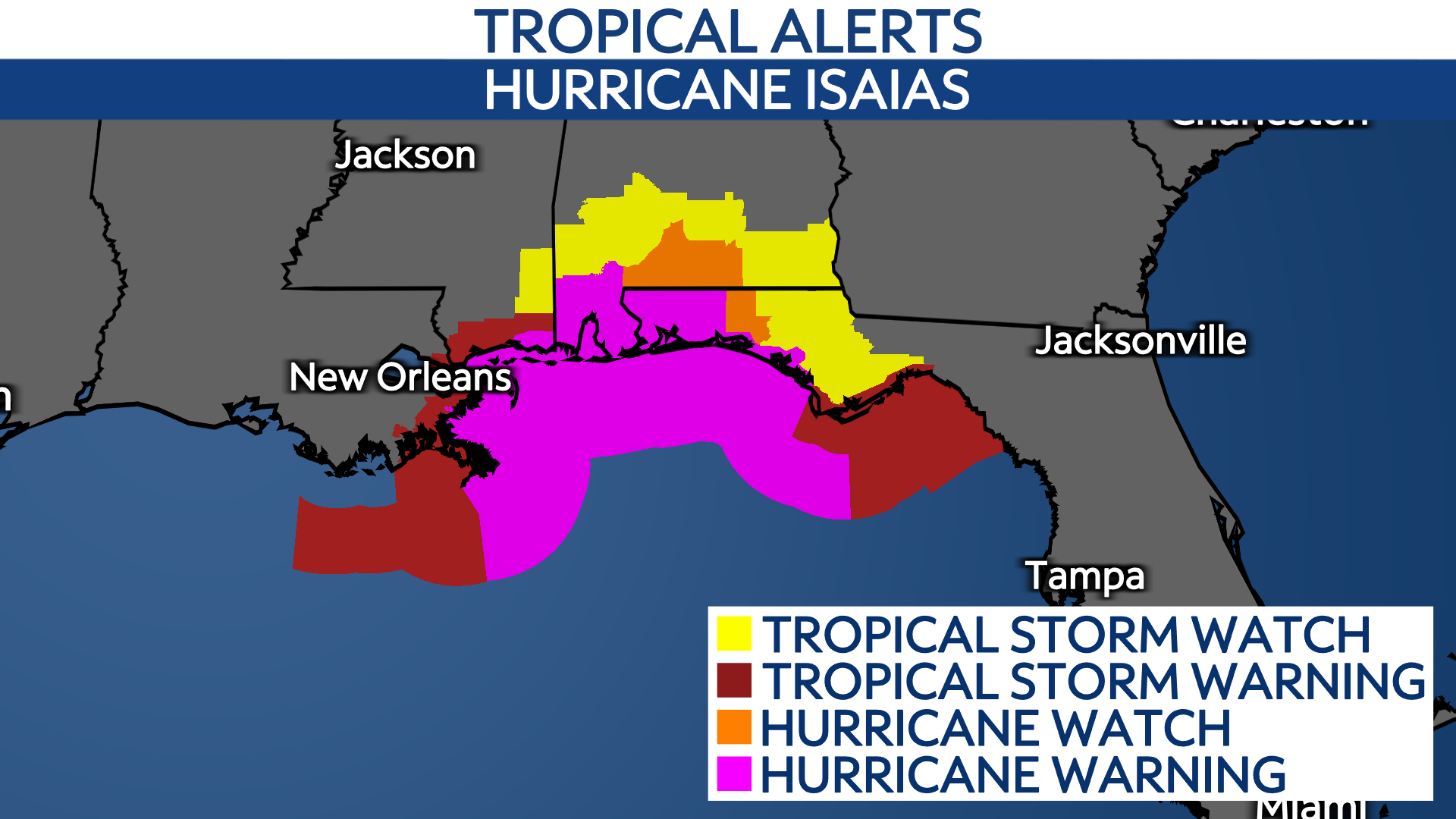
Ahead of landfall, Hurricane and Tropical Storm Watches are in place. Watches are issued when the weather conditions are expected within 48 hours.
A Hurricane Warning is in effect for
– Ocean Springs, MS to the Bay/Gulf County Line, FL
A Tropical Storm Warning is in effect for
– Jefferson/Plaquemines Parish Line, LA to west of Ocean Springs, MS
– East of Bay/Gulf County Line to Aucilla River, FL
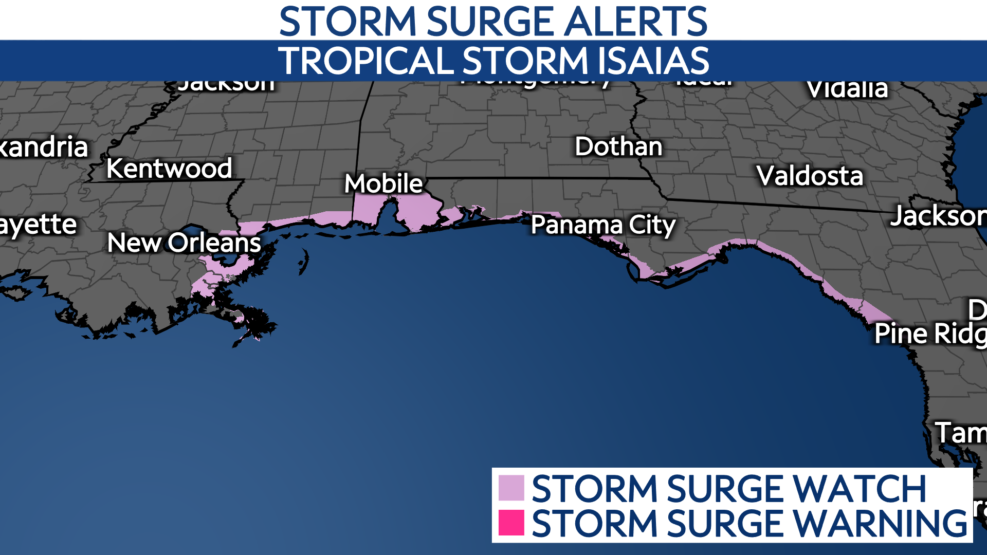
Storm Surge Watches are in place for areas along the northern Gulf Coast.
A Storm Surge Warning is in effect for
– Mouth of the Mississippi River to the Steinhatchee River, FL
A Storm Surge Watch is in effect for
– Steinhatchee River to Yankeetown, FL
What we can expect
The National Hurricane Center’s official forecast shows Isaias strengthening overnight and becoming a hurricane by Thursday. It may hold hurricane strength through landfall, but wind shear could weaken the storm as it nears the Gulf Coast.
Landfall isn’t the only thing to focus on. The worst weather in a tropical system is typically in the right semicircle, so impacts will reach well beyond the landfall point. If Isaias came ashore near Mobile, for example, coastal and inland areas of Mississippi, Alabama and Georgia would be affected too, including the potential for fast-moving tornadoes. The Storm Prediction Center has already flagged a severe weather threat for parts of the Southeast on Saturday.
After landfall, the remnants will move inland and bring impacts including flooding rain, strong wind and power outages, and isolated tornadoes to other areas, including Georgia and Tennessee.
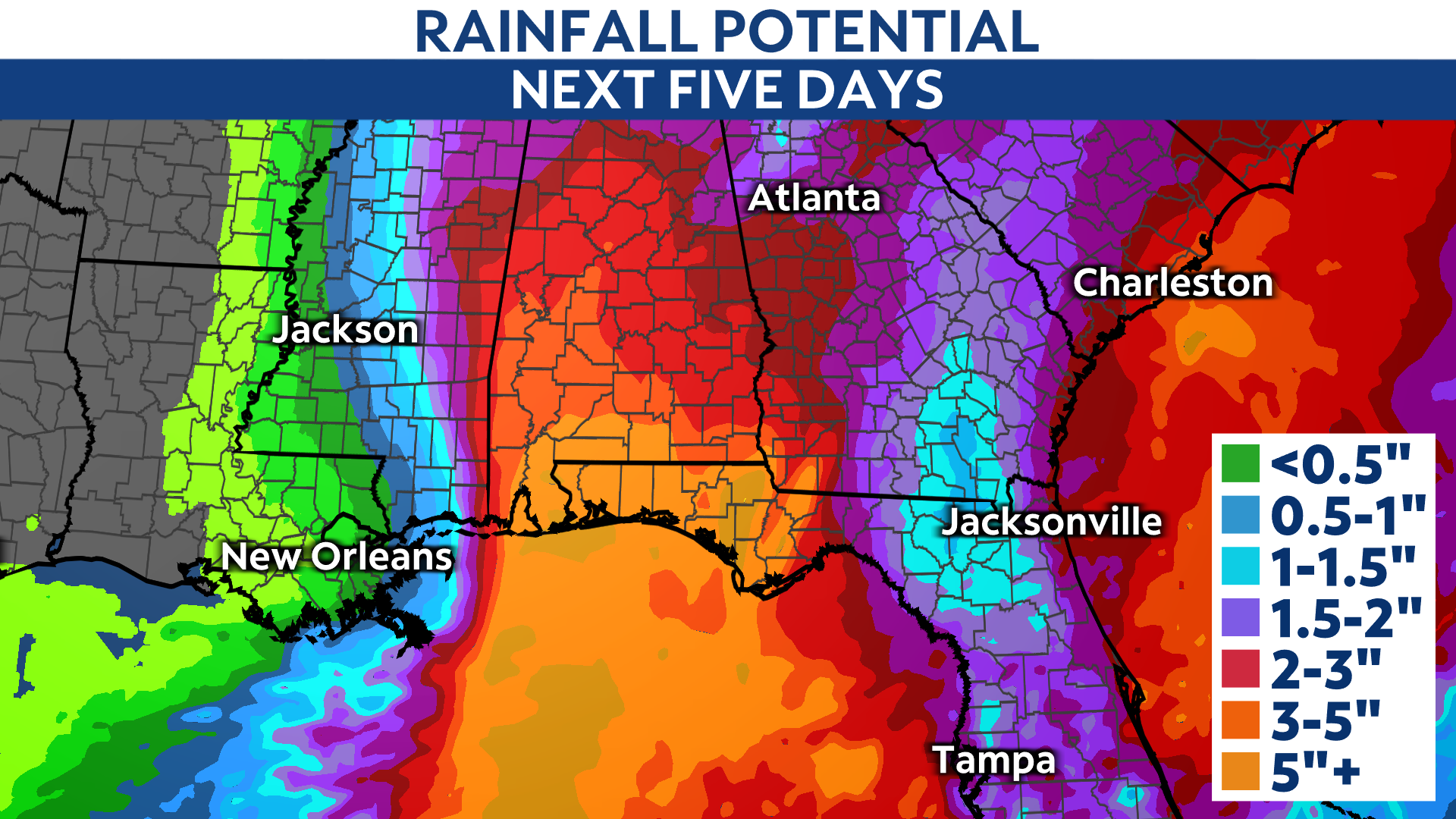
Heavy rain is likely, with early indications pointing to 3 to 5 inches along the Gulf Coast from Louisiana to the Florida Panhandle, spreading inland into Central Alabama.
People in the storm’s path should prepare for long-duration power outages, areas of flooding and lots of debris.
Preparations
Find tips to prepare before landfall, during the storm and in the aftermath.
The best way to stay updated on impacts in your area is to opt in to weather notifications.
Our team of meteorologists dives deep into the science of weather and breaks down timely weather data and information.