
PANAMA CITY, Fla. (WJHG/WECP) – A hurricane warning is in effect for many in Northwest Florida, according to the National Hurricane Center.
The Hurricane Warning is in effect for Bay, Walton, and Okaloosa counties. Tropical Storm Warning for Gulf and Franklin Counties.
10PM CDT, 10/07 UPDATE:
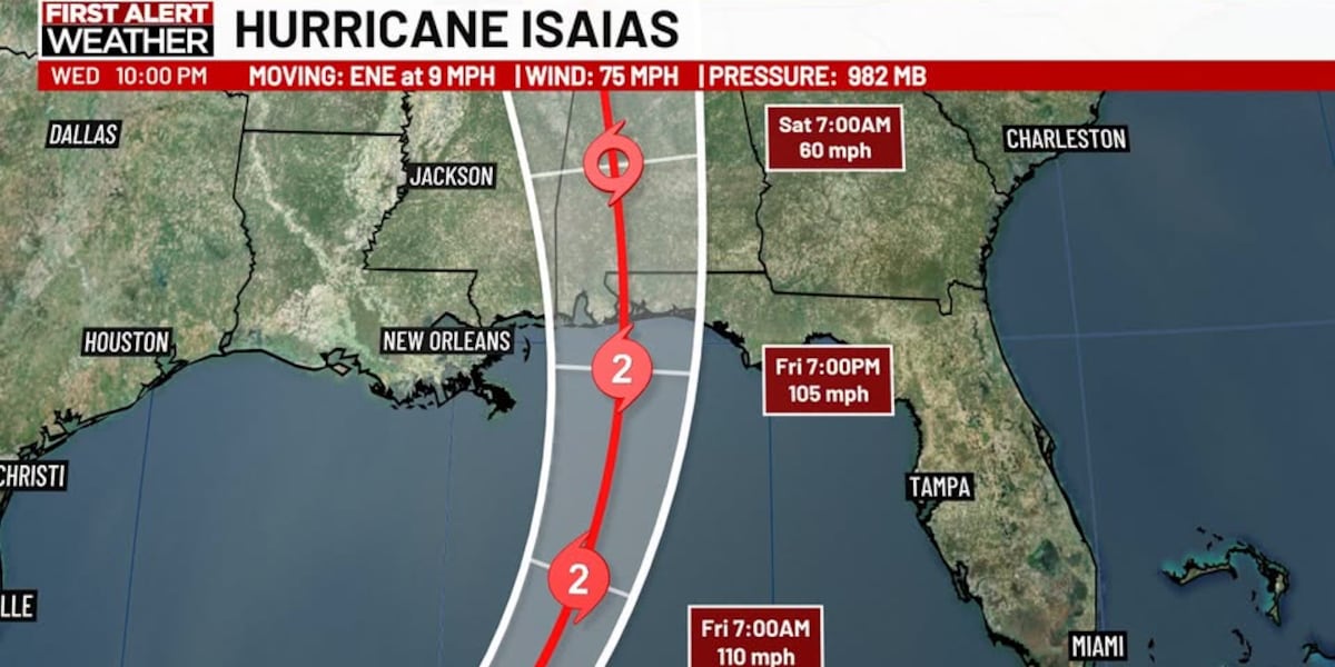
Isaias has strengthened into a hurricane with winds of 75mph winds, pressure at 982mb, and movement remains ENE at 9mph.
Hurricane Isaias is expected to continue strengthening over the next 24-48 hours to a Category 2. The NHC is keeping a strong Category 2 Hurricane at landfall as of its 10pmCDT Advisory and will monitor peak intensity trends ahead before any future adjustments are to be made. There is still a window for shear to create some weakening as it makes final approach into the Northern Gulf Coast. But most model guidance keeps Isaias as a hurricane at landfall.
Landfall is expected sometime late Friday into Friday night. The cone remains unchanged with potential for landfall between Biloxi, MS, to Panama City Beach, FL. Currently the storm remains on track with timing and the current cone. As of late Wednesday, this track and timing favor a faster moving solution among models which favors the system remaining a hurricane and a more easterly track in the cone.
IMPACTS: Storm surge is predicted to be 5-7ft from Pensacola to Indian Pass, and 4-6ft along Franklin County’s coastline. Coastal erosion and some inundation in low lying areas susceptible to surge will be likely. Tropical storm force winds of up to 74mph are going to be likely, especially in thunderstorm bands. If landfall were to occur in the Florida Panhandle those winds may pick up to 100-110mph near landfall. Severe storms will be possible in storm bands where tornadoes are possible, heavy rain of 4-6″, and locally higher amounts of 12+” may lead to flash flooding.
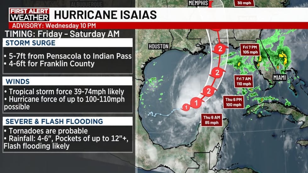 Hurricane Isaias(WJHG)
To stay up to date on all the latest news as it develops, follow WJHG on Facebook, Instagram and X (Twitter).
Have a news tip or see an error that needs correction? Email news@wjhg.com. Please include the article’s headline in your message.
Keep up with all the biggest headlines on the WJHG News app, and check out what’s happening outside using the WJHG Weather app.
Copyright 2026 WJHG. All rights reserved.