
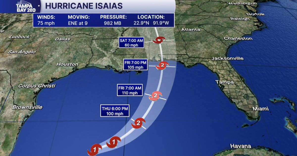
Isaias and is now a hurricane, the National Hurricane Center reports.
With maximum sustained winds of 75 mph, Isaias is the first hurricane of the Atlantic season.
Tampa Bay 28 Chief Meteorologist Denis Phillips shares his latest thoughts on tropical Gulf development and what to expect:
11:39 p.m. update:
Breaking: Isaias is now a hurricane with winds of 75 mph. Next track update will be at 5am.
WFTS
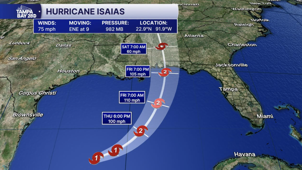
11pm update: No changes to the track. Winds are up to 70 mph. NHC now has Isaias a Cat 2 at landfall with winds around 105 mph. They never “officially” forecast Cat 3, but 110 is 1 mph shy of Cat 3 Major Hurricane Status. So for all practical purposes, it’s Cat 3. Either way, if you live between Pensacola and Mobile, take this storm seriously.
7 p.m. update:
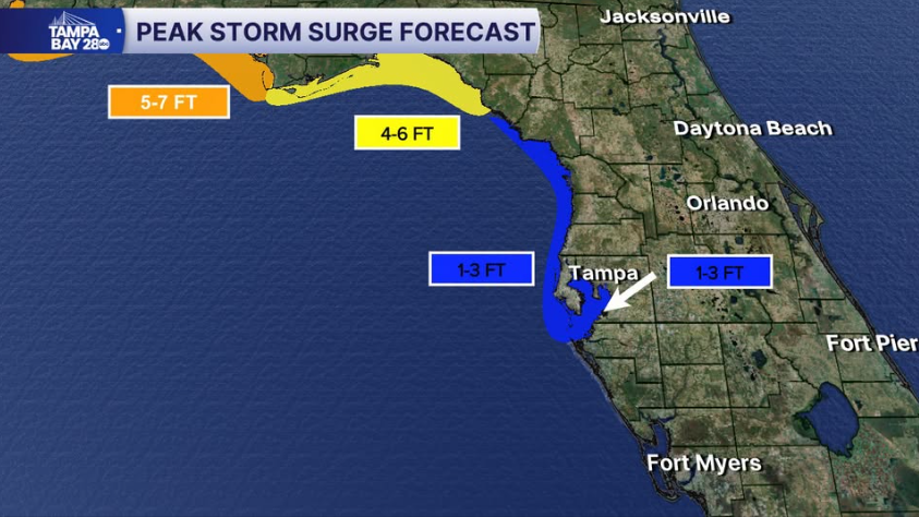
Looks like we could see some storm surge Friday into the weekend into the Tampa Bay. 1-3” feet if the slightly easterly track holds.
WFTS
5 p.m. update:
As of the 5 PM update from the NHC, Isaias has strengthened to winds of 65 mph. Still forecasted to become a hurricane as early as tomorrow morning.
3 p.m. update:
Isaias now has winds of 50 mph. There will be NO impacts for the Tampa Bay area.
I suspect we not only have the season’s first hurricane, it is entirely possible this becomes a major hurricane. Residents along the Northern Gulf Coast from Pensacola to Mobile Bay will likely see hurricane conditions starting Friday afternoon or evening. Tropical Storm winds arrive earlier. There’s a good chance Isaias starts to weaken some upon landfall as it encounters some pretty solid shear.
I’ll have a new update at 5 p.m. when the NHC issues an updated track.
2 p.m. update:
Isaias now has winds of 50 mph. There will be NO impacts for the Tampa Bay area.
I suspect we not only have the season’s 1st hurricane, it is entirely possible this becomes a major hurricane. Residents along the Northern Gulf Coast from Pensacola to Mobile Bay will likely see hurricane conditions starting Friday afternoon or evening.
Tropical Storm winds arrive earlier. There’s a good chance Isaias starts to weaken some upon landfall as it encounters some pretty solid shear.
I’ll have a new update at 5 p.m. when the NHC issues an updated track.
Along with hurricane and tropical storm watches, surge watches have been issued from the Florida Big Bend west to southeast Louisiana. A storm surge of 5-7′ is possible near and east of where the center makes landfall.
Here is the latest Tropics update from Tampa Bay 28 Meteorologist Ally Blake:
Tracking the Tropics | Oct. 7, evening update
HURRICANE RESOURCES

‘My heart breaks’: Woman describes helping injured students after deadly school bus crash in Polk County
A woman on her way to work Monday morning found herself helping injured Winter Haven High School students after a school bus crash that killed two people.
Woman describes helping injured students after deadly school bus crash in Polk County