
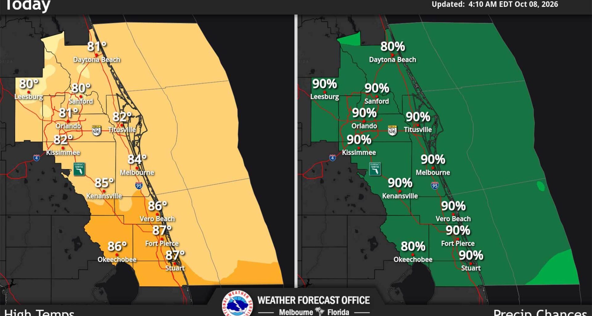
The sluggish cold front that has dropped torrents of rain over Central Florida this week continues to move slowly, stalled over the Treasure Coast on Thursday, meaning another day of high rain chances, according to the National Weather Service in Melbourne.
“Rinse and repeat today, as deep moisture remains present over the Florida peninsula,” forecasters said.
Rain chances are from 80% to 90% for the region with another 2-4 inches forecast bringing a marginal risk for excessive rainfall and some minor flooding.
The highest totals will be more south of Orlando in the afternoon and evening with showers and thunderstorms looking to move offshore later tonight, but some scattered storms could be possible north of I-4 overnight.
The front is forecast to lift northward and could mean increased winds along the Volusia County coast this afternoon into tonight.
That boundary means the beaches will be at a high risk for rip currents and rough surf.
Temperatures meanwhile will top out in the lower 80s north of Melbourne, but some breaks in the clouds could bring them into the mid 80s to the south, and muggy conditions will have heat indices into the upper 90s and lower 100s on the Treasure Coast.
Hurricane Isaias will have little effect on Central Florida, but expect gusts of 20-25 mph on Saturday and another potential for rain, with totals from Friday and Sunday closer to 1-1.5 inches or less. Saturday could see widespread totals, though, of 1-3 inches.
“The highest totals on Friday will likely be north of I-4, closer to the front as it lifts northward. That area remains in a marginal risk for
excessive rainfall to end the week,” forecasters said.