
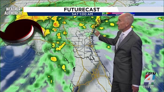
Update: Heavy rain continues for Duval and Nassau counties. 1 to 3 inches of rain has fallen over the last couple of hours with ongoing flooding in affected areas. Lightning and gusty winds will be possible as these storms continue through midnight. Flash Flood Warning through 2:45 a.m. for areas of eastern Duval and Nassau counties.
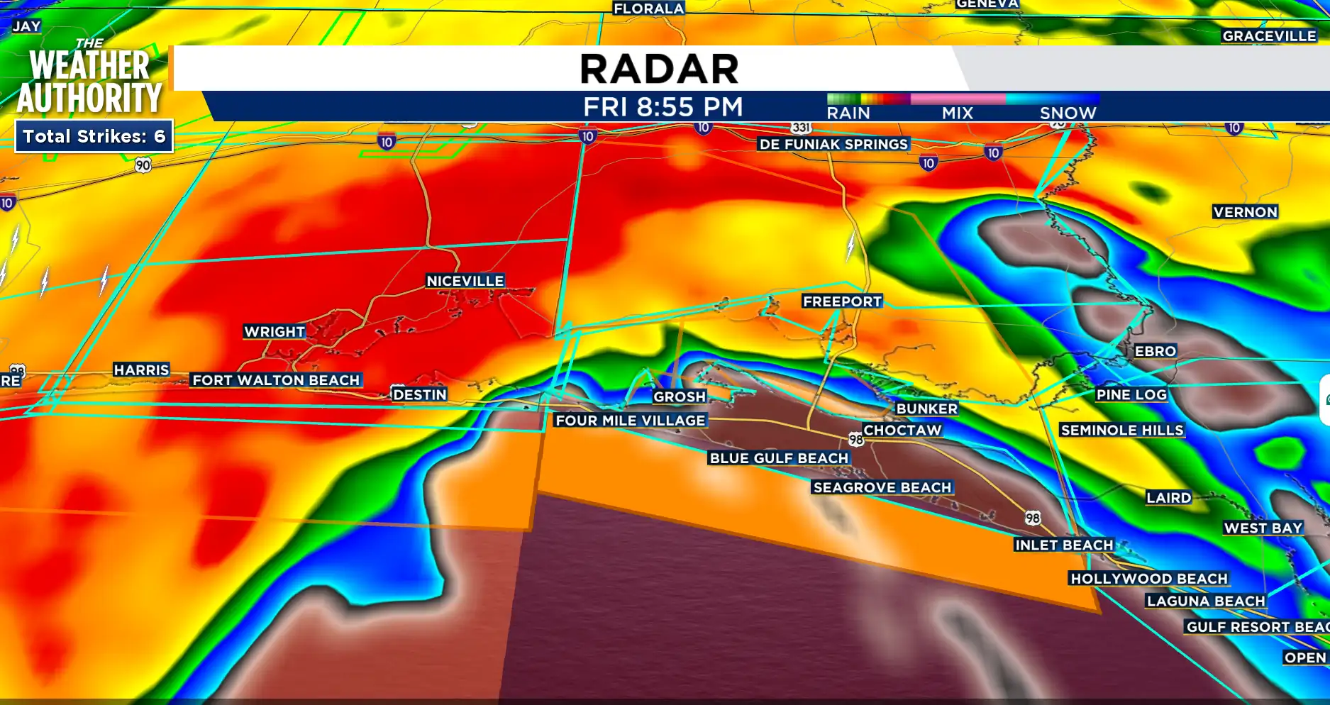
Exact Track 4D shows that Hurricane Isaias made landfall near Destin, Florida, around 8:30 p.m. with maximum sustained winds of 105 mph. The estimated minimum central pressure was 971 mb.
 . (.)
. (.)
A Tornado Watch for our area, along and near I-75 has expired.
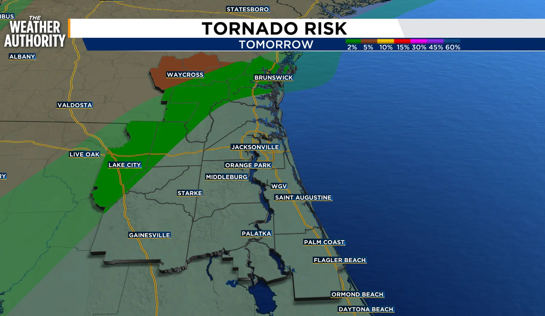
The chance of tornadoes moves north on Saturday with a 2 percent chance from I-75 to Brunswick and a 5 percent chance for northern Ware County.
The potential for strong to severe storms will continue tonight across northeast Florida and through early afternoon Saturday across southeast Georgia. The strengthening onshore winds will continue surf zone risks and tidal flooding along area waterways.
 . (.)
. (.)
Isaias made landfall tonight around 9 p.m. near the projected impact point of Fort Walton Beach and Gulf Breeze, FL. The storm will track inland over the Panhandle and into Alabama as Isaias weakens to a Tropical Storm around 8 a.m. on Saturday.
One more round of potentially strong to severe storms will be possible as the cold front, associated with the weakening of Isaias, will sweep through the area Sunday afternoon.
Drier and warmer weather will settle in next week as puddles and the river levels slowly recede.
Coastal Flood Advisory remains in effect through 2 p.m. Saturday.
Flood Watch will be in effect through 2 a.m. Saturday
Tonight: Scattered showers with storms possible overnight.
Saturday: Strong to isolated severe storms possible through early afternoon, 70-100 percent for SE GA, 60 – 70 percent for NE FL. Lows in the upper 60s and 70s. Highs in the 80s to low 90s. Wind: SE 15-20 mph.
Sunday: Isolated showers and thunderstorms will be possible as a cold front moves through Sunday afternoon. Rain chances, 30-50 percent. Locally heavy rain with flooding will be possible. Lows in the 70s. Highs in the 80s. Wind: SW 10-15 mph.
We will leave the deluge behind next week as drier weather conditions settle in with high pressure building over the region through midweek.
Sunrise: 7:26 a.m.
Sunset: 7:01 p.m.
Copyright 2026 by WJXT News4JAX – All rights reserved.