
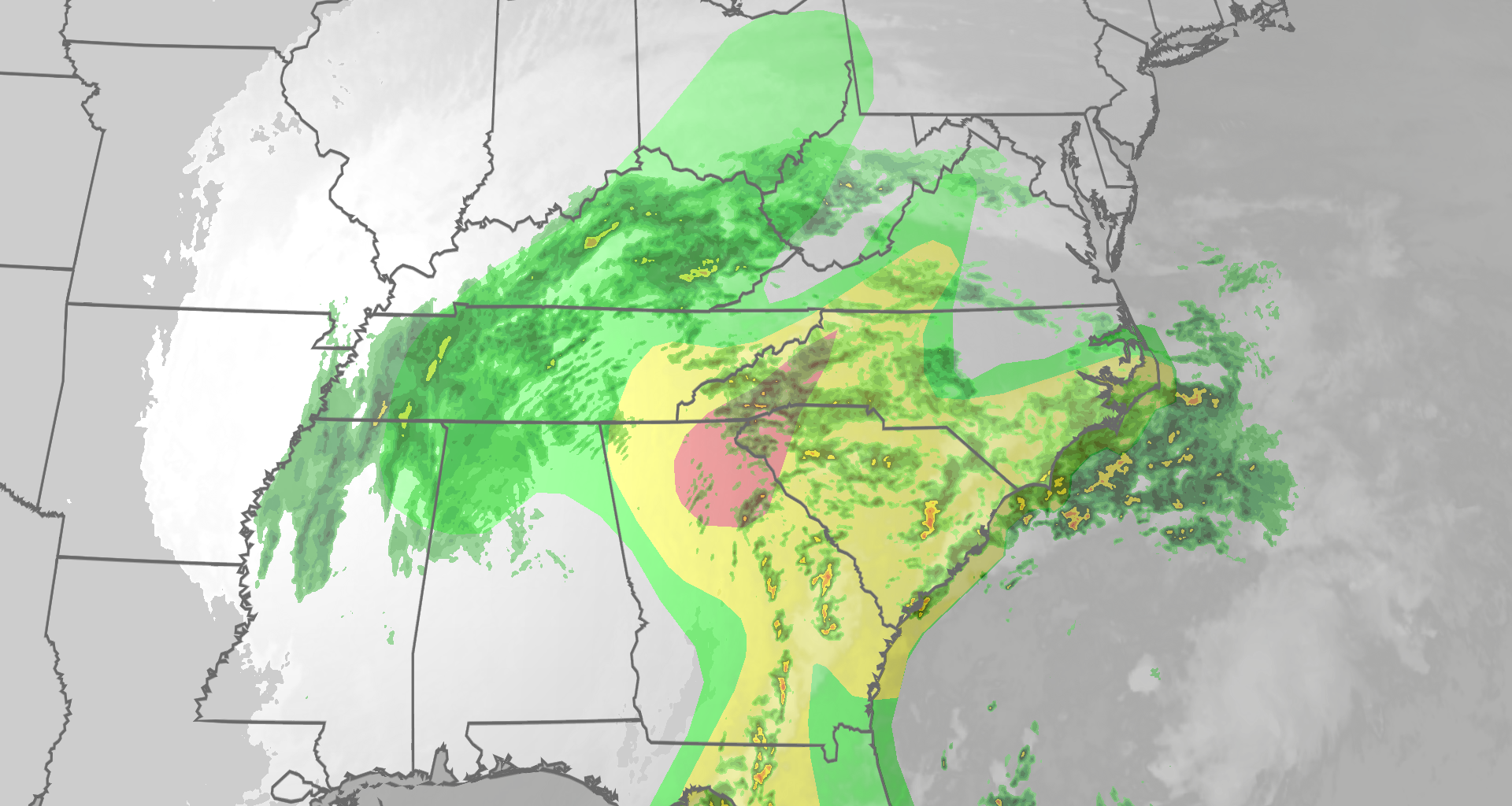
Isaias is well inland over the Southeast but still has a threat of flooding rain, strong wind gusts and tornadoes in parts of the South and East through Sunday.
(MORE: Isaias maps tracker |live updates)
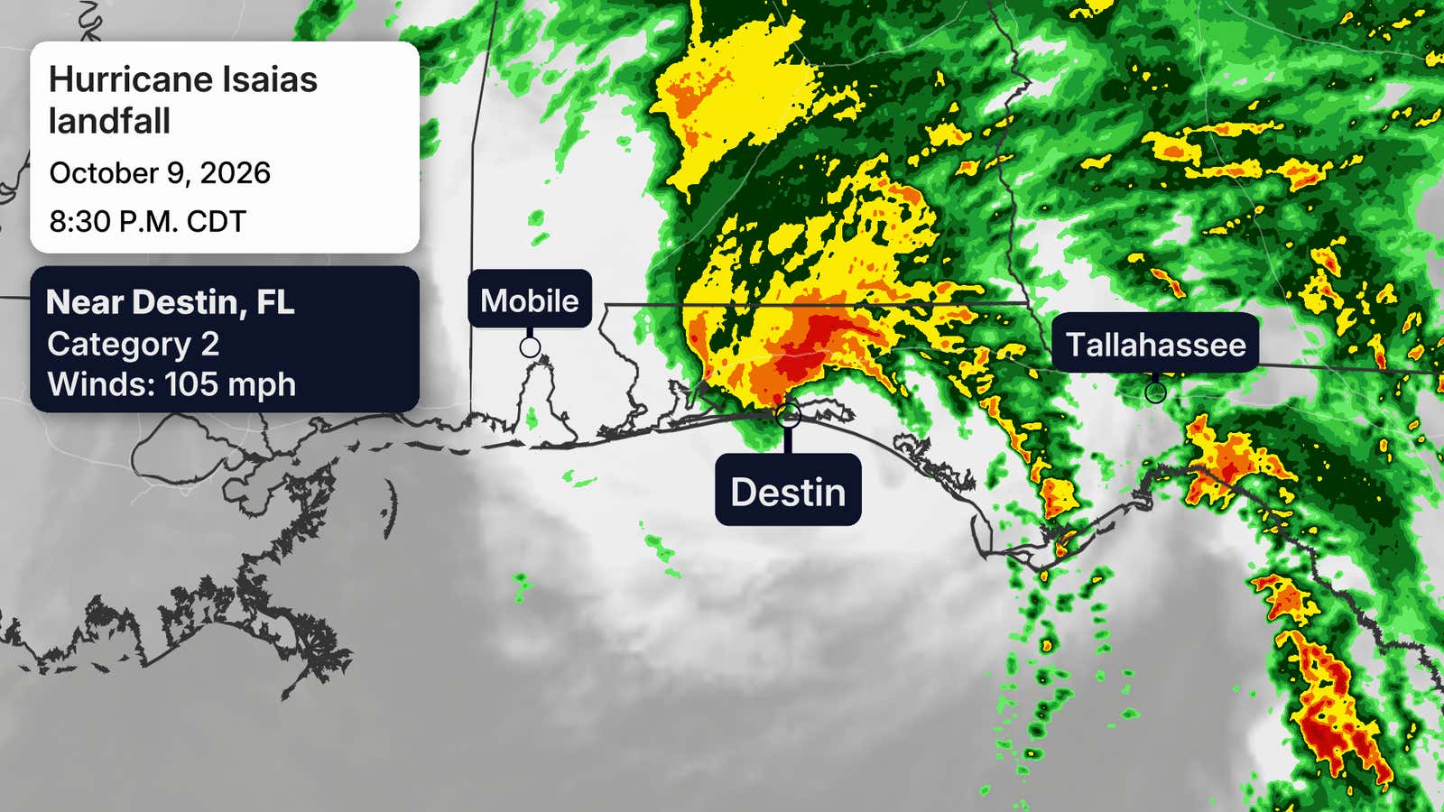
Hurricane Isaias made landfall Friday night in the Florida Panhandle at Category 2 strength.

Weather in your inbox
By signing up you agree to the Terms & Privacy Policy. Unsubscribe at any time.
Wind gusts over 110 mph were clocked in several panhandle locations, along with storm surge flooding. Over 700,000 customers are without power in its wake.
We have a full recap of the events leading up to landfall at the bottom of this article.
Where Isaias is now
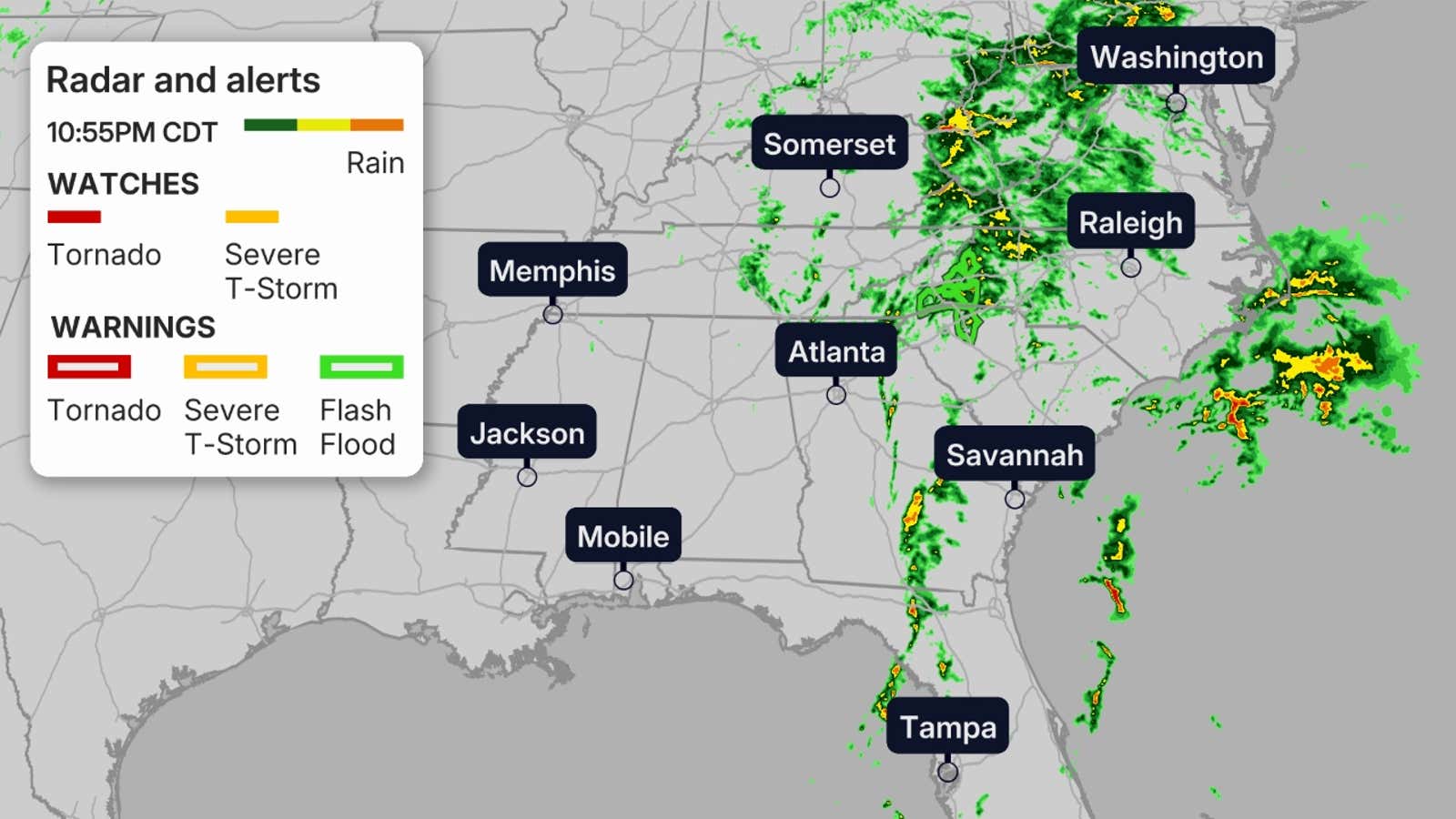
Isaias is now “post tropical,” which just means that it has lost its tropical characteristics, but there is still heavy rain and gusty winds with its inland remnants.
Get More of Our News on Google
Set The Weather Company as a ‘Preferred Source’ to get quicker access to the news you value.

You can see where the rain is currently in the map below, along with any flash flood or tornado watches and warnings.
(MORE: What all these tropical terms mean)
 Isaias’ inland impacts
Rainfall
The biggest threat left from Isaias this weekend is a threat of flash flooding, particularly in parts of the Southeast Saturday.
The heaviest additional rain is expected through Saturday night in the foothills of the Appalachians from eastern and northern Georgia to upstate South Carolina, western North Carolina and western Virginia.
It’s there where the flash flood threat is highest, especially in hilly or mountainous terrain.
Other areas of heavy rain that could lead to flash flooding include:
The coastal Carolinas through Saturday nightParts of northern Florida and eastern Georgia, where long, thin bands of heavy rainfall are possible through Saturday nightParts of the Ohio Valley through Saturday night, then mid-Atlantic including New York City, Philadelphia and Washington D.C. Sunday. In these areas, local flash flooding is possible. 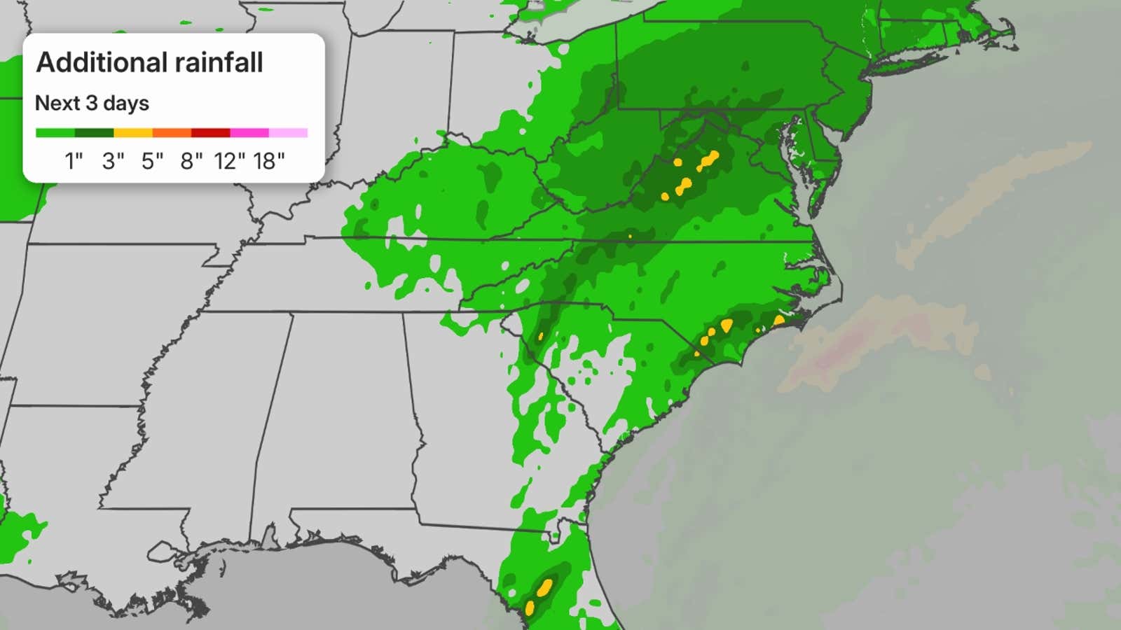
Winds
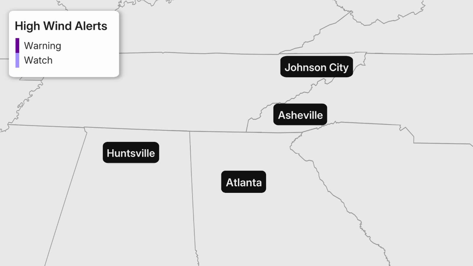
Wind gusts capable of at least some tree damage and additional power outages will continue through early Sunday in parts of the Southeast, particularly where high wind warnings are in effect, shown on the map below.
Some gusts in the Smoky Mountains could reach 60 to 70 mph.
Trees could also be toppled more easily in ground soaked by heavy rain.
Tornadoes
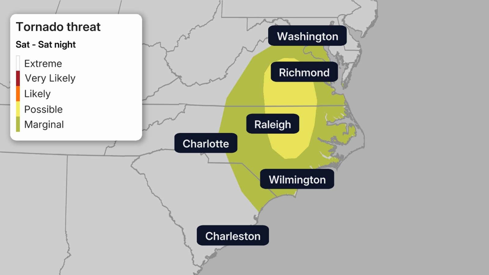
There is a threat for severe thunderstorms and tornadoes across Georgia, the eastern Florida Panhandle and into the Carolinas through Saturday evening.
This is common with the remnants of former tropical storms and hurricanes.
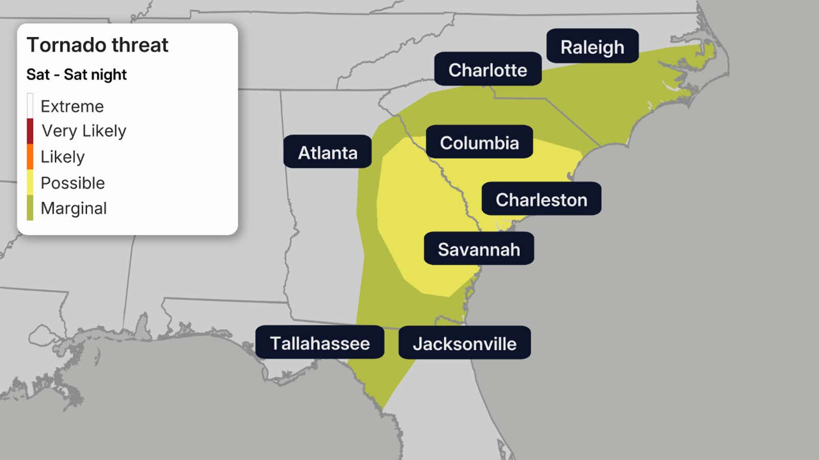
That threat of isolated tornadoes and strong thunderstorm wind gusts continues Sunday in the East.
 Isaias’ landfall
Isaias made landfall near Destin, Florida, Friday evening with sustained winds of 105 mph, a Category 2 hurricane.
That was the first hurricane to landfall in the mainland U.S. in exactly two years, since Milton slammed into western Florida on Oct. 9, 2024.
 Hurricane Isaias archive
A rarely-issued extreme wind warning was issued Friday evening for the western Florida Panhandle, including Pensacola and Destin, for the likelihood of wind gusts over 115 mph ahead of the eyewall of Isaias.
The highest gust recorded was 116 mph in Santa Rosa Sound, Florida, where sustained winds of 91 mph were also measured.
Pensacola reported a 102-mph wind gust earlier Friday evening. Gulf Breeze, Florida, located across Pensacola Bay from Pensacola, reported a wind gust of 97 mph and sustained winds of 83 mph.
Early observations show water levels surpassed 4.0 feet above normally dry ground in Destin and 5.6 feet in Panama City, Florida, and were likely higher in the western Panhandle.
One caveat with these storm surge totals is they are measured relative to the Mean Higher High Water (MHHW) and this number includes tide influences so they should not be interpreted as storm surge heights alone.
The highest wind gust reported was an impressive 117 mph three miles east-southeast of Oriole Beach. Two miles west southwest of Pensacola, at City Hall, a gust of 102 was reported.
There was a roof blown off the Rest and Relax Inn on Plantation Road in Pensacola. Multiple collapsed gas station canopies were reported in Pensacola (Blue Angel Parkway and Mobile Highway) and also in Crestview. Trees were uprooted, one of which crushed a business on Fort Walton Beach. There were also multiple RVs blown over, including one onto US 98 between Gulf Breeze and Navarre.
Less than 12 hours prior to landfall, an instrumented NOAA Saildrone measured a gust of 104 mph near the eyewall of Isaias, according to the National Hurricane Center.
In Alabama, a gust of 75 mph was reported near Orange Beach while Birmingham saw a gust of 49 mph.
Trees fell directly onto residences in Mountain Brook, Birmingham (Five Points & Ensley), Opelika (manufactured home), and Ladonia (tree through a house).
All roads were impassable in Conecuh County due to debris and fallen trees.
Georgia saw a 68 mph gust in Warner Robins while Hartsfield-Jackson Airport saw a gust to 45 mph.
There were road closures due to downed trees across all lanes of State Route 91 near Stocks and on State Route 93 near Pelham and Spence.
In terms of heavy rainfall, Bellwood, Alabama, saw over a foot of rain in just 13 hours. Caney Creek/FAWN Station, Florida, saw 12.06 inches in 24 hours, with 9.67 falling in 3 hours and 4.15 inches falling in 1 hour.
Flash flooding reports were observed at Westland Apartments in Bellair, Florida, while flash flooding stranded a vehicle in floodwaters near Sale City, Georgia.
In Florida, Bayside Subdivision and Destin saw 7.18 inches and 7.52 inches of rainfall, respectively.
The Greater Atlanta area saw 1-3 inches of rainfall in a 6 hour period early Saturday.
A flash flood warning was even in effect for part of Atlanta that morning.
And on Saturday, multiple tornadoes were sighted by storm spotters in the Savannah River Valley including near Newington and Oliver, Georgia, as well as in Allendale County, South Carolina.
How to pronounce Isaias
Isaias (ees-ah-EE-ahs) is one of the trickier names to pronounce on this year’s list. To hear the correct pronunciation, listen here.
Isaias replaced “Ike” on one of the Atlantic name lists after that name was retired following the destructive, deadly 2008 hurricane.
It wasn’t used during its first year of eligibility in 2014, since we only reached the eighth name, Hanna, that year.
However, the name was used in 2020 for a storm that eventually tracked up the East Coast with destructive winds.