
TALLAHASSEE, Fla. (WCTV) – For those who like heaters and coats in the morning, this is the weather for you!
Another breezy day
Yesterday’s cold front is still ushering in cold air today and we will remain breezy behind it. Gusts between 20 and 30 mph through this afternoon.
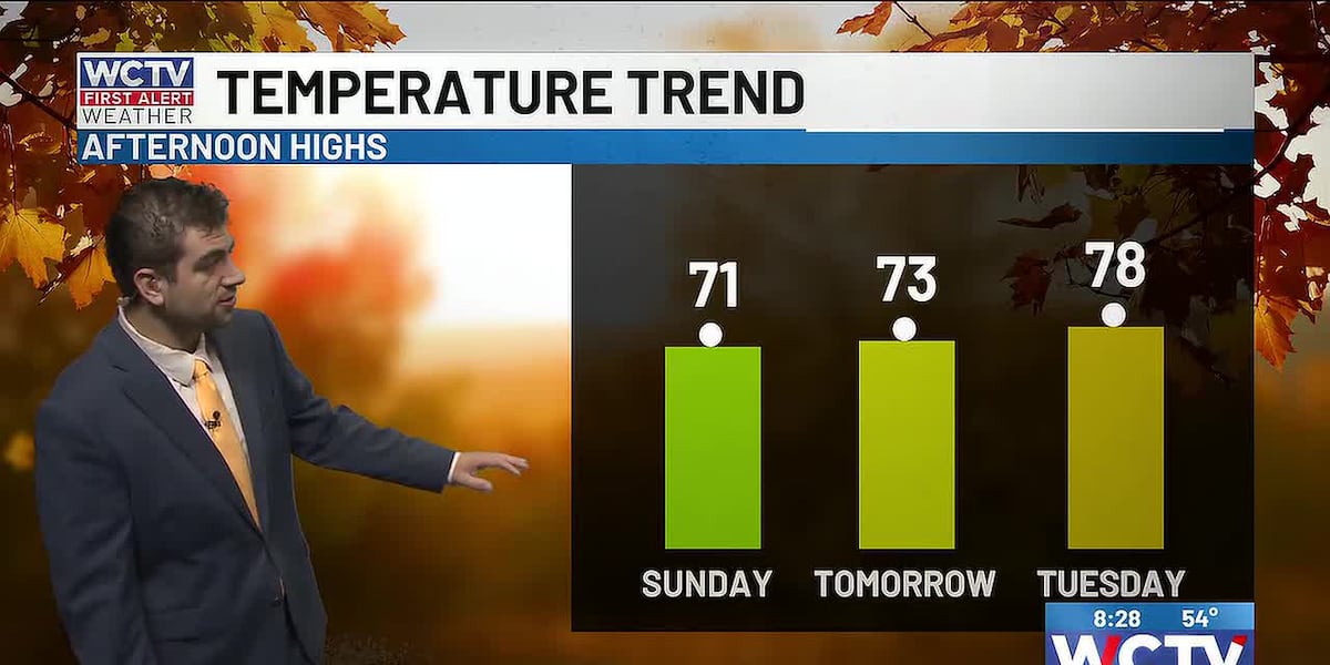
Highs well below average in the upper 60s and low 70s this afternoon, feeling like mid-60s with the winds.
Colder tomorrow morning
As you get ready for the new workweek, it is going to be a chilly start to the morning again. Temperatures will drop into the low 50s and a few upper 40s areawide. So heat in the car and jackets might be necessary.
Tomorrow afternoon will still be cool, in the low 70s. Upper 60s along the coast.
Fall chill sticks around
Morning lows will stay in the upper 40s to low 50s for ALL of your workweek, so this is not a quick blast of fall. The cooler weather is sticking around.
Highs are slowly warming into the mid-to-upper 70s by the end of the week.
Beach and Boating
Water temperature: 76
Small craft advisory through Monday
Sunday: Sunny and breezy. Northeast winds 20 to 30 knots. Waves 4 to 8 feet. Rough on the bays and protected waters. High rip current risk.
Monday: Sunny with a breeze. Northeast winds 20 to 25 knots. Waves 4 to 8 feet. Rough on the bays and protected waters. High rip current risk.
Tuesday: Sunny with a light breeze. Northeast winds 10 to 20 knots. Waves 2 to 4 feet. Choppy bays and protected waters. Moderate rip current risk.
To stay updated on all the latest forecasts and weather, follow WCTV First Alert Weather on Facebook and X (Twitter).
Click here to see all the latest weather headlines and here to view the First Alert Radar. Receive push alerts and watch the latest forecast anytime on the free WCTV First Alert Weather app. Click here to download it now.
Interested in becoming a WCTV First Alert Weather Watcher? Click here to join the team!
Copyright 2026 WCTV. All rights reserved.