
ORLANDO, Fla. – Cooler-than-normal temperatures and gusty northeast winds will continue across Central Florida this week, while dangerous surf conditions remain along the Atlantic coast.
Monday
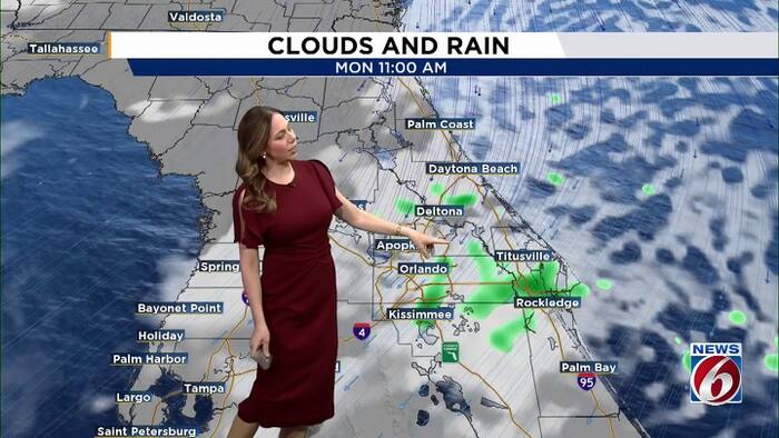
Expect another breezy day, with fast-moving showers occasionally moving onshore. Rain chances remain around 20% to 35%.
Northeast winds will generally range from 15 to 20 mph, with gusts of 25 to 35 mph possible. Coastal areas could see stronger gusts at times.
Highs will reach the upper 70s to near 80 degrees. Rough surf and dangerous rip currents will continue at all Central Florida Atlantic beaches. Breaking waves of 6 to 10 feet could also contribute to beach erosion around high tide.
A High Surf Advisory and high risk for life-threatening rip currents remain in effect along area beaches.
This week
Breezy conditions continue, with gusty north-northeast winds, especially near the coast. A little drier air moves in Tuesday, keeping rain chances limited.
Dangerous surf and rip currents will persist, making beach activities hazardous even when skies are dry.
Weekend outlook
Winds could strengthen again as high pressure builds to the north and low pressure develops near a lingering front over the Florida Straits and Bahamas. That pressure pattern could bring another windy weekend, along with rough surf, dangerous rip currents and additional beach erosion.
Rain chances are expected to slightly increase Friday night into the weekend, especially from Cape Canaveral southward, as moisture gathers along the front.
Temperatures will remain a few degrees below typical mid-October levels, with highs generally in the upper 70s to low 80s. Overnight temperatures may trend slightly warmer late in the week as onshore winds strengthen.
Daily Forecast
The News 6 Weather team ensures you’re always on top of the day’s weather.
Copyright 2026 by WKMG ClickOrlando – All rights reserved.