
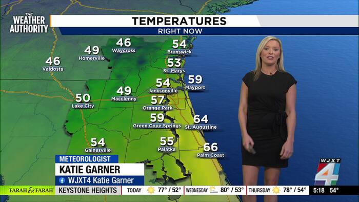
The main weather story today is the continued contrast between pleasant conditions inland and hazardous conditions along the coast.
Jacksonville will see sunshine and an afternoon high near 74°, with northeast winds increasing to 9–16 mph and gusts around 22 mph.
Persistent onshore flow will continue to produce rough surf, dangerous rip currents and beach erosion along our Northeast Florida and Southeast Georgia beaches.
Coastal and tidal flooding will remain a concern through the week, with another increase in winds and coastal impacts expected this weekend.
For today’s coverage, the key message is that sunny skies do not mean safe swimming or boating conditions.
The NWS briefing highlights elevated rip current risk, rough surf and the potential for minor to moderate beach erosion during this prolonged northeast wind event.
The Jacksonville forecast page currently lists a High Surf Advisory through 2 a.m. Wednesday, a Coastal Flood Advisory through 4 a.m. Thursday and a Rip Current Statement through 2 a.m. Friday.
Those expiration times may be adjusted as the event continues, and impacts are expected to persist beyond the current advisory windows.
Along the St. Johns River, minor tidal flooding is expected around high tide this week.
Prolonged onshore winds can impede the river’s drainage into the Atlantic and keep water levels elevated through successive tidal cycles.
Low-lying and flood-prone locations along the river should remain a focus of our coverage, even with little rainfall in the immediate forecast. Residents in vulnerable areas should monitor water levels and move items susceptible to flooding to higher ground.
Tonight will be clear and cool, with a Jacksonville low around 58° and north winds near 7 mph.
Wednesday brings mostly sunny skies and a high near 78°, with north winds of 9–15 mph and gusts around 22 mph. Wednesday night will be another cool one, with clear skies and a low near 56°.
Thursday remains sunny with a high around 76°, followed by a low near 58° Thursday night. The forecast stays dry through Friday, with sunshine, breezy conditions and a high near 77°.
The weekend brings a more impactful coastal setup as onshore winds strengthen again and shower chances return.
Friday night will be milder and breezy, with a low around 64°. Saturday turns windy with partly sunny skies, a 40% chance of showers and a high near 73°.
Shower chances decrease to 30% Saturday night, with a low around 64°. Sunday remains windy with sunshine between showers, a 40% rain chance and a high near 74°. These rain chances do not indicate a washout, but outdoor plans will need to account for passing showers and persistent wind.
The bigger weekend concern is worsening surf, erosion and tidal flooding. The NWS indicates moderate tidal flooding is possible along the St. Johns River and portions of the Florida coast as the next wind surge develops.
We should emphasize that coastal impacts can build over several days of persistent onshore flow. The strongest messaging should remain focused on staying out of the rough ocean, hazardous boating conditions and watching flood-prone areas around high tide.
Looking ahead to Monday, windy conditions continue with a high near 75° and a lower, 20% chance of showers
Copyright 2026 by WJXT News4JAX – All rights reserved.