
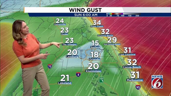
ORLANDO, Fla. – Central Florida is gearing up for a much windier weekend, with gusts picking up and sustained winds reaching 20–30 mph. Strong onshore winds will also bring rough surf, dangerous rip currents and the potential for coastal flooding and beach erosion
This Week
Northeast winds will stay gusty, reaching 20–25 mph today and strengthening a bit Friday. Highs will remain in the upper 70s to low 80s.
Weekend
Rain chances increase Saturday (20-30%) into early next week as more moisture moves into the region.
Winds will also pick up, with sustained northeast winds of 20–30 mph expected Saturday through Monday and higher gusts between 35-40mph. Wind Advisories may be needed, especially along the coast. Breezy conditions could continue into Tuesday.
Temperatures won’t change much, with highs in the upper 70s to low 80s.
Strong onshore winds will keep overnight lows milder, generally in the 60s inland and upper 60s to low 70s near the coast.
Coastal Hazards
The combination of strong onshore winds and high tides is expected to bring another round of hazardous beach conditions this weekend into early next week.
Rough surf, dangerous rip currents, beach erosion and minor coastal flooding are all possible.
Daily Forecast
The News 6 Weather team ensures you’re always on top of the day’s weather.
Copyright 2026 by WKMG ClickOrlando – All rights reserved.