
West Palm Beach, Fla (CBS12) — A blustery, wet and hazardous stretch of weather is expected across the Treasure Coast and Palm Beaches, with the greatest concerns today and tomorrow.
Persistent northeast winds will push showers onshore, while high tides and rough surf raise the risk of coastal flooding.
Windy conditions and occasional coastal showers are expected to linger later in the week.
Showers and gusty winds today
Scattered showers will move inland from the Atlantic today, with the highest rain chances along the coast and across the Treasure Coast.
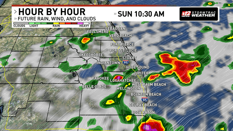
Rain will be slightly more widespread for the first half of Sunday. (WPEC)
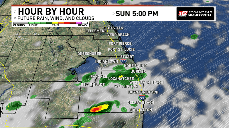
Rain chances become more isolated for the evening, but they will still be possible all throughout Sunday. (WPEC)
Repeated downpours could produce 2 to 3 inches of rain in some spots, with locally higher amounts possible.
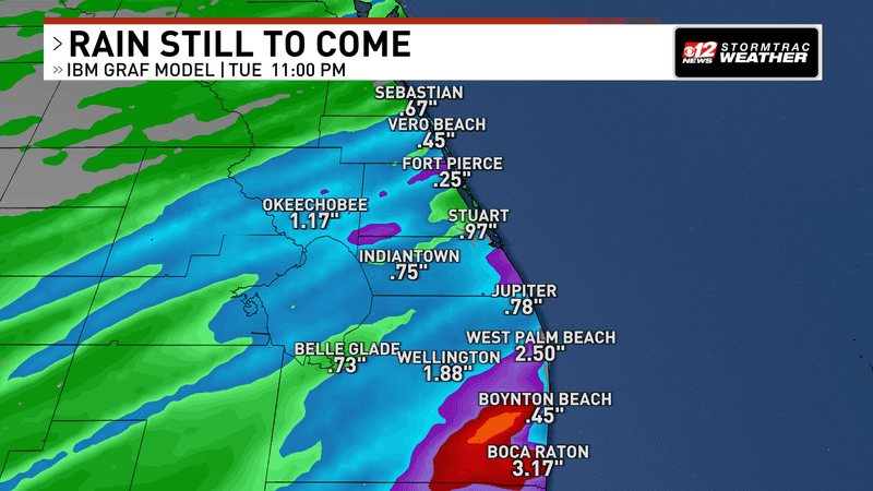
Isolated pockets of a few inches of rain will be a result of training downpours today. (WPEC)
The National Weather Service has placed parts of Martin and Palm Beach counties in a slight risk for excessive rainfall, while the broader coast is under a marginal risk.
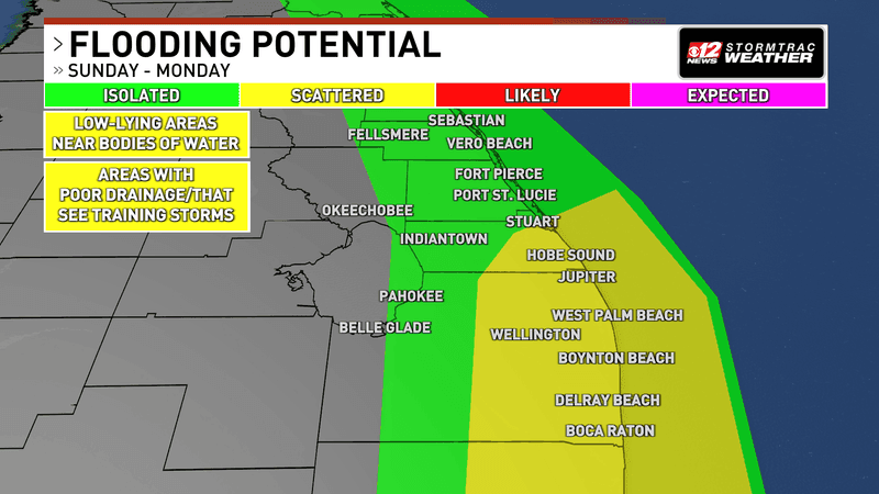
Repeated downpours Sunday could cause scattered flooding, especially near waterways, in low-lying areas and where showers repeatedly pass over the same locations. (WPEC)
A few thunderstorms could develop, but confidence is low; any storm could bring lightning, heavy rain and gusts up to 45 mph.
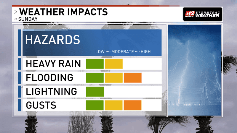
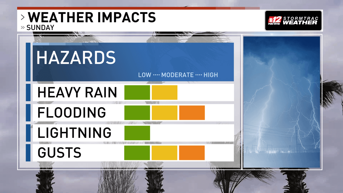
Sunday’s main concerns are higher risks for flooding and gusty winds, a moderate heavy-rain threat, and a low lightning threat. (WPEC)
Northeast winds of 15 to 25 mph, with gusts around 30 to 35 mph, will make for a blustery day.
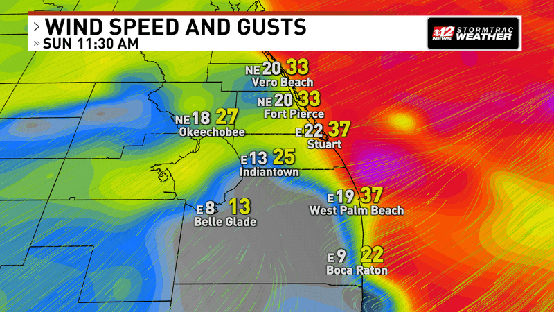
Sustained winds will be close to 20-25 miles per hour today with occasional gusts in the upper 30s. (WPEC)
A Wind Advisory is in effect for the Treasure Coast through 8 PM Sunday.
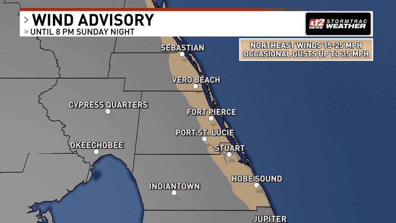
Northeast winds of 15–25 mph with occasional gusts up to 35 mph are expected through 8 PM Sunday. (WPEC)
Coastal flooding and beach hazards
A Coastal Flood Warning is in effect for the Treasure Coast through 2 AM Wednesday, with significant flooding possible in low-lying coastal areas.
Coastal Palm Beach County has a Coastal Flood Advisory through 2 AM Monday, followed by a Coastal Flood Watch through Tuesday morning as more significant flooding remains possible.
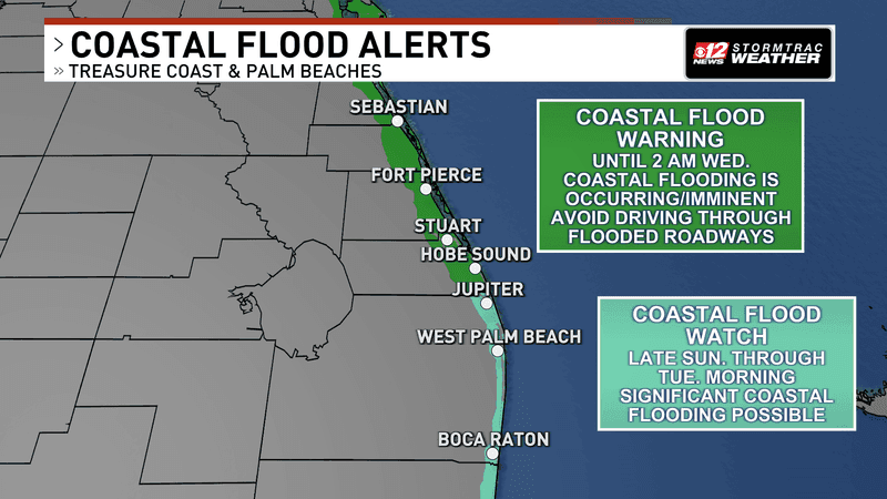
A Coastal Flood Warning remains in effect for the Treasure Coast through 2 AM Wednesday, while a Coastal Flood Watch covers coastal Palm Beach County late Sunday through Tuesday morning. (WPEC)
King tides are adding to the concern: high water combines with strong onshore winds and large waves, increasing the chance of water reaching coastal roads and low-lying areas.
West Palm Beach high tides are at 8:18 AM and 8:23 PM Sunday, then 9:01 AM and 9:06 PM Monday.
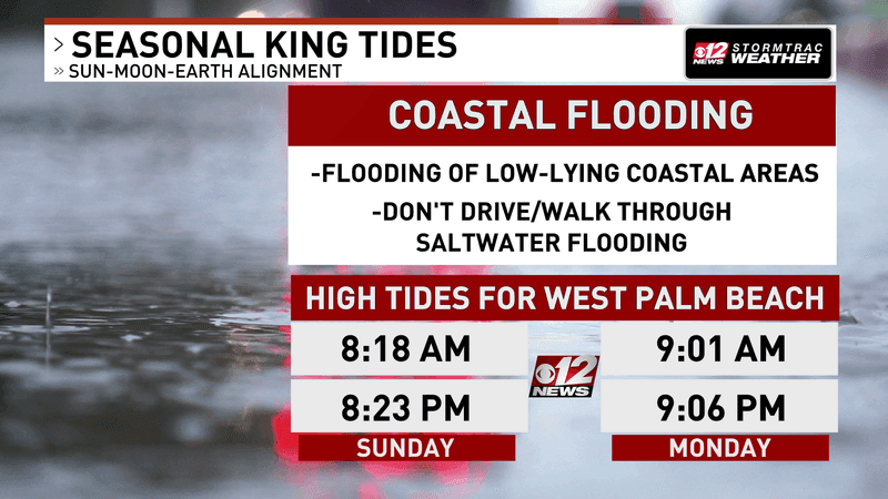
King tides may worsen flooding in low-lying coastal areas; high tides in West Palm Beach are listed for 8:18 AM and 8:23 PM Sunday, and 9:01 AM and 9:06 PM Monday. (WPEC)
A High Surf Advisory and a High Risk of Rip Currents are also in effect along the Treasure Coast, with similar beach hazards in Palm Beach County.
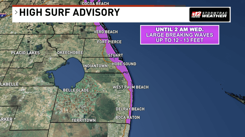
Large breaking waves of 12–13 feet are possible along parts of the coast through 2 AM Wednesday. (WPEC)
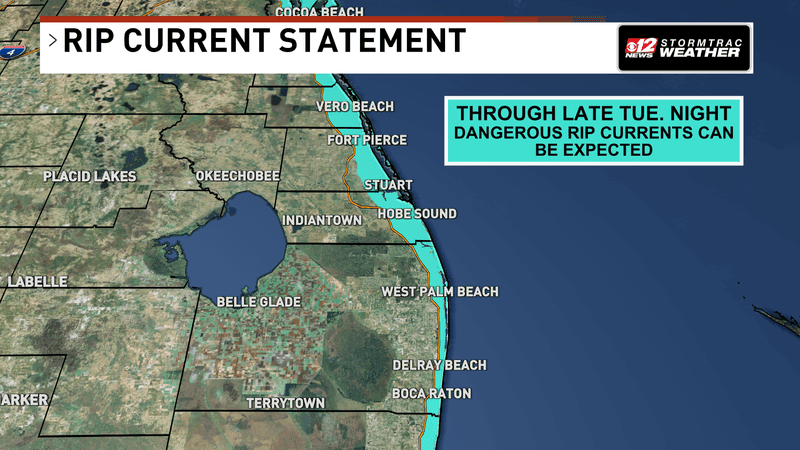
Dangerous rip currents are expected along the Treasure Coast and Palm Beaches through late Tuesday night. (WPEC)
Breaking waves could reach 7 to 12 feet along the Treasure Coast, and dangerous surf is expected to continue into midweek.
Stay out of the water and never walk or drive through floodwater.
The week ahead and Halloween
Showers remain possible Monday and Tuesday, especially along the coast, though storm chances are expected to stay low.
Northeast winds will remain blustery, with gusts of 30 to 35 mph possible.
Coastal flooding, high surf and dangerous rip currents are expected to persist into midweek.
Gale Warnings are also in effect for portions of the Atlantic waters, creating dangerous conditions for boaters.
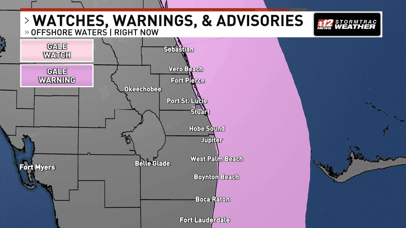
Gale conditions are expected over portions of the offshore waters, with a Gale Warning in some areas and a Gale Watch in others. (WPEC)
By Wednesday, rain coverage should ease some, but the onshore flow may still bring occasional showers to coastal communities through the end of the week.
Looking ahead to Halloween on Saturday, the early outlook favors continued northeast breezes and a chance for a passing coastal shower; widespread rain is not currently indicated.
Temperatures are expected to remain seasonable, with the forecast details subject to change as the weekend gets closer.