
TALLAHASSEE, Fla. (WCTV) – Not as chilly as you head out the door this morning, thanks to the northeast light breeze. Even a light wind makes a huge difference in how chilly we get.
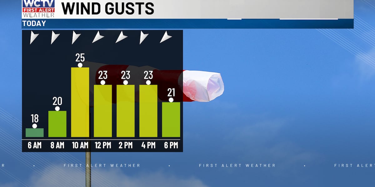
You might need a light jacket as you head out the door this morning. Great weather for your afternoon, with highs near 80 and a nice breeze. Gusts could get as high as 30 mph. Most of the day, sustained winds will be between 15 and 25 mph.
Elevated fire risk
Humidity will not be as low as yesterday, but it is still low enough to mention an increased fire risk when combined with strong winds. Avoid any type of burning through tomorrow. Any fire that does start could spread quickly.
Rough Gulf waters
Strong winds will make conditions rough for boaters this weekend. A small craft advisory is in effect through 2 p.m. Tuesday.
Sunday: Sunny and windy. Northeast winds 20 to 30 knots. Waves 5 to 9 feet. Rough on the bays and protected waters. A high rip current risk.
Monday: Sunny and windy. Northeast winds 20 to 30 knots. Waves 5 to 9 feet. Rough on the bays and protected waters. A high rip current risk.
Good weather continues
High pressure starts to build in the upper atmosphere. This will keep the dry weather around for the rest of the week for the majority of the area. This will also build temperatures back into the low 80s.
Winds start to shift more east midweek aloft. This will increase moisture just a little bit. So a few more clouds and a stray to isolated shower chance is possible Thursday and Friday. However, most will continue to stay rain-free through Halloween.
To stay updated on all the latest forecasts and weather, follow WCTV First Alert Weather on Facebook and X (Twitter).
Click here to see all the latest weather headlines and here to view the First Alert Radar. Receive push alerts and watch the latest forecast anytime on the free WCTV First Alert Weather app. Click here to download it now.
Interested in becoming a WCTV First Alert Weather Watcher? Click here to join the team!
Copyright 2026 WCTV. All rights reserved.