
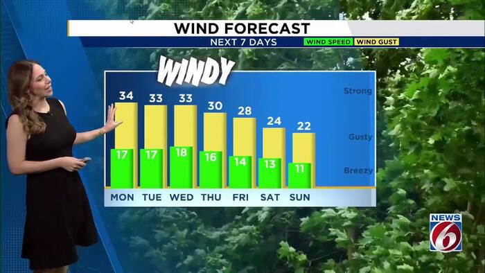
ORLANDO, Fla. – Gusty northeast winds and quick-moving showers will continue across Central Florida through Tuesday, with some squalls capable of producing wind gusts up to 40 mph.
Early week
A wind advisory remains in effect along the coast through 8 p.m. today, where winds could gust up to 40 mph. Fast-moving showers will bring brief downpours, with the highest rain chances along the coast.
Tuesday, rain chances will shift south, reaching 30% to 40%. Highs will remain in the low 80s.
Coastal hazards
Life-threatening rip currents, breaking waves of 7 to 11 feet, and beach erosion will continue. A High Surf Advisory and Coastal Flood Warning remain in effect, along with a gale warning for boaters. Minor flooding could affect low-lying roads, parking lots and properties near the coast during morning high tides.
Halloween weekend
It’s still a little too early to know exactly what Halloween weather will look like, but temperatures should stay close to or a bit warmer than normal heading into the weekend.
And don’t forget, we’ll also turn the clocks back on Sunday. That means an extra hour of sleep, but it’ll also get darker earlier in the evening.
Daily Forecast
The News 6 Weather team ensures you’re always on top of the day’s weather.
Copyright 2026 by WKMG ClickOrlando – All rights reserved.