
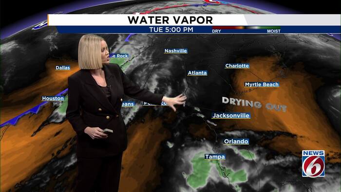
ORLANDO, Fla. – After days of heavy rain and widespread flooding in parts of Brevard County, we are finally getting a chance to dry out.
We’ve seen very little shower activity this evening, and most neighborhoods will remain dry overnight. A few showers could still brush the coastline, but widespread rain is not anticipated. Overnight temperatures will remain mild, with lows in the lower to middle 70s.
Water is slowly receding in some areas of Brevard County, but roads and low-lying neighborhoods remain flooded, especially across the southern part of the county. That’s where peak rainfall totals were between 18 and 24 inches. A Flood Warning remains in effect through Wednesday morning for southern Brevard County.
Even a small amount of additional rain could cause problems in areas where the ground is already saturated. Remember, do not attempt to drive through standing water or on flooded roads. Turn around don’t drown!
Mostly Dry and Warm Through Friday
A few showers will still be possible Wednesday, but rain chances are down to just 20% to 30%. Most of Central Florida will stay dry, with afternoon temperatures climbing into the middle 80s. Orlando could top out around 86 degrees. Typically this time of year our high is around 80,
The drying trend continues Thursday and Friday as drier air moves into the region. Rain chances will be minimal, with highs remaining in the middle 80s. Overnight temperatures will gradually become a little more comfortable, dropping into the 60s.
Dangerous Beach Conditions Continue
While the weather is improving inland, conditions along our beaches remain dangerous.
A high risk of life-threatening rip currents and rough surf will continue through at least midweek. Your best best be is to stay out of the water.
Boating conditions will also improve slowly. Seas of 4 to 6 feet are expected Wednesday, with rough conditions lingering offshore. Small craft operators should continue to use caution.
A Dry Cold Front Brings a Weekend Cooldown
A weak cold front is expected to move through Central Florida Saturday, but it won’t bring much rain. Most of us should remain dry through the weekend.
Temperatures will gradually come down behind the front. Highs in the lower to middle 80s Saturday will slip closer to 80 degrees Sunday. By Monday, afternoon temperatures could range from the middle 70s to around 80 degrees.
We’ll also see some cooler mornings. Overnight lows will drop into the 60s this weekend, with upper 50s possible near and northwest of Interstate 4 by Monday night.
We are still finetuning the chance of rain early next week. Another disturbance aloft could bring showers back to Central Florida Monday, but computer models disagree on how that system will develop and how much moisture will be available.
For now, rain chances remain relatively low, around 20% to 30% Monday. We’ll continue to watch that system closely, especially with some communities still recovering from this week’s flooding.
Daily Forecast
The News 6 Weather team ensures you’re always on top of the day’s weather.
Copyright 2026 by WKMG ClickOrlando – All rights reserved.