
TALLAHASSEE, Fla. (WCTV) – Staying dry with a gradual warming trend. This should persist the drought heading into next week.
A weak cold front is passing by to our northeast. There will be no rain from this front, keeping us dry this evening and tonight.
With mainly light winds and clear skies, temperatures will fall into the low 40s, slightly higher than last night.
High pressure builds back in on Friday. This will bring a sunny and dry day with slightly warmer temperatures, with highs reaching the upper 70s.
The high will sit over the Big Bend and South Georgia, keeping skies clear overnight and will be the next coldest morning with temperatures into the upper 30s and low 40s. This will be the coldest of the next 7 days.
Temperatures will top out near 80 on Sunday with sunny skies continuing.
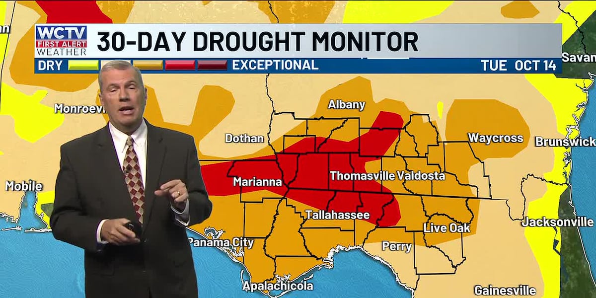
The dry and above-average warmth will continue into next week. This will lead to the worsening of the drought situation across the Big Bend and South Georgia.
⬇️When we are not on tv, you can catch local weather updates 24/7 on WCTV First Alert Weather Now.⬇️
To stay updated on all the latest forecasts and weather, follow WCTV First Alert Weather on Facebook and X (Twitter).
Click here to see all the latest weather headlines and here to view the First Alert Radar. Receive push alerts and watch the latest forecast anytime on the free WCTV First Alert Weather app. Click here to download it now.
Interested in becoming a WCTV First Alert Weather Watcher? Click here to join the team!
Copyright 2025 WCTV. All rights reserved.