
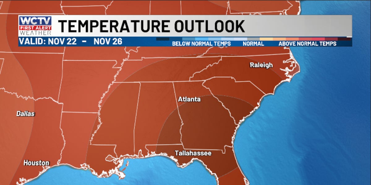
TALLAHASSEE, Fla. (WCTV) – The 80s continue for the upcoming work week as rain chances remain low.
Tonight Through Monday Night
Another calm night is on tap across the area. We are dry under a partly cloudy to mostly clear sky.
A cold front will move across the region tonight. We are not expecting any rain with this weather system, but it should offer some drier air to start the work week.
Lows settle in the upper-40s and low-50s. Some areas of patchy fog are possible for late tonight and early Monday.
We are dry and mild on Monday. Temperatures top out in the upper-70s and low-80s under some sunshine.
The forecast is looking calm and cool for Monday night. Overnight lows bottom out in the low-to-mid-40s under a mostly clear sky.
No Big Changes
Our “copy and paste” forecast will continue for the middle of the week.
We remain dry under some sunshine for Tuesday, Wednesday and Thursday.
Highs hover in the upper-70s and low-80s, while lows fall into the low-and-mid-50s.
Extended Forecast
Looking ahead, we could see a stronger weather system and better rain chances by next weekend.
However, models are not in great agreement at this time. The GFS model is suggesting we could see higher rain chances on Saturday, but the European model is slower. It is showing more showers for late Sunday and next Monday.
We will keep an eye on this and keep you posted.
Highs for the weekend look to stay in the upper-70s, with lows in the upper-50s and low-60s.
To stay updated on all the latest forecasts and weather, follow WCTV First Alert Weather on Facebook and X (Twitter).
Click here to see all the latest weather headlines and here to view the First Alert Radar. Receive push alerts and watch the latest forecast anytime on the free WCTV First Alert Weather app. Click here to download it now.
Interested in becoming a WCTV First Alert Weather Watcher? Click here to join the team!
Copyright 2025 WCTV. All rights reserved.