
TALLAHASSEE, Fla. (WCTV) – A cool start to your Thursday morning, nearing a record this afternoon.
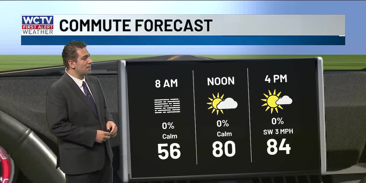
A dense fog advisory is in effect this morning as areas of patchy dense fog are expected throughout the area on your morning drive. Otherwise, it is jacket weather with temperatures in the upper 50s, you head out the door and get the kids ready for school.
This afternoon will be very warm with highs in the upper 80s, which will be near a record high. The record number to beat is 84, set back in 1941. Partly sunny skies with no rain today.
More dry weather is expected on Friday, but a few more clouds are expected tomorrow. Friday will also start with some morning fog. Highs in the low 80s.
This weekend will be dry for most. There is a chance for some showers on Saturday as a cold front approaches the area. I have that chance at 20%. The dry soils may help fight the increase in moisture, as we have seen so much of the past several weeks.
The front is through by Sunday, drying us out. Temperatures will be in the low 80s by the afternoon with partly to mostly sunny skies.
Watch the video above to see the full forecast.
To stay updated on all the latest forecasts and weather, follow WCTV First Alert Weather on Facebook and X (Twitter).
Click here to see all the latest weather headlines and here to view the First Alert Radar. Receive push alerts and watch the latest forecast anytime on the free WCTV First Alert Weather app. Click here to download it now.
Interested in becoming a WCTV First Alert Weather Watcher? Click here to join the team!
Copyright 2025 WCTV. All rights reserved.