
TALLAHASSEE, Fla. (WCTV) – More fog is possible tonight ahead of a chance of showers in storms early tomorrow.
⛈️Rain arrives late tonight:
Before a line of showers and storms arrives, foggy skies will develop as winds calm.
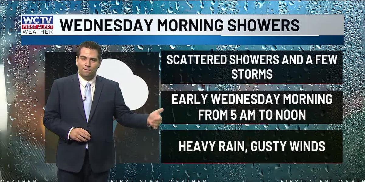
Showers and storms arrive in the western Big Bend by 5 a.m. and will slowly move across North Florida and South Georgia. The heart of the area will be looking at wet weather around 6 to 8 a.m. Be sure to pack the rain jacket as you head out the door. Temperatures will be in the 60s.
The line of showers could bring a few gusty storms. The low-end risk of severe weather has led to the Storm Prediction Center to issue a marginal risk (or level 1/5 risk) for severe storms. This means that most storms will NOT be severe, but one or two storms could bring winds up to 60 mph, small hail and an isolated tornado.
Showers and storms will be out of the area by lunchtime on Wednesday. Clouds should gradually decrease throughout the day. Highs in the mid to upper 70s. The rain chance is at 40%.
If you are traveling locally or across the Southeast tomorrow afternoon, there will be no weather impacts to worry about.
🦃Thanksgiving and Black Friday:
Turning much cooler behind the Wednesday showers. Thanksgiving morning, temperatures will be in the 40s. Breezy with sunny skies by the afternoon. Highs in the 60s. The winds will make it feel a bit colder. For a little fun context. The forecast high on Thursday is 65. That is the average high for Christmas Day.
Friday will remain chilly, with the morning starting in the 30s. There will likely be areas of frost. The thermometer will rise to the low 60s in the afternoon with sunny skies and an occasional breeze.
🔥Fire risk increases late week:
The very dry airmass and breezy winds will lead to a higher fire risk on Thanksgiving and Halloween.
A better chance for showers:
A more unsettled weather pattern looks to take shape as we wrap up November and start December. I have a 30% chance of showers Sunday through Tuesday. This is a weather setup that is not set in stone, but I am seeing enough consistency to raise those chances.
⬇️You can track your holiday forecast 24/7 on WCTV First Alert Weather Now, streaming now. ⬇️
To stay updated on all the latest forecasts and weather, follow WCTV First Alert Weather on Facebook and X (Twitter).
Click here to see all the latest weather headlines and here to view the First Alert Radar. Receive push alerts and watch the latest forecast anytime on the free WCTV First Alert Weather app. Click here to download it now.
Interested in becoming a WCTV First Alert Weather Watcher? Click here to join the team!
Copyright 2025 WCTV. All rights reserved.