
A cooler start this Thursday morning with lows dropping to mostly mid to upper 60s in Broward and Miami-Dade.
A few inland areas woke up to even cooler lows in the low 60s. This afternoon will be seasonably warm with highs in the low 80s.
We’ll enjoy mainly dry conditions and slightly lower humidity.

South Florida humidity tracker.
There is a moderate risk of rip currents along the Atlantic beaches and there are no alerts or advisories for boaters along the Atlantic waters or the Keys waters.
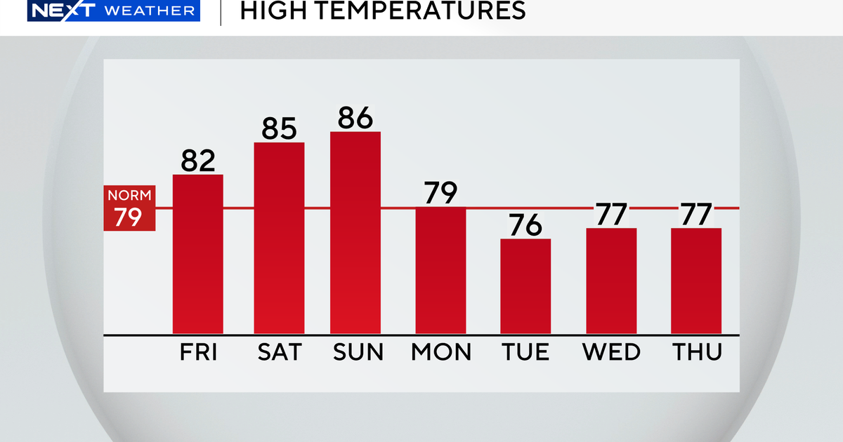
Friday morning will not be as cool but it will be comfortable with lows in the low 70s along the coast and the upper 60s inland. Highs will remain near normal in the low 80s with plenty of sunshine.

High temperatures in South Florida over the next seven days.
We quickly warm up this weekend as highs soar to the mid to upper 80s Saturday and Sunday.
Near record highs will be possible.
The chance of rain rises on Sunday with the potential for spotty showers. Scattered showers will be possible on Monday as highs start to drop to the upper 70s ahead of our next cold front.

Low temperatures in South Florida over the next seven days.
Lows will fall to the low 60s by Tuesday morning with highs only in the upper 70s Tuesday afternoon.
We will enjoy a cool start on Wednesday with lows in the upper 60s and highs will remain in the upper 70s through midweek.