
Later in the afternoon on Saturday, strong showers are expected to move into some counties surrounding the I-4 corridor and slowly push to the east.Temperatures on Saturday night could drop to the mid-sixties, with rain coverage between 40% to 50%.The moisture left in the air from the evening showers will produce some patchy, dense fog starting on Sunday morning.Plan for a rainy finish to the weekend with showers on Sunday, affecting multiple Central Florida counties.Conditions are expected to dry out by Tuesday as temperatures fall into the upper sixties and low seventies after the front moves out.Active Alerts: None at this timeFirst Warning Weather Stay with WESH 2 online and on-air for the most accurate Central Florida weather forecast.RadarSevere Weather AlertsDownload the WESH 2 News app to get the most up-to-date weather alerts. The First Warning Weather team includes First Warning Chief Meteorologist Tony Mainolfi, Eric Burris, Marquise Meda and Cam Tran.
CENTRAL FLORIDA, USA —
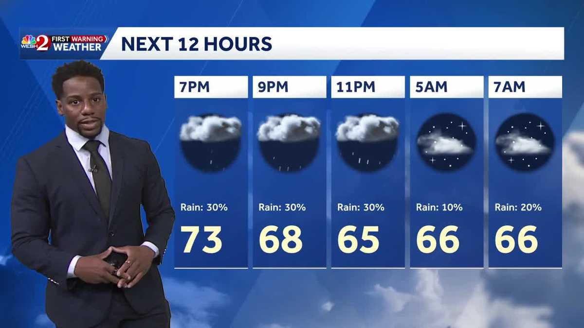
Later in the afternoon on Saturday, strong showers are expected to move into some counties surrounding the I-4 corridor and slowly push to the east.
Temperatures on Saturday night could drop to the mid-sixties, with rain coverage between 40% to 50%.
The moisture left in the air from the evening showers will produce some patchy, dense fog starting on Sunday morning.
Plan for a rainy finish to the weekend with showers on Sunday, affecting multiple Central Florida counties.
Conditions are expected to dry out by Tuesday as temperatures fall into the upper sixties and low seventies after the front moves out.
Active Alerts:
First Warning Weather
Stay with WESH 2 online and on-air for the most accurate Central Florida weather forecast.
Download the WESH 2 News app to get the most up-to-date weather alerts.
The First Warning Weather team includes First Warning Chief Meteorologist Tony Mainolfi, Eric Burris, Marquise Meda and Cam Tran.