
TALLAHASSEE, Fla. (WCTV) – Enjoy the December warmth because our next round of frigid air is on the way.
Tonight Through Sunday Night
The forecast is looking calm for Saturday night. Lows fall into the upper-40s and low-50s under a mostly clear sky. Some patchy fog is possible by early Sunday.
On Sunday, all eyes are on our next cold front. The moisture is pretty low with this system, so we are not anticipating widespread rain chances. However, a couple of showers are possible during the morning and early afternoon as our front moves across the region.
The bigger story, this weather system will bring another shot of cold air. Highs on Sunday top out in the mid-60s under a partly sunny sky. However, temperatures tumble into the upper-20s and low-30s for Sunday night.
We are also expecting a gusty wind to end the weekend. We could see gusts up to 20-25 mph at times.
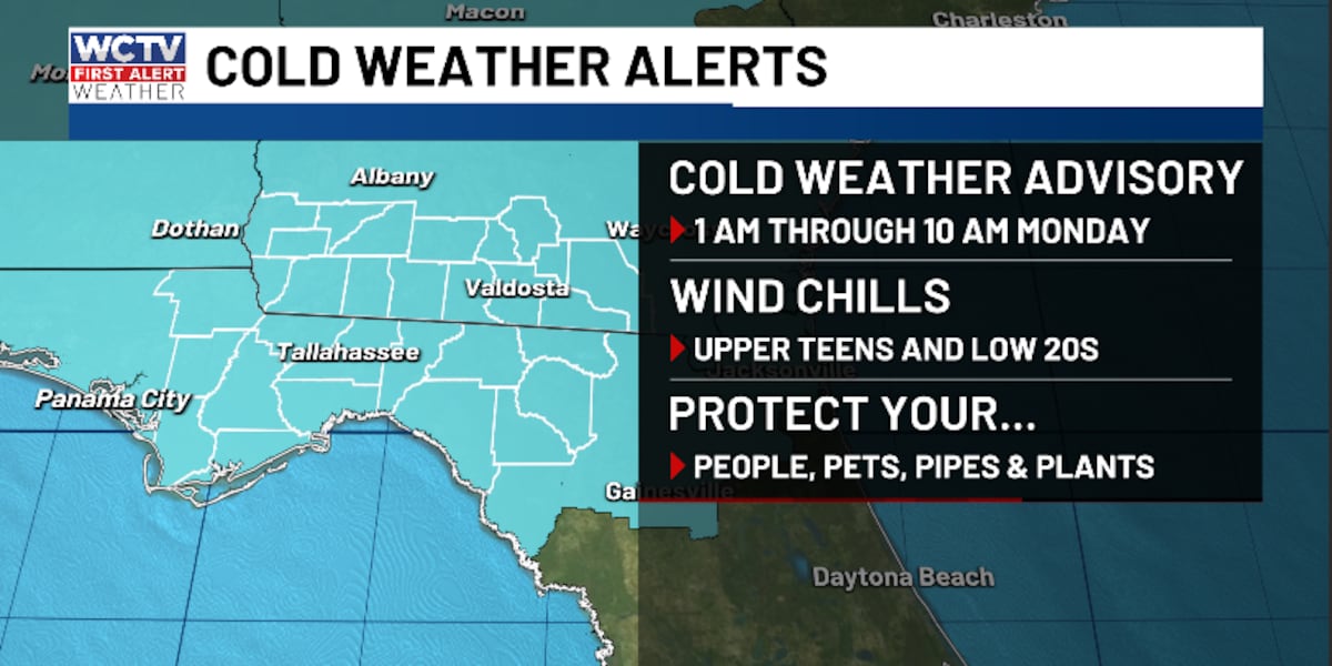
With the cold air and breezy wind, the wind chill could dip into the upper-teens and low-20s for Sunday night and Monday morning. As a result, the National Weather Service has issued a Cold Weather Advisory from 1 a.m. through 10 a.m. Monday.
Be sure to protect your pets, plants, pipes and people.
Starting The Work Week
Monday is looking sunny, dry and cold. Highs only top out in the upper-40s and low-50s. Again, the wind could be slightly gusty.
We are expecting the wind to calm down for Monday night. With a clear sky and calm wind, those low temperatures should dip into the upper-20s by Tuesday morning.
After a frigid start to your Tuesday, we are tracking a nice rebound for the afternoon. Highs reach the low-60s under a sunny sky. Lows are not as cold as we bottom out in the upper-30s.
Extended Forecast
This cold snap is relatively brief. We are warming up for the middle and end of the work week.
Temperatures on Wednesday top out in the upper-60s under a mix of Sun and clouds. Lows bottom out in the upper-40s and low-50s.
An isolated shower could be possible on Thursday under a partly cloudy sky. Highs climb into the low-70s with lows in the mid-50s.
Friday is also looking warm and above average. Temperatures hover in the low-70s under a mix of Sun and clouds. Overnight lows settle in the low-50s.
To stay updated on all the latest forecasts and weather, follow WCTV First Alert Weather on Facebook and X (Twitter).
Click here to see all the latest weather headlines and here to view the First Alert Radar. Receive push alerts and watch the latest forecast anytime on the free WCTV First Alert Weather app. Click here to download it now.
Interested in becoming a WCTV First Alert Weather Watcher? Click here to join the team!
Copyright 2025 WCTV. All rights reserved.