
1 / 3

SANIBEL-CAPTIVA CONSERVATION FOUNDATION
2 / 3
SANIBEL-CAPTIVA CONSERVATION FOUNDATION
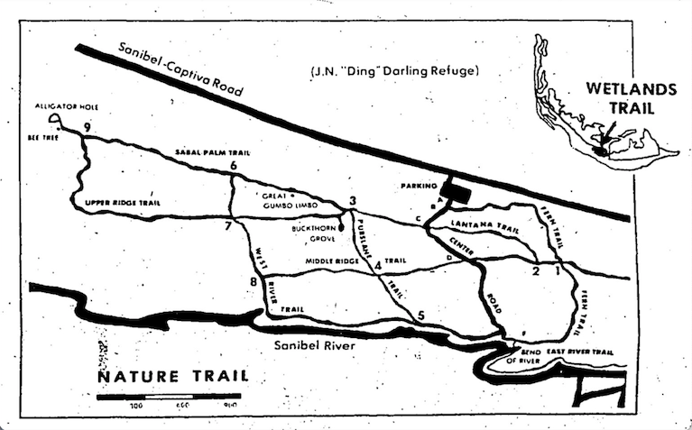
A trail map from 1977 illustrates the more than four miles of trails at the William and Ruth Brooks Trail on Sanibel that the Florida Gulf Coast University students are re-mapping.
3 / 3
SANIBEL-CAPTIVA CONSERVATION FOUNDATION
[expand]
close
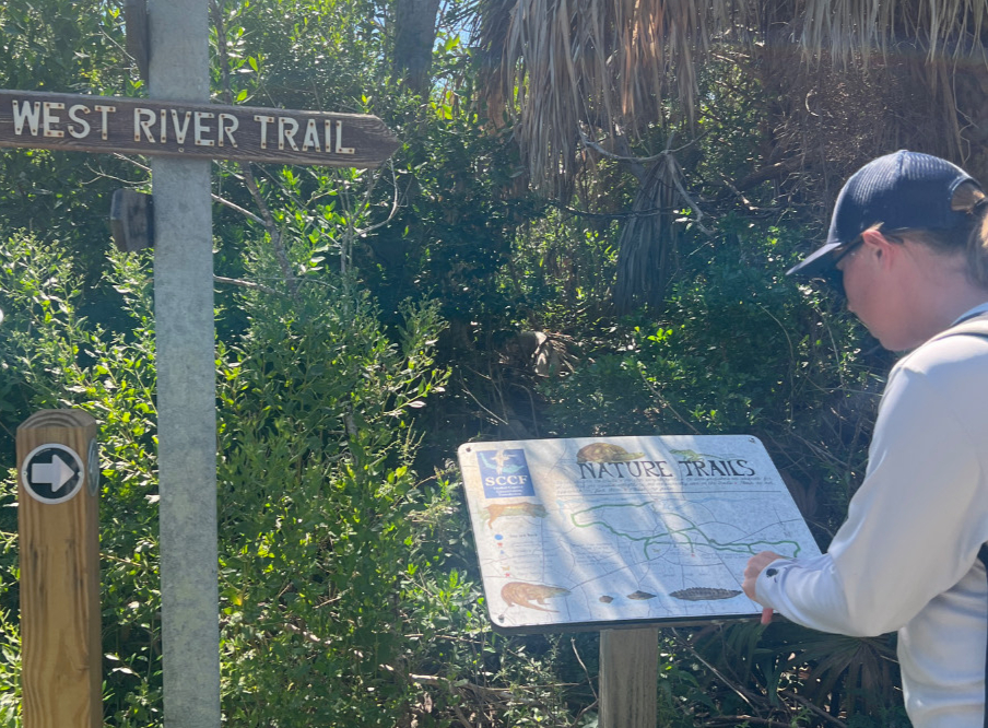
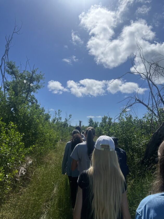
The Sanibel-Captiva Conservation Foundation (SCCF) reported that it is getting assistance on mapping trails at the William and Ruth Brooks Trail from an Environmental Geographic Information System — GIS — class at Florida Gulf Coast University (FGCU).
Through the project, students are creating GIS layers and maps illustrating three newly cleared trails in the 212-acre Erick Lindblad Preserve, located behind the SCCF’s headquarters. The preserve lands were acquired from 1969-84 to protect a core component of the Sanibel Slough and interior freshwater wetlands — unique features for a barrier island.
The trails — of which only one is currently open to the public — were renamed earlier this year thanks to funding provided by the Brooks, which allowed expedited the removal of extensive debris, fallen trees and other trail-clearing work needed following damage from three hurricanes.
In collaboration with SCCF Wildlife & Habitat Management Director Chris Lechowicz and Coastal Watch Director Kealy Pfau, FGCU associate professor Suveshnee Munien created an SCCF Trail Mapping Service-Learning Project.
FGCU students are visiting the preserve several times this semester to document and map the trails and other interesting features, such as benches, bird boxes, signage locations, invasive species, fire lines, low areas on the trail that are muddy or full of water during the rainy season, habitat characteristics, interesting flora, and named locations such as Alligator Hole.
“They will also create an interactive trail map for public use that will be posted on our website,” Lechowicz said.
The SCCF noted that the collaboration benefits both FGCU and it.
“This immersive, real-world experience challenges students to translate classroom theory into practical action by tackling pressing local environmental challenges,” Munien said. “This hands-on process equips them with the critical problem-solving skills and professional portfolio needed to gain a competitive edge in the job market.”
The other two trails within the William and Ruth Brooks Trail system are expected to be opened early next year, after the boardwalks are rebuilt and new signage is installed.
“SCCF will benefit from collaborating with FGCU by having up-to-date GIS layers that depict our newly cleared trail system and notable features,” Lechowicz said. “We hope to partner on more service-learning projects with FGCU in the future.”
The trails the students are mapping include three loops, previously known as the East River Loop, Impoundment Loop and Sabal Palm Loop, which includes the former High Ridge Trail.
The trails were originally marked and mapped in 1975.