
ORLANDO, Fla. — Our temperatures will remain stable through most of this upcoming week. We are tracking highs in the upper 70s each day until Friday.
Another cold front will pass through central Florida on Monday. This system will be dry and significantly weaker, with little to no impact on our temperatures.

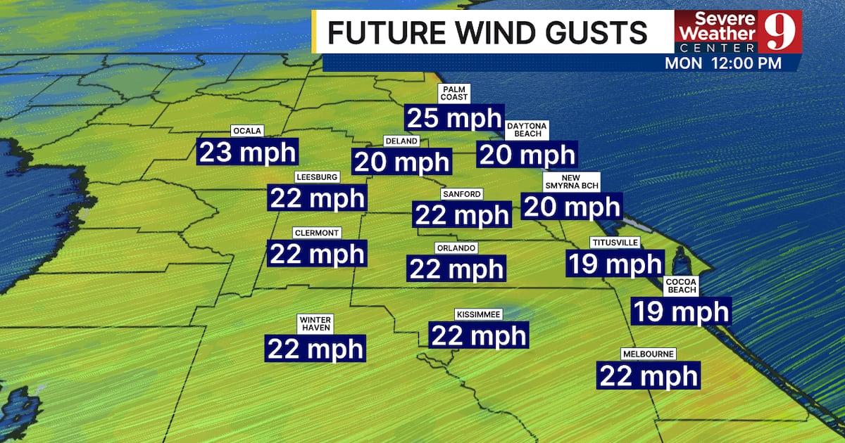
The one impact we could see is some stronger winds. Gusts during the afternoon are expected to reach 25 to 35 mph.
Morning lows will also be stable. We saw a handful of places this morning fall into the low 50s and even the upper 40s. Starting Sunday morning, we will have low temperatures around 60 degrees.
Rain chances will be largely held in check. A few isolated coastal showers are possible Monday through Christmas Day. We are not tracking any heavy rainfall, and this is certainly not enough to ruin any outdoor plans.

We will not see any major cold fronts pass through the area between now and the new year. This means we will see very little change in temperatures and limited rain chances.
Click here to download our free news, weather and smart TV apps. And click here to stream Channel 9 Eyewitness News live.

TOP STORIES FROM WFTV CHANNEL 9
©2025 Cox Media Group