
TALLAHASSEE, Fla. (WTXL) — Today’s uptick in cloudiness will provide minimal opportunity for a brief passing showers in inland locations early this evening. Otherwise, a few breaks in the clouds will be possible through midnight. A southwest wind pattern will keep temperatures on the milder side for the evening and the entire night. Forecast temperatures will drop into the 50s before midnight and then level off around the middle 50s early Saturday morning. As southwest winds continue, readings will rise a few degrees before the sun comes up.
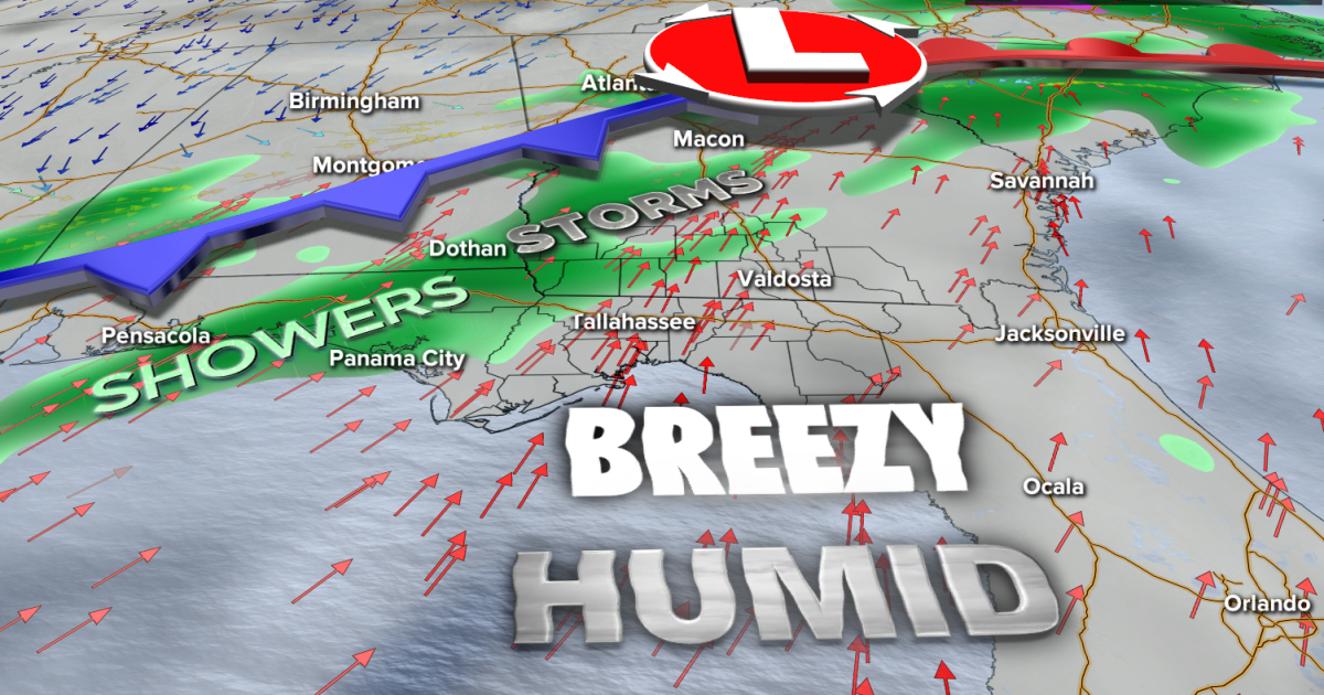
A low-pressure system in the Tennessee Valley and an attached cold front will sweep their way across Deep South states Saturday. The effect they will have on us includes breezy and more humid conditions. A few showers are possible Saturday morning prior to the cold front’s approach in the afternoon. A broken line of showers, rain, and thunderstorms will form along the front and push west to east across most neighborhoods around and north of Interstate 10 in the afternoon. Some downpours will be generally gusty, and an isolated case of severe-level wind gusts and hail is possible. Most of the rain chance will subside by the evening and nighttime hours.
Expected highs will be in the low to mid 70s.
A clearing trend will begin Sunday. Some leftover pockets of clouds will remain, but sunshine will be increased over Saturday’s amounts. Lows will be around 50° Sunday morning with highs in the 60s.
Next week will feature a warmer trend that lasts for several days, along with a partly cloudy sky. There is enough moisture for a few isolated showers starting around midweek.
–Casanova Nurse, Chief Meteorologist
Want to see more local news? Visit the WTXL ABC 27 Website.
Stay in touch with us anywhere, anytime.