
ORLANDO, Fla. – Central Florida will enjoy a mainly dry Sunday to wrap up the weekend, with just a few isolated showers possible later in the day as a weak front approaches from the north.
Most areas, including Daytona Beach for the final day of Biketoberfest, should stay mostly dry, warm, and pleasant.
Highs will climb into the mid to upper 80s this afternoon under partly sunny skies. In Orlando, expect a high of 87.
A few brief showers could develop north of Orlando and along the Treasure Coast late today, but rain chances stay low at around 20–30%.
[EXCLUSIVE: Become a News 6 Insider (it’s FREE) | PINIT! Share your photos]
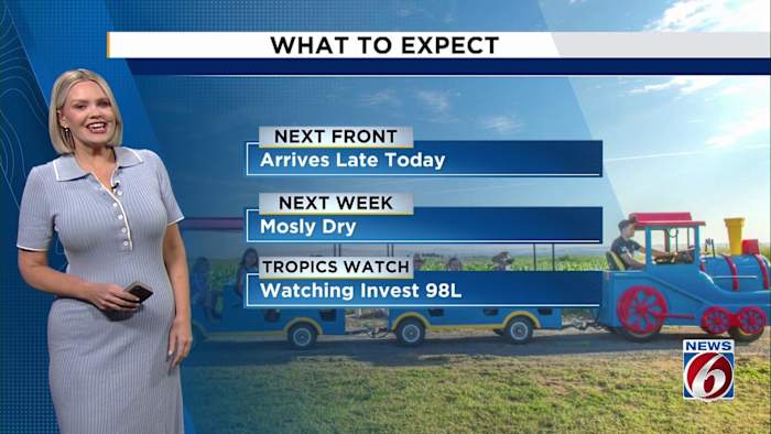
A weak cold front will slide into the area tonight and stall across South Florida on Monday. Behind it, slightly cooler and drier air will move in, though temperatures will remain near or slightly above normal — generally in the 80s through midweek.
If you’re heading to the beach, the risk of rip currents remains high through Monday and conditions will remain rough near inlets due to a lingering ocean swell. Boaters should expect poor marine conditions Sunday, with seas running 4–6 feet offshore.
Looking ahead, another, stronger front will arrive around midweek, bringing a touch of cooler, more seasonable air by Thursday and Friday.
Meanwhile, in the tropics, Invest 98L in the central Atlantic has a 50% chance of development over the next seven days. It’s not an immediate concern for Florida, but our team will keep an eye on it as it slowly organizes.
[6 THINGS TO DO: Oct. 18-19]
Daily Forecast
The News 6 Weather team ensures you’re always on top of the day’s weather.
Copyright 2025 by WKMG ClickOrlando – All rights reserved.