
JACKSONVILLE, Fla. — Tracking the 40s and 50s this morning.
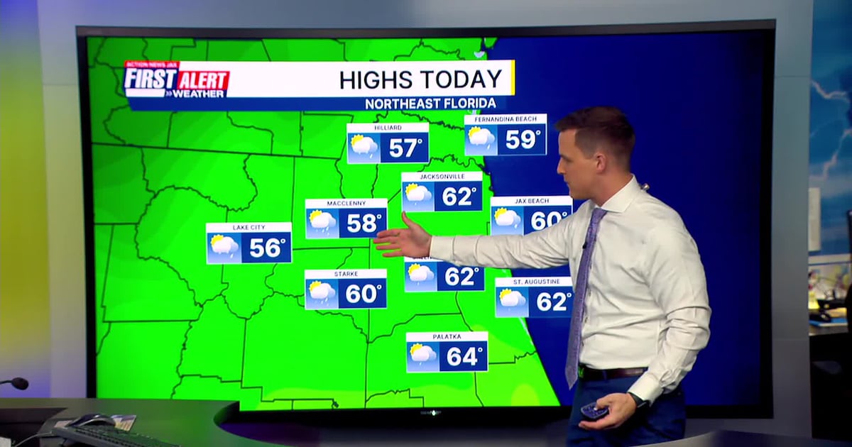
Mostly cloudy skies today with a few isolated AM sprinkles possible. Most neighborhoods won’t see morning rain.A line of showers will arrive in Jacksonville between 1 p.m. and 3 p.m. this afternoon.The showers will move-in to Lake City and Waycross near or just before noon.The initial band of showers will be gone by the evening commute. A few more showers are possible tonight south of I-10Showers should be done in time for the AM commute on Thursday.Highs today in the lower 60s in Jacksonville. Overnight, we drop to the lower 40s.Highs tomorrow are only in the lower 50s with a breezy northwest wind.The coldest air of the season, so far, arrives Friday morning.Widespread frost/freeze to end the week.Temperatures will be in the 20s inland and lower 30s along the coast.Some frost and freezing conditions will be east of the St. Johns River to just off the beach.Freeze Watch for our entire viewing area, including the beaches, for Thursday night into Friday morning.
TODAY: Mostly cloudy with a few afternoon showers. High: 62
TONIGHT: Mostly cloudy, a few showers south. Low: 42
THURSDAY: Clearing & cool. Breezy. 42/53
FRIDAY: AM frost/freeze. Sunny & chilly. 25/56
SATURDAY: Inland AM frost/freeze. Mostly sunny. 30/65
SUNDAY: Morning showers. Mostly cloudy. 38/58
MLK DAY: Inland AM frost/freeze. Mostly sunny. 30/56
TUESDAY: Inland AM frost/freeze. Mostly sunny. 30/59

WATCH THE FORECAST | DOWNLOAD THE APPS
Follow Action News Jax Meteorologists on Twitter for updates:
Mike Buresh | Garrett Bedenbaugh | Corey Simma | Trevor Gibbs
ALLERGY TRACKER: See what the pollen counts look like in our area
LISTEN: Mike Buresh ‘All the Weather, All the Time’ Podcast
INTERACTIVE RADAR: Keep track of the rain as it moves through your neighborhood
SHARE WITH US: Send us photos of the weather you’re seeing in your area ⬇️