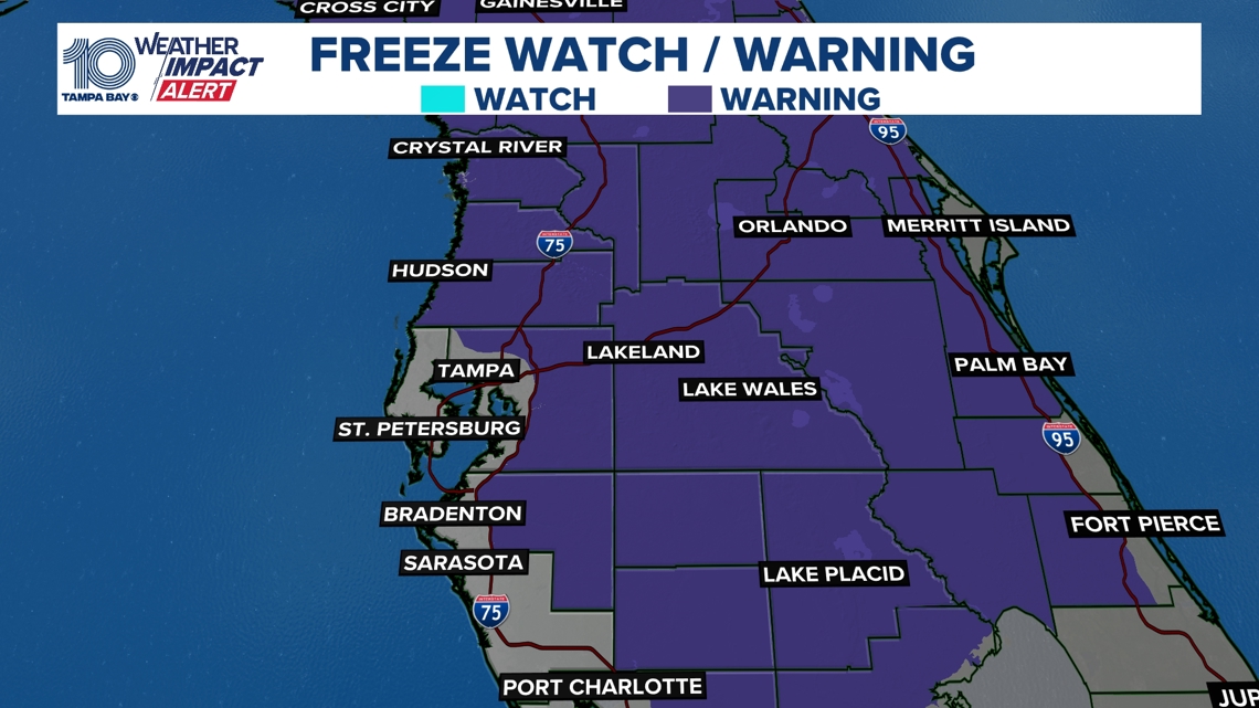
Freeze warnings and cold weather advisories in effect from 1 a.m. to 9 a.m. Friday as a widespread freeze reaches deep into Florida.
TAMPA, Fla. — Breezy, much colder air continues to move in on Thursday behind a strong cold front. The coldest temperatures of the season arrive overnight, setting the stage for a widespread freeze across much of the area by Friday morning.
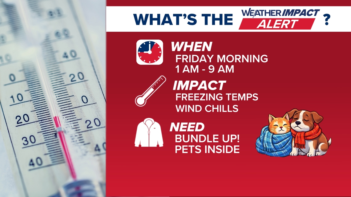
WHEN:
1 a.m. to 9 a.m. Friday morning, a Cold Weather Advisory and Freeze Warning are in effect for much of the viewing area as temperatures fall into the 20s and 30s, with wind chills in the 20s for some communities.
IMPACT:
Sub-freezing temperatures and biting north winds will create dangerous cold conditions for people, pets, plants and exposed pipes. Sensitive vegetation may be damaged or killed, unprotected plumbing could freeze, and cold stress is a concern for anyone spending time outdoors early Friday.
NEED:
Bring pets indoors, protect plants and outdoor pipes and dress in warm layers if you’re heading out early. Check on elderly neighbors and anyone without reliable heat, and limit time outdoors during the coldest hours.

Looking ahead:
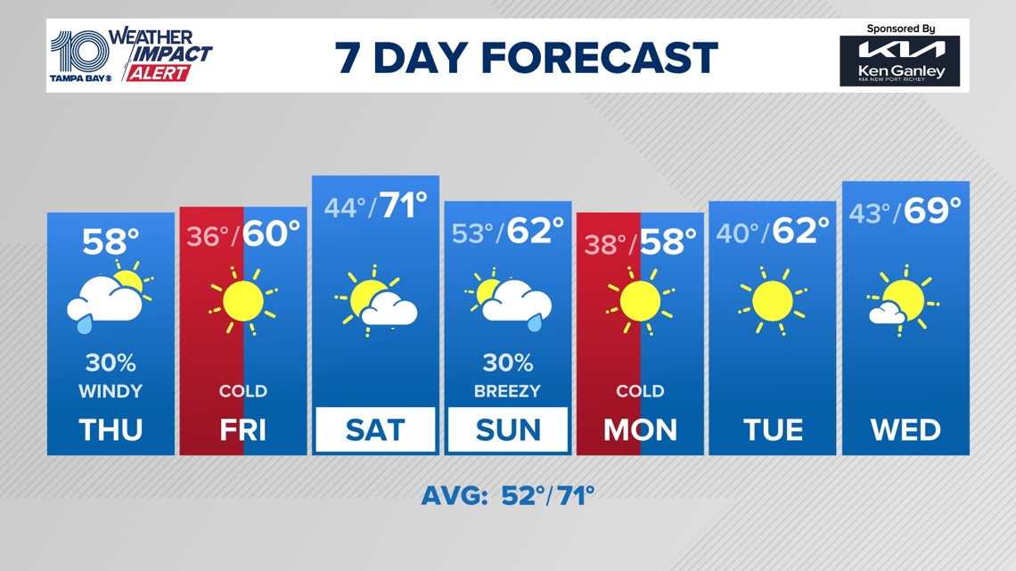
Temperatures improve slightly over the weekend, but a weaker front will move through late Sunday. Another reinforcing surge of cold air arrives by Monday morning, bringing another Weather Impact Alert and keeping winter-like conditions in place to start next week.

How cold is this freeze compared to previous records?
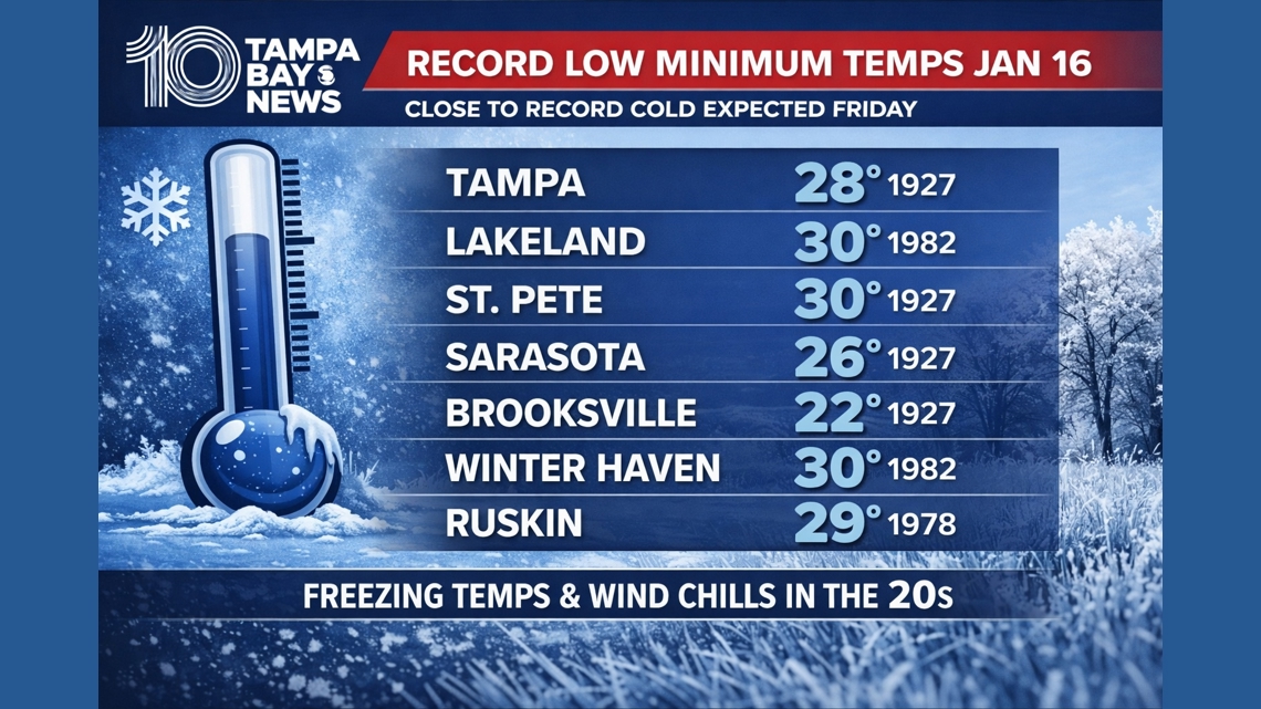
Friday morning’s temperatures will be near record territory for Jan. 16, especially inland and north of I-4. While most locations are expected to stay just above record lows, some communities could come within a few degrees of records that have stood since the 1920s and early 1980s. Tampa’s record low for January 16 is 28° (set in 1927), with similar upper-20s to near-30° records across the region. Even without records falling, this will still be one of the coldest mornings many residents have experienced in years.