
TALLAHASSEE, Fla. (WCTV) – Sunshine will stick around on Friday, but our next weather system could bring rain showers and a **few** snowflakes mixed in by Sunday morning.
Tonight Through Friday Night
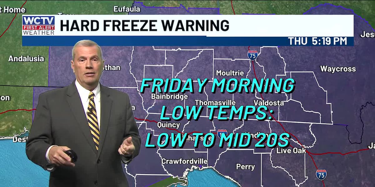
High pressure will control the forecast for the next 24 hours or so. As a result, we stay dry, clear and frigid. Be sure to protect your people, pets, plants and pipes. Lows tumble into the low-and-mid-20s.
After some very cold weather to start your Friday, we are tracking a nice rebound for the afternoon. We remain dry under plenty of sunshine. Highs climb into the mid-and-upper-50s.
Again, we are looking quiet for Friday night. However, clouds begin to increase ahead of our next weather system. Lows settle in the low-40s.
Weekend System
Let’s discuss the elephant in the room: our weekend weather system.
On Saturday, we are looking partly sunny to mostly cloudy. Spotty rain showers are possible as temperatures climb into the mid-60s. We could see a few more showers for Saturday night, but temperatures remain above freezing. We bottom out in the upper-30s to low-40s.
All eyes are on Sunday. Social media is buzzing with plenty of click-bait, so let’s discuss the facts.
Cold air will continue filtering into the region by Sunday morning. With a little bit of leftover moisture, we could see a brief window of a wintry mix. However, it is important to keep in mind, air temperatures will be above freezing.
BOTTOM LINE: Yes, we may see a few snowflakes or sleet pellets mixed into the cold rain Sunday morning, but we are not expecting impacts as temperatures remain in the mid-to-upper-30s. At this point, this is not looking like a repeat of January 2025.
As always, the forecast can change, so stay updated with WCTV through the weekend as we bring you frequent updates without the hype train.
Behind This Sunday System
After some precipitation Sunday morning, we are drying out and clearing out for the afternoon and evening. Temperatures plummet into the mid-20s by Sunday night.
High pressure takes over for early next week, so we are looking dry, cold and mostly sunny.
Temperatures on Monday and Tuesday hover in the low-to-mid-50s. Overnight lows dip into the mid-and-upper-20s.
To stay updated on all the latest forecasts and weather, follow WCTV First Alert Weather on Facebook and X (Twitter).
Click here to see all the latest weather headlines and here to view the First Alert Radar. Receive push alerts and watch the latest forecast anytime on the free WCTV First Alert Weather app. Click here to download it now.
Interested in becoming a WCTV First Alert Weather Watcher? Click here to join the team!
Copyright 2026 WCTV. All rights reserved.