
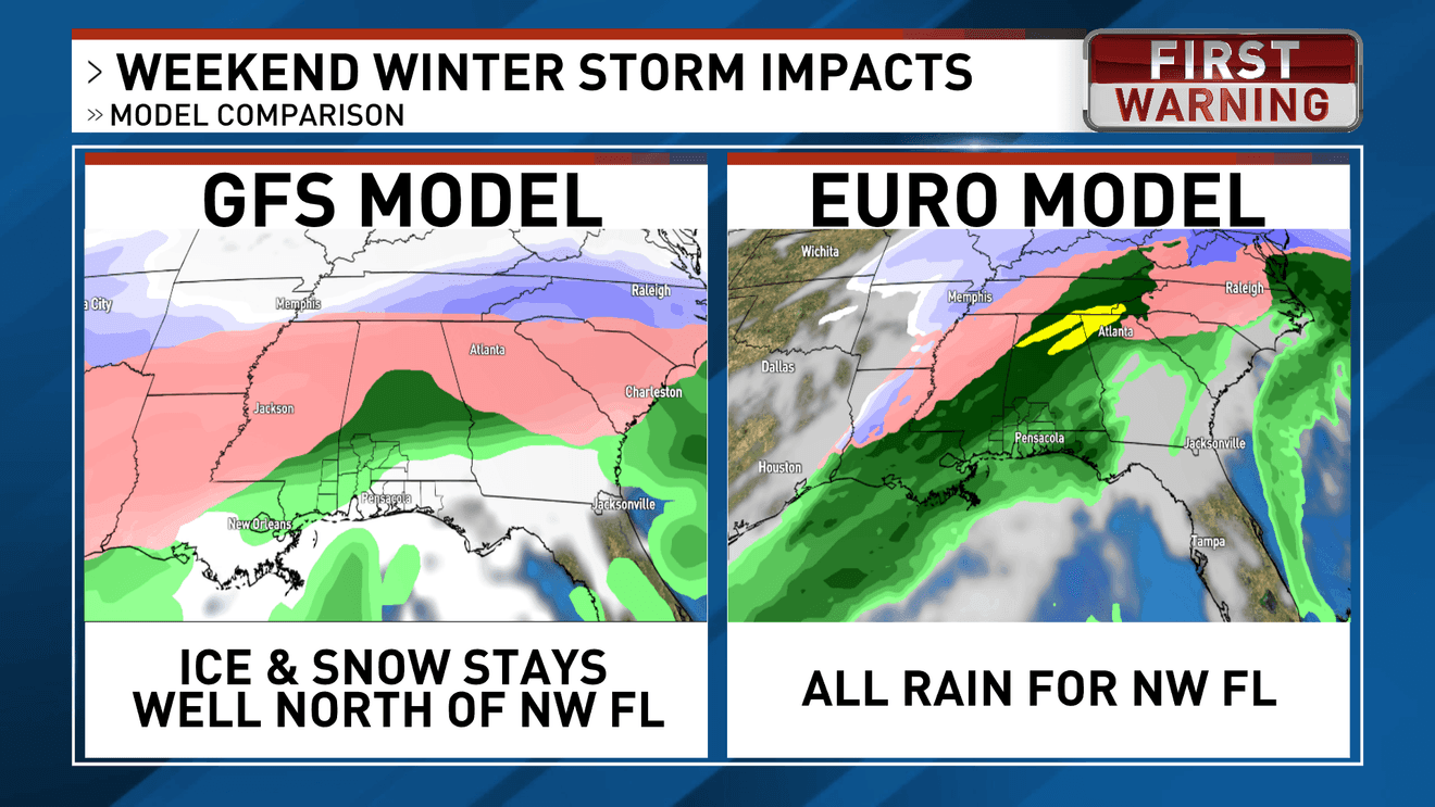
PENSACOLA, Fla. — A powerful winter storm is forecast to blast across a large portion of the United States this weekend, bringing heavy snow, freezing rain, dangerous ice, and sharply cold temperatures from the Southern Plains to the Northeast. This system may impact well over 170 million Americans — potentially stretching across 30+ states through Monday. Florida is forecast to see rain ahead of the cold air this weekend, followed by much colder temperatures, but no significant snow or wintry precipitation is currently expected for the state.
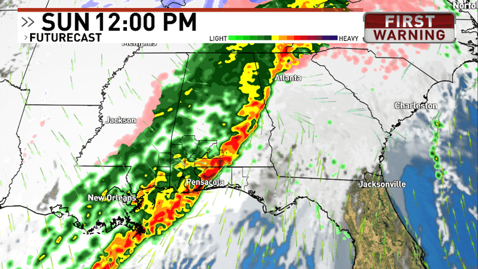
The Gulf Coast can expect 2 rounds of significant rainfall. Round one on Saturday night and round two on Sunday. Some of the storms on Sunday may be on the strong side as the front moves through.
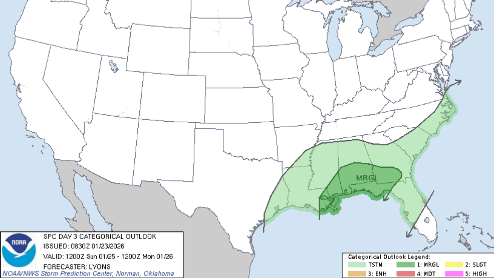
As of late Friday, the Storm Prediction Center has the WEAR-TV area under a level 1 out of 5 for strong storms for Sunday. Storms are expected to move in late Saturday and continue through Sunday morning and afternoon. The heaviest of the rain is likely right in the middle of the day Sunday.
To the north, the same storm system will bring winter weather to millions. The WEAR-TV area will be well south of the wintry weather but will continue to monitor for any changes south.
400612ca-b9d9-4cfc-98db-763ed82c6b9c-GFSEUROCOMPARISON.png
Comment with Bubbles
BE THE FIRST TO COMMENT
After the storms move out of our area, we are expecting to see temperatures plumet with lows in the 20s Monday morning. Highs Monday and Tuesday will only be in the 40s. Get ready for cold weather next week!
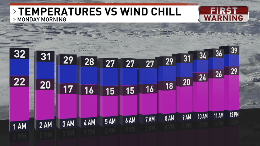
Wind Chill Monday morning