
TAMPA, Fla. – FOX 13 meteorologists are tracking Invest 98L as it treks across the Caribbean.
What we know:
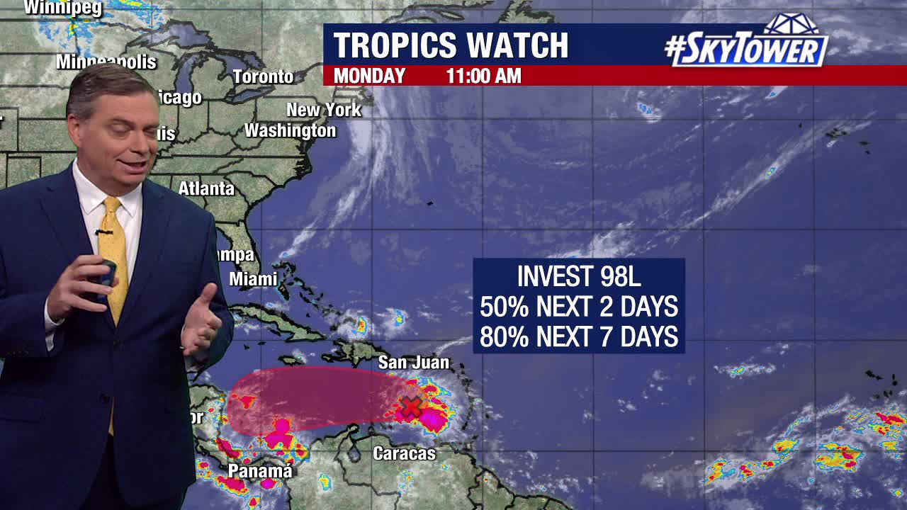
As of Monday afternoon, it had a 50% chance of developing over the next two days and an 80% chance of developing over the next week.
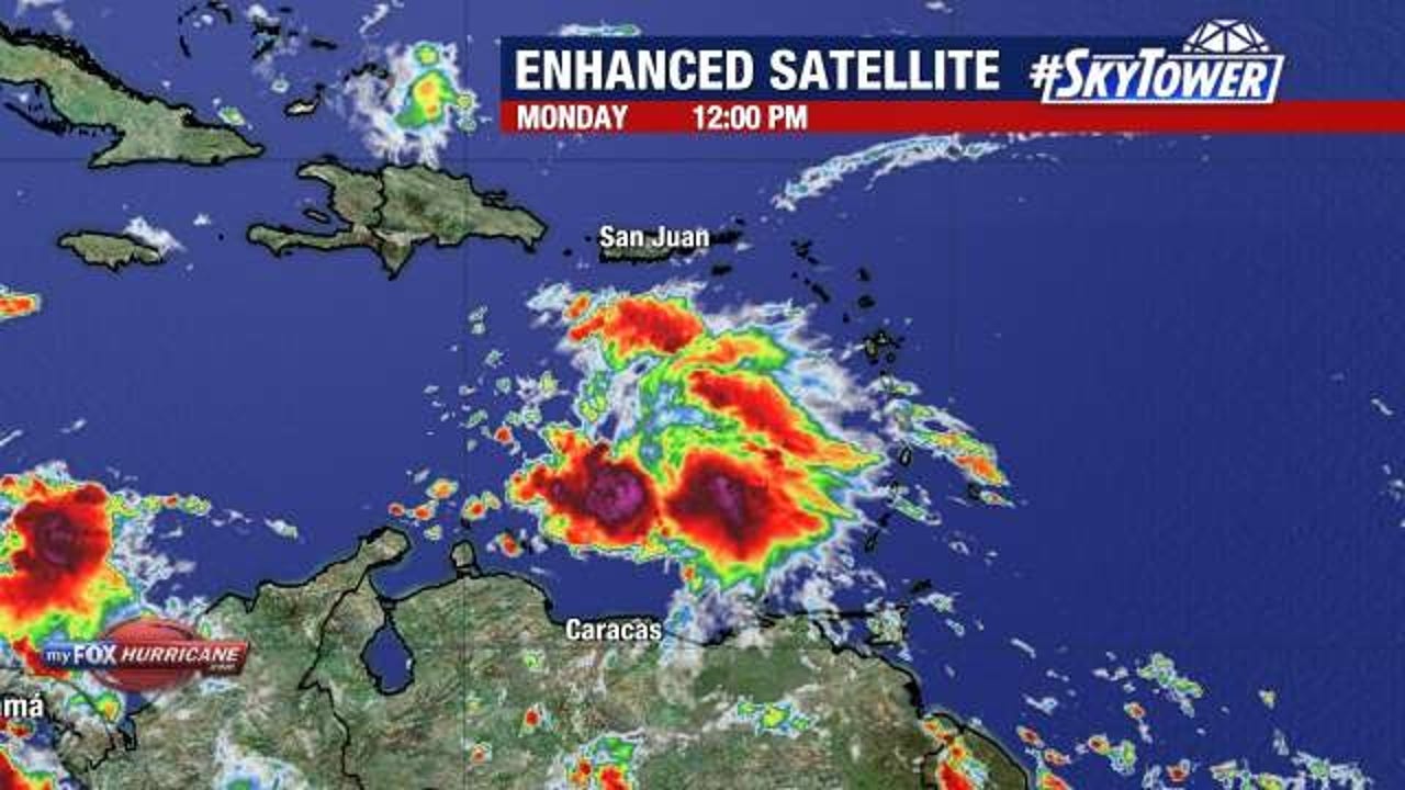
The NHC said Invest 98L, which is currently located in the eastern Caribbean a few hundred miles to the west of the Windward Islands, is continuing to produce a large area of poorly organized showers and thunderstorms.

It is moving west at 20-25 miles per hour, but FOX 13 Meteorologist Valerie Mills says Invest 98L is expected to slow down significantly over the next few days.
Dig deeper:
However, because it will be sitting over water with temperatures in the 80s, there will be a tug to the north.
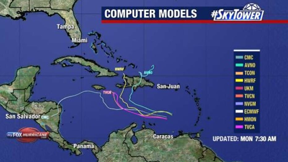
She noted that models have been struggling to predict where the system will go as there is no defined center of circulation yet.
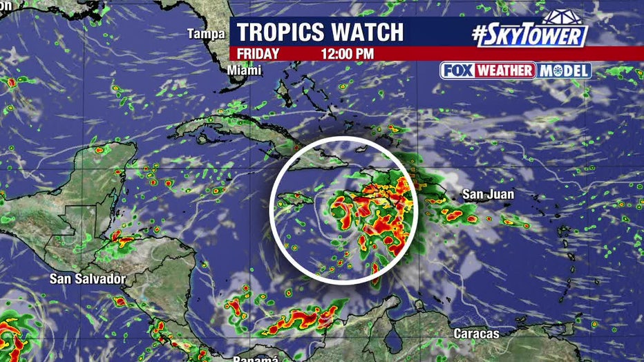
Mills added that the trend is to continue tracking west and then make a sharp turn to the north and northeast.
READ: Manasota Key residents still working to rebuild, restart one year after Hurricane Milton
She said that turn will likely occur well to the east of Florida and should not be a concern for us.
However, she said that will be bringing some active weather to portions of the Caribbean Islands over the next several days.
What is an invest?
The term “invest” is used by the National Hurricane Center (NHC) to identify weather disturbances it is investigating for possible development into a tropical depression or tropical storm within the next seven days. Additionally, the designation allows the NHC to run special hurricane computer forecast models on the system.
What’s next:
If Invest 98L becomes Tropical Storm or Hurricane Melissa, it will be the 13th named storm of the 2025 Atlantic hurricane season.
The Source: This story was written with information from FOX 13 Meteorologist Valerie Mills forecast, the National Hurricane Center and FOX Weather.