
Buckle up South Florida, as the rollercoaster ride is about to begin.
Our warming trend continues on Thursday with morning upper-50s and low-60s pushing into the mid-70s briefly in the afternoon.
But it will be brief, because a cold front will roll in the afternoon and bring scattered showers and our next big cooldown.
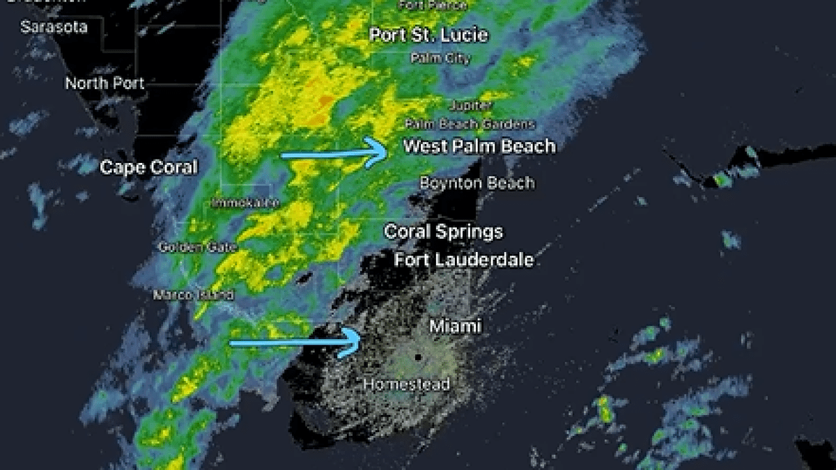
2/5 @ 11AM: Heading out for lunch? Might want to take an umbrella with you!
A line of light to moderate showers continues to slide eastward across South Florida out ahead of a strong front.
Then, some more dry weather with gusty northwesterly winds behind the front! pic.twitter.com/Pw9FXax21s
— NWS Miami (@NWSMiami) February 5, 2026
We are forecasting widespread mid-40s across Miami-Dade and Broward with 50s for the Florida Keys. You factor in the wind, and we will likely see wind chills in the 30s with numbers actually flirting with the 20s well inland.
Because of this, a cold weather advisory will be in effect Thursday night for inland Broward and Miami-Dade.
Friday afternoon will still be quite cool with highs struggling to get out of the 60s.
We start our next warming trend this weekend with morning upper-40s Saturday and then morning mid-50s by Sunday. Highs will be in the 70s both days too along with a ton of sun.