
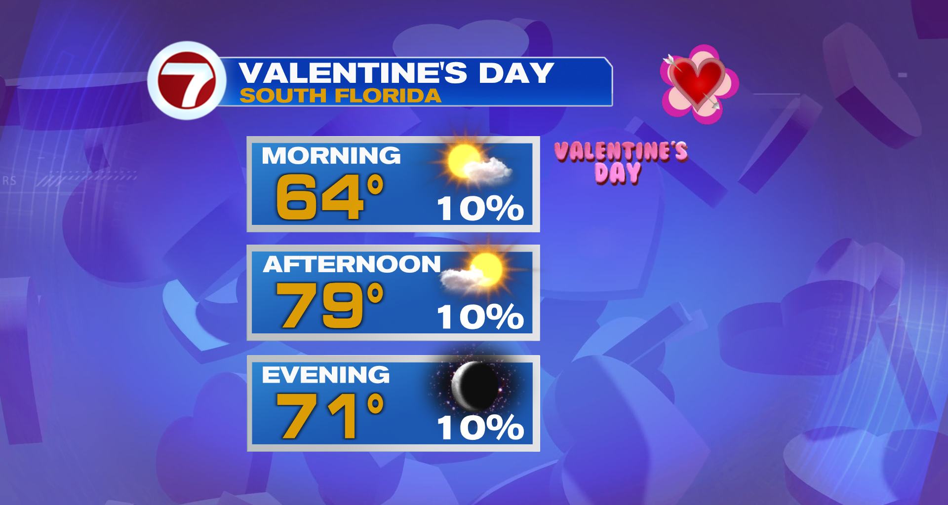
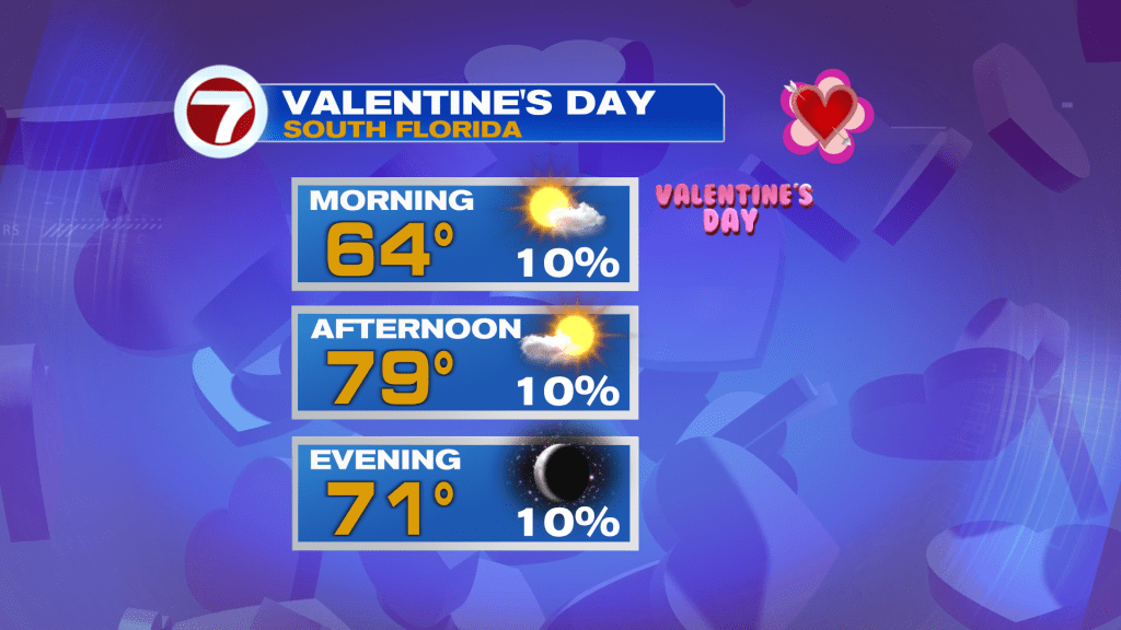
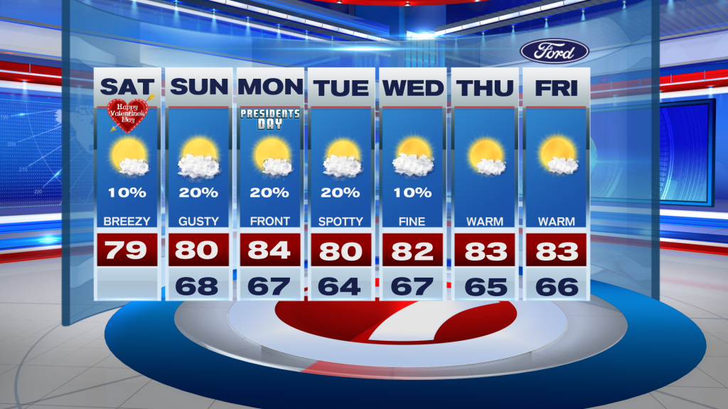
Happy Valentines Day, South Florida!
The rest of today looks great with a mix of sun and clouds and highs in the upper-70s. A stray shower can’t be ruled out along the coast but it won’t be a big deal.
Looking ahead to the rest of the weekend, weather overall looks good for the beach with warm temps and highs near 80. The only thing to keep an eye on is rip currents and windy conditions on Sunday ahead of a front.
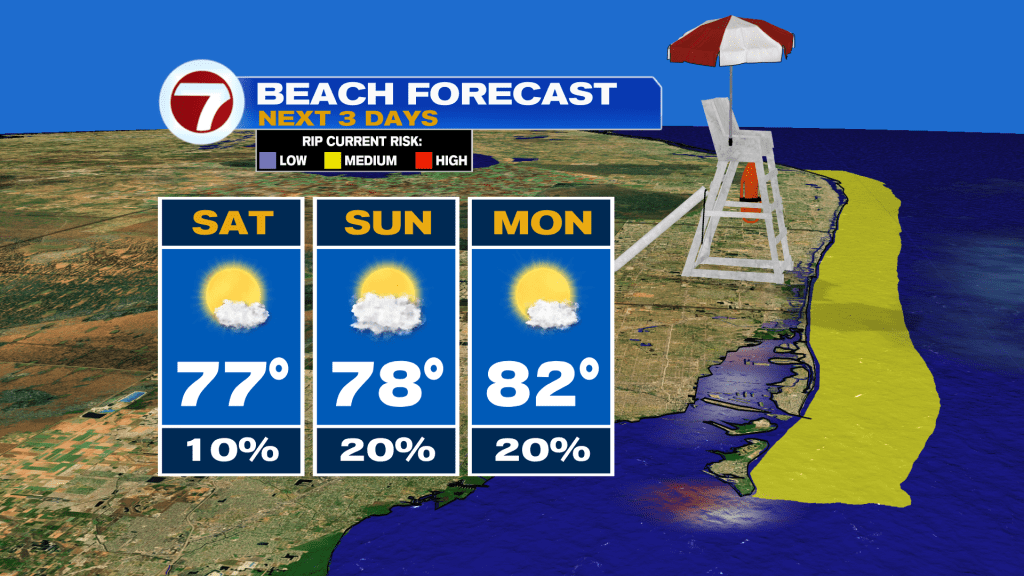
The front will push through Sunday night into Monday. This will not be a strong one with little to no temperature drop behind it.
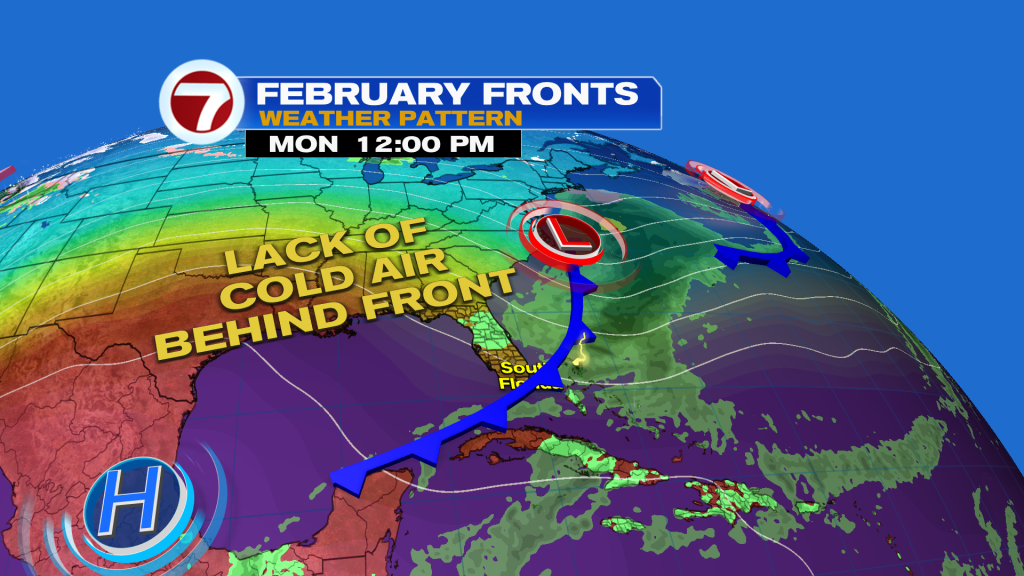
Also, we’re unfortunately not going to see much drought relief from this front. We’re only expecting isolated showers with it, and little to no rainfall accumulation is expected.

Looking ahead to next week, high pressure is forecast to build across Florida. This is going to block any cold fronts from coming down, and will send our temperatures soaring into the mid-80s by late in the week. The potential for record heat is increasing as a result.
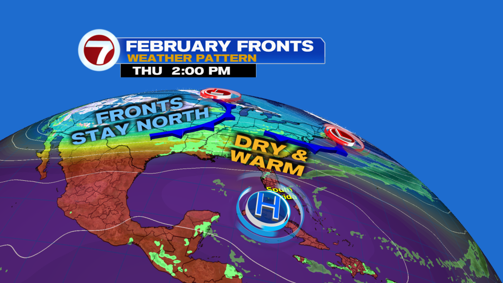
Otherwise, the rest of next week looks relatively sunny and dry.
Join our Newsletter for the latest news right to your inbox