
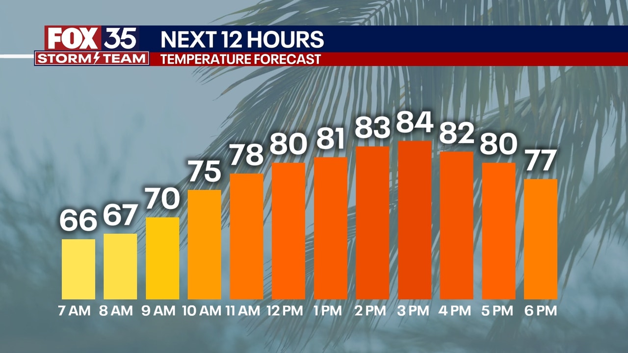
Temperatures as you head out the door this morning will feel a little more fall-like. Plan for temperatures in the low and middle 60s this morning, before highs jump into the mid 80s for inland areas and upper 70s near the coast.
Sunshine will be plentiful with low humidity values too. It will really be a gorgeous day! Winds will be a bit breezy at times as gusts peak around 20-25 mph.
Tonight’s forecast
Mostly clear, cool and crisp. Low will fall into the 60s for most. A few spots could fall into the 50s near Marion and Flagler Counties.
This week
This stretch of pleasant weather continues into Friday and Saturday. It will be picture-perfect with highs in the upper 70s and low 80s, low humidity, and plenty of sunshine. Clouds will begin to build in ahead of our next round of rain on Sunday. Only a few stray showers will be expected late Sunday, with slightly higher chances of scattered showers and downpours Monday, lasting into Tuesday.