
JACKSONVILLE, Fla. — Here’s what the First Alert Weather Team said you can expect for the First Alert Weather forecast:
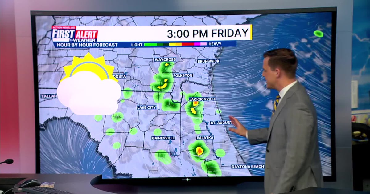
Tracking partly sunny conditions this afternoon with warm temperatures in the 80s.A well inland isolated shower is possible between 7 and 9 pm along I-75 to the west of Jacksonville. Some patchy fog will develop overnight again. Any fog will burn off by 9 am.Afternoon highs continue to be warm in the 80s on Friday into the weekendSome near record highs are likely way from the coast Sunday and into next week.A few isolated showers are possible each day through the weekend. Most local neighborhoods don’t see rain.No significant rain over the next 6 days. The Gate River Run Saturday looks dry, mild, and somewhat humid with warming temperatures into the 70s by mid-morning. Some fog is possible early between 7 and 8:30/9 AM on SaturdayA very warm start to The Players Championship week! The next cold front doesn’t arrive until late next week. We will be tracking to see if any impacts for the Players tournament rounds.
WATCH THE FORECAST | DOWNLOAD THE APPS
Follow Action News Jax Meteorologists on Twitter for updates:
Mike Buresh | Garrett Bedenbaugh | Corey Simma | Trevor Gibbs
First Alert 7-day Forecast:TONIGHT: Partly cloudy. Some fog spreading inland. LOW: 61TOMORROW: AM patchy fog. Partly sunny. Isolated inland shower possible. High: 83SATURDAY: AM fog. Partly cloudy. Isolated shower. 62/83SUNDAY: Partly cloudy. Isolated shower. 62/84 (Record: 86 – 1974)MONDAY: Partly sunny. 64/86 (Record: 88 – 2024)TUESDAY: Mostly sunny. 63/86 WEDNESDAY: Mostly sunny. 64/86 (Record: 89 – 1967)THURSDAY: Increasing clouds with late day showers/storms. Warm. 66/84
ALLERGY TRACKER: See what the pollen counts look like in our area