
The Weather Authority is tracking a gorgeous day to end off your work week.
The Weather Authority’s Nikki Sheaks said, “Not seeing any rainfall on this Friday morning, and that’s going to be the case through the entirety of the day.”
On this Friday, we will be seeing a nice dose of sunshine with no rain in sight.
Dry air still lingers from the last cold front, which will help keep the rain away today.
The mostly sunny skies will help allow for our surface to heat up this afternoon, and high temperatures will be running a few degrees above seasonal in the upper 80s for most. However, it won’t be oppressive thanks to “pleasant” dew points sitting in the low 60s through the day, as well as, a breeze.
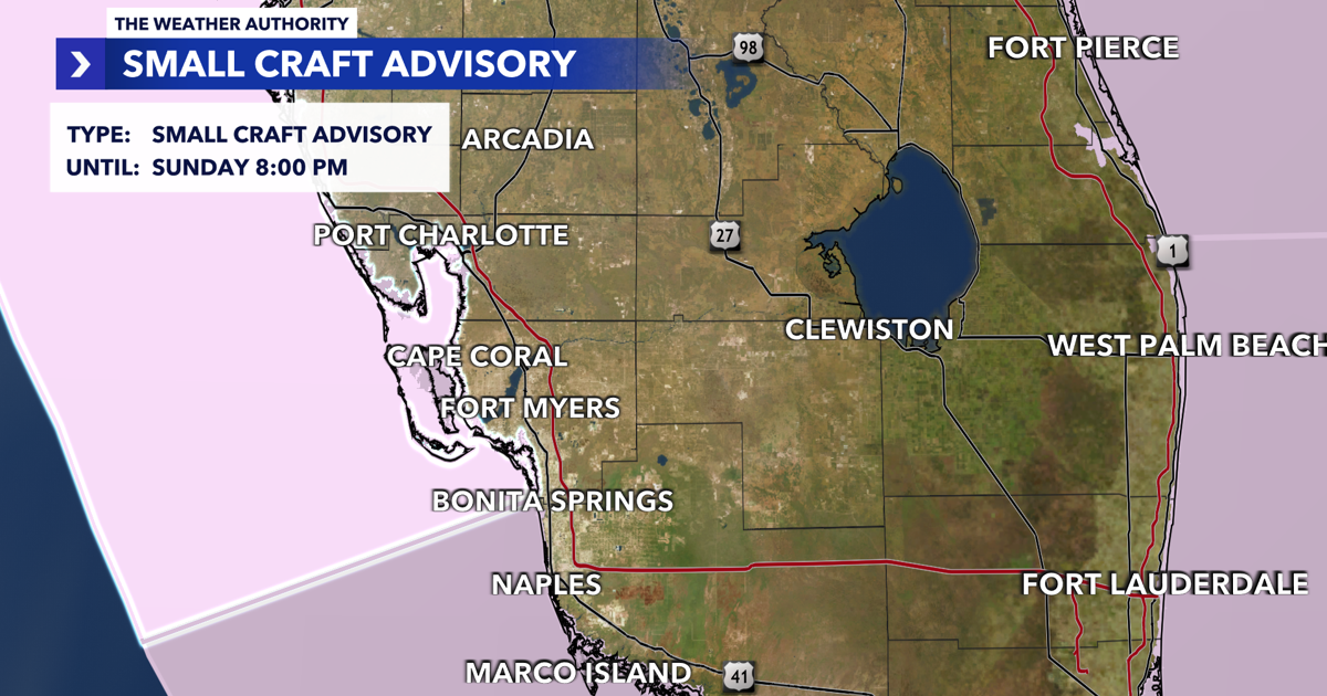
Sustained winds will get close to that 20 mile per hour mark this afternoon. That has prompted a small craft advisory for today through Sunday night because the breezy conditions will lead to wave heights around three to five feet the next few days.
If you’re heading outside for Friday night plans, maybe checking out a high school football game, don’t worry about the umbrella, as we’re in for a mainly clear and mild evening.
This weekend, we will see a few chances for showers both Saturday and Sunday as moisture moves into the area ahead of our next cold front on Monday.
Monday will be our “biggest rain day” of the upcoming week with a shot of isolated showers and storms as the front pushes through Southwest Florida. Dry and cooler air will move in after the frontal passage and then another front will help reinforce that dry and cool air on Thursday.

That’ll lead to our coolest low temperature in Fort Myers since April on Halloween!