
Heavy rain and damaging wind expected to hit Central Florida starting Sunday
TO CHECK WITH YOUR AIRLINE CARRIER BEFORE YOU HEAD TO MCO. YOU REALLY FEEL FOR THE ONE GUY THERE WHO SAID HE HAS TO FLY HOME INTO SNOW IN A BLIZZARD. DEFINITELY NOT LOOKING FORWARD TO THAT, BUT WE HAVE SOME ISSUES OURSELVES THAT WE’RE DEALING WITH. WE’VE GOT A COOL FRONT COMING OUR WAY. ALSO, A SEVERE WEATHER RISK. THAT’S CORRECT. IT’S GOING TO BE A TWO DAY DOUBLE EXPERIENCE, A SEVERE WEATHER, RIGHT. SO ON SUNDAY, TEMPERATURES HIT THE MID 80S. WE HAVE A LOT OF INSTABILITY IN THE AFTERNOON AS A WARM FRONT KIND OF JUST LIFTS ACROSS THE REGION. AND THEN HEADING INTO MONDAY, THAT COOL FRONT THAT YOU MENTIONED, THAT WILL BRING ANOTHER RISK WITH STRONGER GUSTY WINDS AS WELL AS THE CHANCE FOR SOME HEAVIER SHOWERS AS WELL. SO HERE IS A LOOK AT THE IMPACTS THAT WE’RE GOING TO SEE ACROSS CENTRAL FLORIDA ON SUNDAY. TO CLOSE OUT YOUR WEEKEND. WIDESPREAD ALL ACROSS THE LAND. HEAVY RAIN AT THE TOP OF OUR LIST. I KNOW WE NEED THE SHOWERS, BUT WE DON’T NEED THEM ALL AT ONCE IN THESE STRONG DAMAGING WINDS COULD POSSIBLY SURGE UPWARDS OF 30MPH OR EVEN GREATER. TODAY, WHAT WE’RE WATCHING OUT THIS STATIONARY BOUNDARY DRAPED ACROSS SOUTHERN FLORIDA. YOU SEE A FEW MORE SHOWERS OUT TOWARDS WEST PALM BEACH, BUT WE HAD OUR OWN FAIR SHARE OF SHOWERS ACROSS THE I-4 CORRIDOR TODAY. MOST OF THOSE HAVE COME TO AN END. WE HAVE A FLEETING SHOWER OUT TOWARDS WINTER HAVEN AND THE SHOWERS THAT WE HAD HERE IN ORANGE COUNTY HAVE NOW, NOW ALL JUST FADED OUT OF THE PICTURE RIGHT NOW ACROSS ORANGE COUNTY, TEMPERATURES SHOW 75 DEGREES IN ORLANDO. STILL A LITTLE BIT BREEZY THOUGH, WITH WINDS FROM THE EAST AND NORTHEAST AT 13MPH. BEAUTIFUL LOOKING SUNSET. WE’VE SEEN THE SKY PART JUST A BIT AFTER THE PASSAGE OF THE RAIN, TEMPERATURE WISE ACROSS CENTRAL FLORIDA, THOUGH, IT’S A TIGHT KNIT PAIRING RANGING FROM 73 DEGREES UP NORTH IN PALM COAST. 77 FOR OCALA AND WILDWOOD, THOSE APPEAR TO BE THE WARMEST PLACES HERE. JUST BEFORE 730. ULTIMATELY, AS WE CRUISE ACROSS THE REST OF THE EVENING, QUIET AND WARM CONDITIONS WILL BE IN STORE FOR US. TEMPERATURES SHOULD SETTLE INTO THE MID AND UPPER 60S. SO A WARM START TO YOUR SUNDAY AS WE WARM UP THROUGH THE AFTERNOON. TEMPERATURES RANGING BETWEEN 77 AND 87 DEGREES. THE WARMER THE AIR, THE MORE INSTABILITY WE’RE GOING TO HAVE WITH THAT WARM FRONT LIFTING. SO LET’S START THINGS OFF. AT 12:00. WE COULD SEE A FEW ISOLATED SHOWERS ACROSS I-75, BUT THESE BECOME A LOT MORE WIDESPREAD IN THE AFTERNOON WITH THE INCREASE OF TEMPERATURES. RIGHT. A LOT OF AIR COMING IN FROM THE SOUTH. SO WE’RE PICKING UP THAT MOISTURE FROM BOTH THE ATLANTIC AND THE GULF AND THE ATLANTIC COAST. SO HERE’S WHAT’S HAPPENING AT 530. YOU SEE ALL THIS RED HERE ON FUTURECAST INDICATING HEAVIER DOWNPOURS AND STRONGER STORMS ACROSS OUR NECK OF THE WOODS. SO WE’RE CARRYING THAT CHANCE FOR IMPACT WEATHER ACROSS YOUR SUNDAY AFTERNOON INTO THE EVENING BEFORE SHOWERS START TO FADE BY 9:00. AND WE’RE DRIER HEADING INTO MONDAY, BUT WE’RE ONLY GOING TO STAY DRY FOR SO LONG BECAUSE THAT COLD FRONT WILL BE KNOCKING ON OUR FRONT DOOR HEADING INTO MONDAY AFTERNOON AND ACROSS THE EARLY EVENING MONDAY. NOW, WINDS ARE GOING TO BE A PRIMARY IMPACT ON MONDAY WITH THE FRONT RUSHING IN. TAKE A LOOK AT THIS. WE COULD SEE SOME GUSTS CLOSE TO 40MPH OUT TOWARDS THE WEST ALONG I-75. RAINFALL WON’T BE AS HIGH MONDAY AS WE’LL SEE THE CHANCE FOR SHOWERS WIPE AWAY BY 5:00 AND 6:00, BUT WE WILL STILL BE BREEZY AFTER THE FRONT PASSES. AS FAR AS RAINFALL ACCUMULATION IS CONCERNED, HEADING INTO TUESDAY, WE COULD SEE POCKETS OF RAIN BETWEEN TWO, MAYBE EVEN CLOSE TO 4 OR 5IN IN ISOLATED AREAS. SO NOT EVERYONE IS GETTING THE RAIN, BUT WE COULD HAVE SOME POTENTIAL FOR FLOODING COMING UP NOW. FROM SUNDAY TO TUESDAY, TEMPERATURES COOL DRASTICALLY AFTER THE FRONT PASSES YOU BY. SO IMPACT WEATHER SUNDAY AND MONDAY. SAINT PATTY’S DAY ON TUESDAY WE DROP DOWN TO T
Heavy rain and damaging wind expected to hit Central Florida starting Sunday

Updated: 8:21 PM EDT Mar 14, 2026
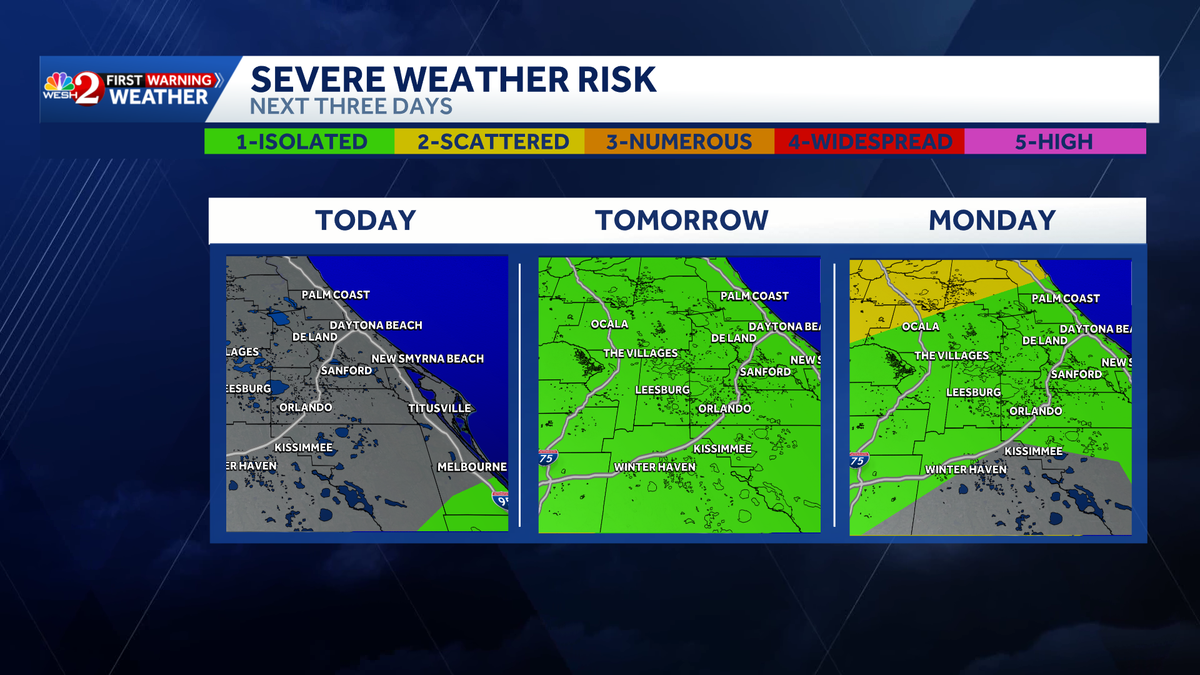
Heavy rain and damaging winds are expected to hit Central Florida on Sunday and Monday, with a cold front moving across the state on Monday. WESH 2’s First Warning Weather meteorologists are calling for Impact Weather on both days, starting on Sunday afternoon from 2 to 8 p.m.Primary impacts for Sunday will include heavier rain overhead for longer durations of time.This can potentially lead to flooding concerns in areas that have long-lasting storms.Monday’s timing is a bit earlier in the afternoon, and drying out heading into the evening, from noon to 5 p.m.Stronger winds will have a greater impact on Monday with the cold front moving past. First Warning Weather Stay with WESH 2 online and on-air for the most accurate Central Florida weather forecast.RadarSevere Weather AlertsDownload the WESH 2 News app to get the most up-to-date weather alerts. The First Warning Weather team includes First Warning Chief Meteorologist Tony Mainolfi, Eric Burris, Marquise Meda and Cam Tran.What is Impact Weather?Impact Weather suggests weather conditions could be disruptive or a nuisance for travel and day-to-day activities.
CENTRAL FLORIDA, USA —
Heavy rain and damaging winds are expected to hit Central Florida on Sunday and Monday, with a cold front moving across the state on Monday.
WESH 2’s First Warning Weather meteorologists are calling for Impact Weather on both days, starting on Sunday afternoon from 2 to 8 p.m.
Primary impacts for Sunday will include heavier rain overhead for longer durations of time.
This can potentially lead to flooding concerns in areas that have long-lasting storms.
Monday’s timing is a bit earlier in the afternoon, and drying out heading into the evening, from noon to 5 p.m.
Stronger winds will have a greater impact on Monday with the cold front moving past.
This content is imported from Facebook.
You may be able to find the same content in another format, or you may be able to find more information, at their web site.
First Warning Weather
Stay with WESH 2 online and on-air for the most accurate Central Florida weather forecast.
Download the WESH 2 News app to get the most up-to-date weather alerts.
The First Warning Weather team includes First Warning Chief Meteorologist Tony Mainolfi, Eric Burris, Marquise Meda and Cam Tran.
What is Impact Weather?
Impact Weather suggests weather conditions could be disruptive or a nuisance for travel and day-to-day activities.