
Central Florida has a slight risk of strong-to-severe storms to kick off the week.
The region is expected to be partly sunny with highs at 85 degrees.
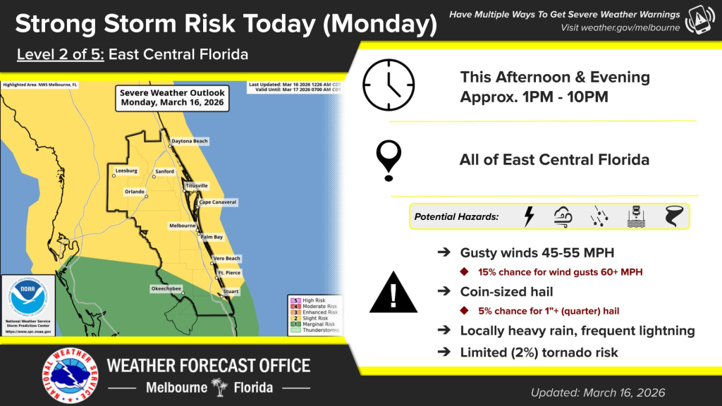
Primary threats of the storm include damaging wind gusts at 60+ mph and quarter-sized hail, according to NWS Melbourne.
There is also a small chance of a couple of tornadoes.
There is a sliding scale of risk used to grade storm chances: little/none, marginal, slight, enhanced, moderate and high.
Before 1 p.m., storm threats are little to none across all of Central Florida.
The storm threat becomes slight for most of Central Florida from 1 p.m. to 7 p.m.
Okechobee has a marginal chance from 1 p.m. to 10 p.m, while Melbourne’s chances downgrade from slight to marginal from 7 p.m to 10 p.m.
After 10 p.m., storm chances across the region are little to none.
Temperatures are expected to drop tonight, with the coldest spots located on the interior of east Central Florida, including Daytona Beach and greater Orlando, according to NWS Melbourne.
Wind chill values could fall into the upper 30s across portions of Lake and Volusia counties.
There is a moderate risk for rip currents at all Atlantic beaches.