
Cold weather brings freeze alerts
JACKSONVILLE, Fla. – If you stepped outside this morning and thought it felt unusually chilly, you were right. I’m Meteorologist Katie Garner with The Weather Authority, and I’m here to get you up to speed on what’s happening across Jacksonville and Northeast Florida.
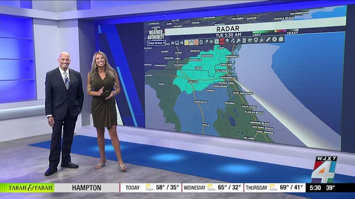
A cold front pushed through yesterday, bringing rain and leaving us with brisk air behind it. Early this morning, temperatures dropped to 39 degrees in Jacksonville, around 40 along the coast, and 40 in Orange Park. Exact Track 4D radar and current condition graphics confirm these numbers.
Inland southeast Georgia is under a freeze warning until 8 a.m. and there’s a freeze watch plus frost advisories in effect for Wednesday morning. It’s a good day for big coats and maybe even a turtleneck or two.
Temperatures expected to rebound soon
The rollercoaster continues, but relief is in sight. I know many of you are wondering if spring is truly here. The first day of spring is Friday, and temperatures are forecast to rebound quickly by then.
Here’s the breakdown: we’re expected to stay below average through Thursday, hanging close to the upper 50s and low 60s. But by Friday and Saturday, we’re likely to pop back into the 70s and even the low 80s.
Don’t pack away the warm jackets just yet. Mornings will remain brisk for a couple more days, with breezy conditions picking up as well. It’s all thanks to that lingering cold front and dry air behind it.
Drought and fire danger continue
Unfortunately, the rain that moved through didn’t help our drought situation. The latest drought monitor shows severe dryness across the Jacksonville area and much of southeast Georgia. We’ll need to keep watering our plants and be extra mindful about fire safety. The fire risk is still very real.
If you’re taking your dog out for a walk today, conditions will be crisp but pleasant by the afternoon. And if you ever capture an amazing weather moment, don’t forget to share your photos with us through SnapJAX at news4jax.com/snapjax.
Looking ahead
Stay tuned to The Weather Authority for up-to-date alerts and maps on Exact Track 4D. I’ll be tracking the shift from chilly mornings to spring-like afternoons and monitoring any new weather developments across the region.
Copyright 2026 by WJXT News4JAX – All rights reserved.