
Here’s what the First Alert Weather Team said you can expect for the First Alert Weather forecast:
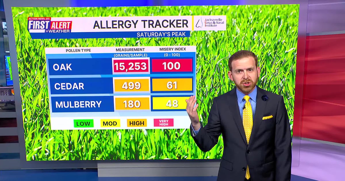
It’s been a sunny and warm day for SaturdaySunday is very similar, with cool morning temperatures and warm daytime highsSunday and Monday afternoon will both approach record highsOnshore winds surge in on Tuesday, cooling temperatures and bringing us a shot at rainThe best chance for showers will be near the coast on Tuesday, then inland in Northeast Florida WednesdayIt doesn’t look like a lot of rain, which is not good news for the drought, wildfire season or pollenThe oak pollen hit the highest numbers of the year so far on SaturdayCounts continue very high through at least TuesdayWildfire danger is also top of mind until this onshore wind on Tuesday
WATCH THE FORECAST | DOWNLOAD THE APPS
TONIGHT: Mostly Clear. Low: 55
TOMORROW: Mostly Sunny & Very Warm. High: 87 (Record: 90 – 1935)
MONDAY: Mostly Sunny. 58/87 (Record: 91 – 1935)
TUESDAY: Cloudy, Breezy & Cooler. Brief Shower. 60/69
WEDNESDAY: Partly Cloudy & Breezy. Isolated Shower. 57/73
THURSDAY: Partly Cloudy. 57/82
FRIDAY: Mostly Sunny. 59/85
SATURDAY: Partly Cloudy. 61/82
Follow Action News Jax Meteorologists on Twitter for updates:
Mike Buresh | Garrett Bedenbaugh | Corey Simma | Trevor Gibbs

ALLERGY TRACKER: See what the pollen counts look like in our area
LISTEN: Mike Buresh ‘All the Weather, All the Time’ Podcast
INTERACTIVE RADAR: Keep track of the rain as it moves through your neighborhood
SHARE WITH US: Send us photos of the weather you’re seeing in your area ⬇️