
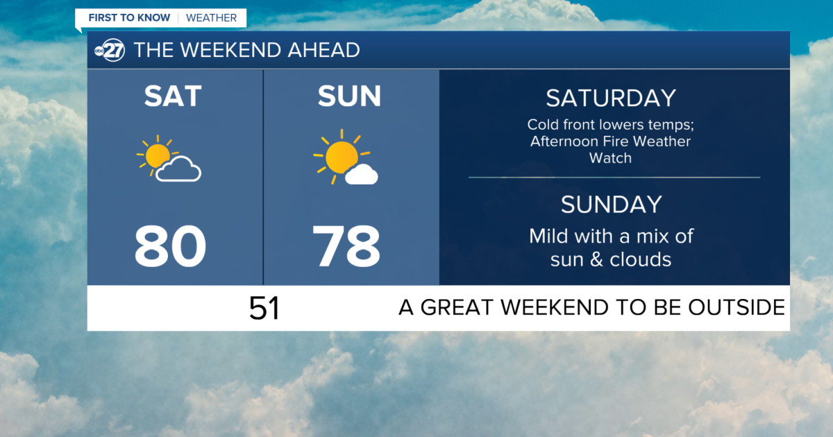
TALLAHASSEE, FL. — We have another warm and humid start to the day today. Temperatures are in the low to mid 60s, and there is patchy fog across the area. As this lifts after sunrise, clouds can remain, but much like yesterday they will clear quickly into the afternoon. We could be close to if not matching a record high for today with temperatures in the upper 80s.
We could be close to if not matching a record high for today with temperatures in the upper 80s. The sun will be shining in full force as we end the day and head into the night. Conditions tonight will be similar to this morning, except with more wind as a front approaches.
Abc 27
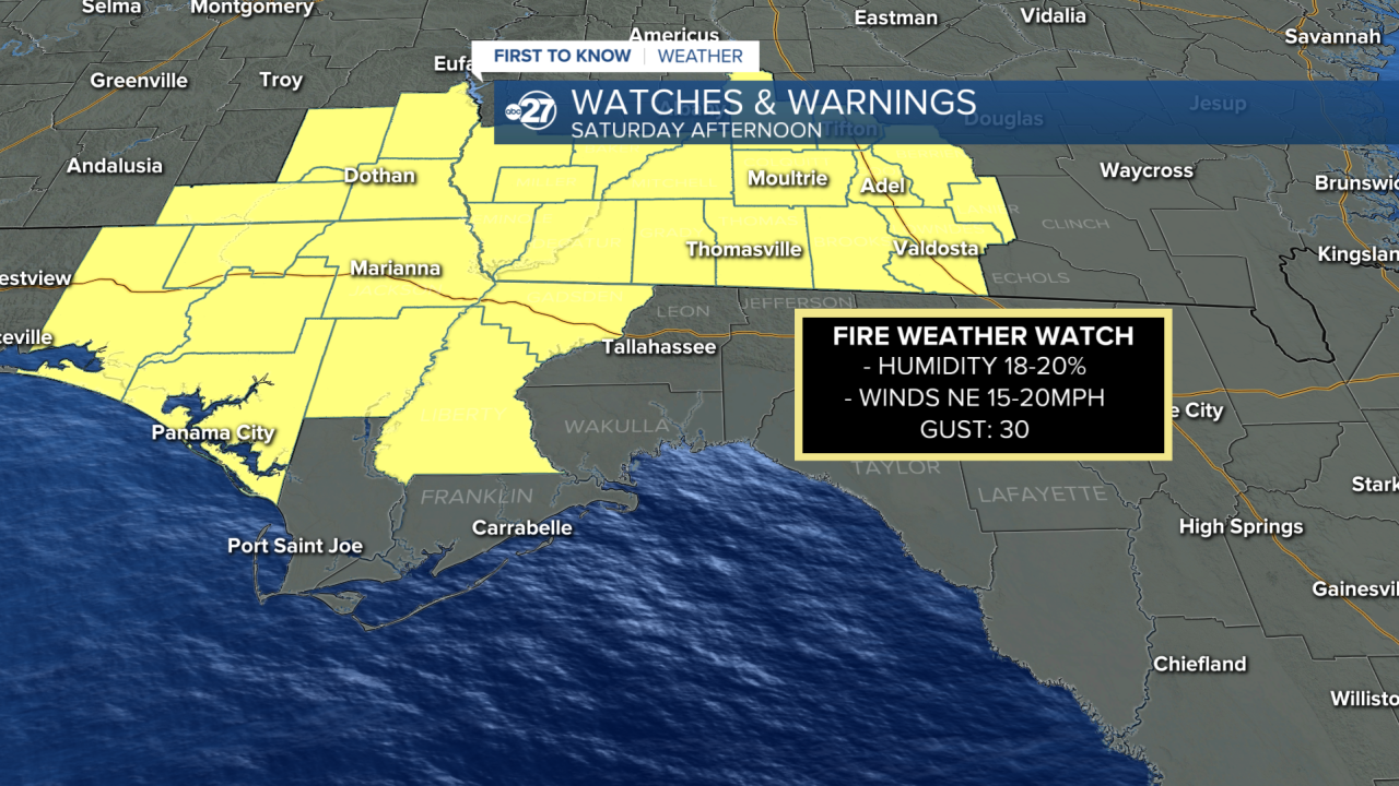
Winds will be strong tomorrow from the Northeast at 15-20 mph and gusts around 30 mph. As a result many counties in our viewing area are in a Fire Weather Watch for Saturday afternoon. With the increase in the drought to exceptional (level 5) the chance for fires to spark is higher. Please be mindful of those fire starters this weekend.
Want to see more local news? Visit the WTXL ABC 27 Website.
Stay in touch with us anywhere, anytime.