
JACKSONVILLE, Fla. — Notes from the First Alert Weather Team:
Noticeably warmer Sunday morning. We are starting the day in the 60s and 70s at the beaches.More clouds around and breezy today. Isolated showers in the evening.Another chance for showers and isolated thunderstorms on Monday, starting around midday. It’ll be cloudy and a bit more humid to start the week. Another chance for rain mid-week with a cold front that’ll bring COOL temperatures in time for Halloween.We will start Halloween day in the mid-40s and only warm up to the upper 60s!
TROPICS:
Hurricane Melissa rapidly intensified overnight and is now a major (Category 3) hurricaneRapid intensification is going to continue through today, and it is now forecast to be a Category five hurricane as it nears Jamaica This is going to be a slow-moving storm and should make landfall in Jamaica on Tuesday This is going to be a catastrophic event for the island with a multi-day period of damaging wind and heavy rainfall (rainfall totals could reach 2 ft)Melissa will then track over Cuba and the Bahamas before heading out into the Atlantic No threat to the US
First Weather Alert 7-day forecast:
SUNDAY: Breezy. Partly cloudy. Isolated showers. HIGH: 80
SUNDAY NIGHT: Partly to mostly cloudy. Breezy at the beaches. LOW: 66
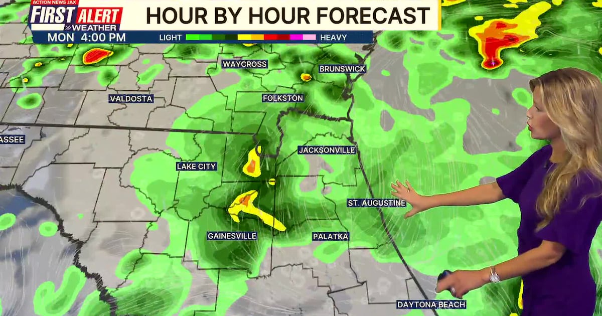
MONDAY: Mostly cloudy. Showers and isolated thunderstorms for the second half of the day. 66/77
TUESDAY: Partly cloudy and cooler. Breezy. 64/73
WEDNESDAY: Partly sunny. A few showers. 57/75
THURSDAY: Mostly sunny and much cooler. 51/67
HALLOWEEN: Sunny, cool, and dry! 46/67
SATURDAY: Sunny. 47/71

WATCH THE FORECAST | DOWNLOAD THE APPS
Follow Action News Jax Meteorologists on Twitter for updates:
Mike Buresh | Garrett Bedenbaugh | Corey Simma | Trevor Gibbs
ALLERGY TRACKER: See what the pollen counts look like in our area
LISTEN: Mike Buresh ‘All the Weather, All the Time’ Podcast
INTERACTIVE RADAR: Keep track of the rain as it moves through your neighborhood
SHARE WITH US: Send us photos of the weather you’re seeing in your area ⬇️