
Big changes are heading to Southwest Florida this week!
After a dry stretch of weather, we’ve finally seen some showers move into the area this afternoon thanks to a front sitting to our north.

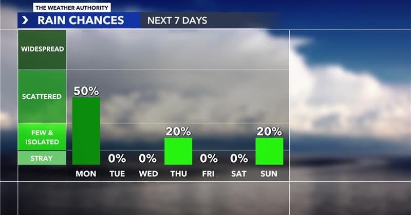
We will have another chance for showers and storms heading into tomorrow afternoon and evening as the front approaches. The front will finally sweep through late Monday and into early Tuesday to help usher in our first batch of drier and slightly cooler air.
Another cold front will move through heading into early Thursday morning and that one will bring a more significant drop in our temperatures. We can expect crisp conditions with lows in the 50s and 60s and highs in the 70s for the end of the work week.
Models are indicating that another front will move in next Sunday which could prompt a few showers up ahead of it with another round of dry and cool air moving in behind it.