
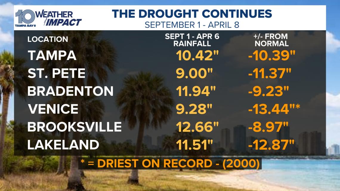
National Weather Service data shows that some areas have gotten less than half their normal rainfall since Sept. 1.
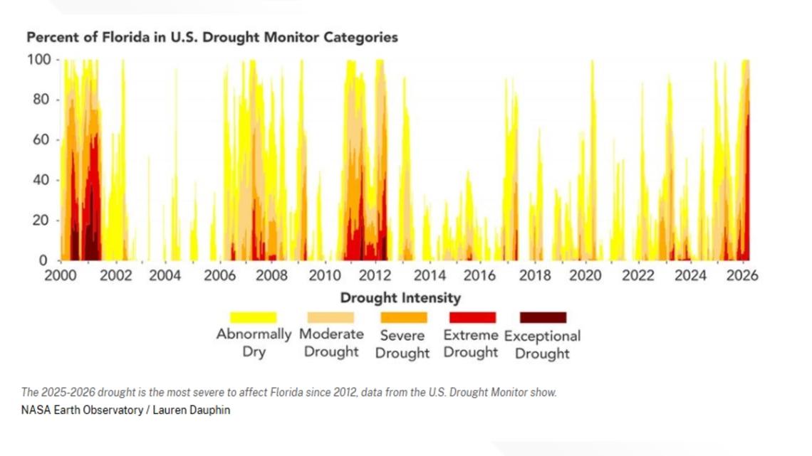
ST. PETERSBURG, Fla. — Florida’s current drought is the “most widespread and severe to affect the state since 2012,” according to NASA researchers citing the U.S. Drought Monitor.
Despite recent rainfall, records show Florida is still dangerously dry, with nearly 80% of the state under extreme conditions in April 2026.
National Weather Service data shows that some areas, including those here in the Tampa Bay region, have gotten less than half their normal rainfall since Sept. 1, 2025.
St. Petersburg has only seen 9 inches of rain since Sept. 1, compared to the normal 19 inches, NASA says. That’s the driest year on record for that time period.
So, what does this mean for the Tampa Bay area?
Florida’s underground water supply, often used for drinking water and farming, is already drying up, according to data from NASA and the German Research Center for Geosciences.
This could pose a threat to crops, which were already affected by deep freezes in February. It could also mean tightening the already existing restrictions on lawn watering, car washing, fountains and water service at restaurants.
Perhaps the most dangerous impact is the threat of a severe wildfire season. Fire officials told 10 Tampa Bay News that current drought conditions could make for one of the worst wildfire seasons in more than a decade.
In just the first three months of 2026, the Florida Forest Service has already responded to more than 1,600 wildfires. That’s more than half of what crews typically see in an entire year.
Is this the worst drought in Florida history?
No. NASA says that, based on the U.S. Drought Monitor, the 2000–2001 drought was more intense, lasted longer and affected a larger area of Florida.
10 Tampa Bay News reporter Andy Paden contributed to this report.