
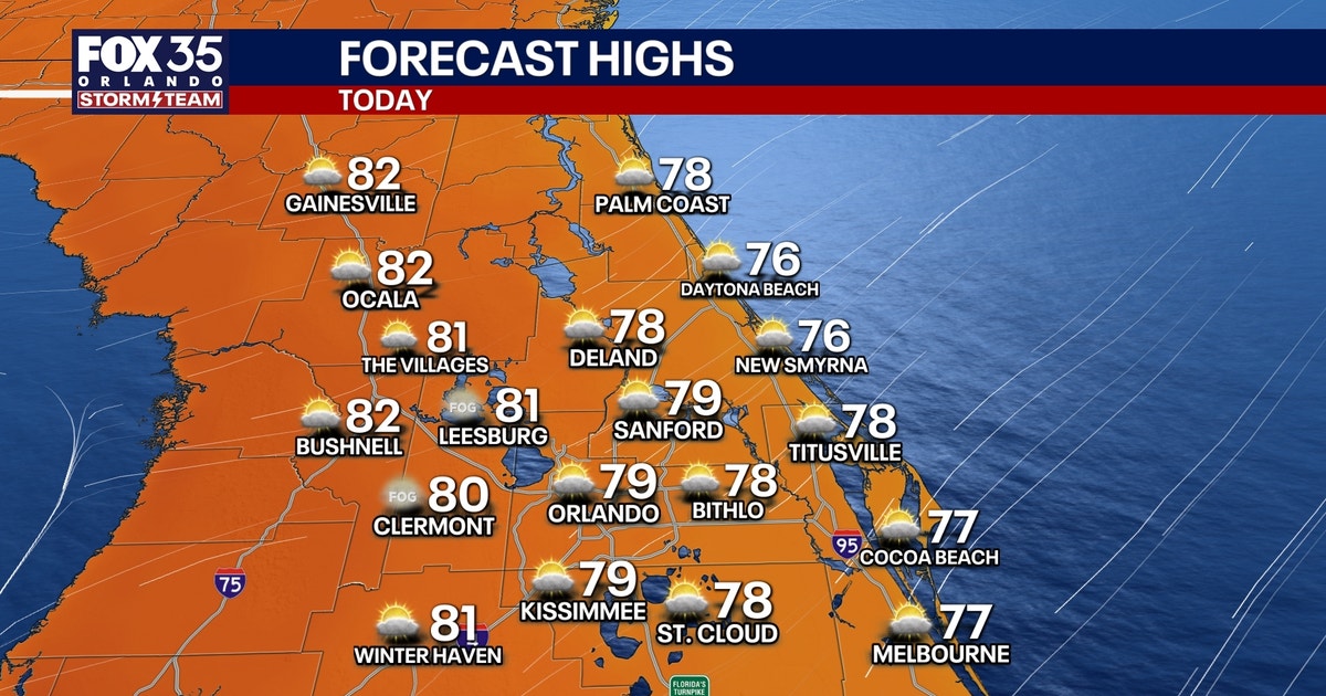
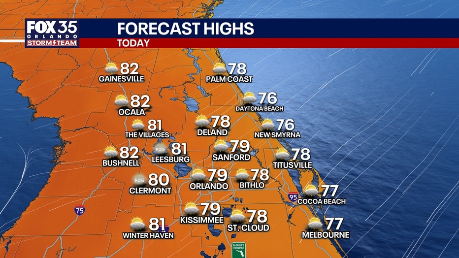
ORLANDO, Fla. – We’re finally beginning to dry out across Central Florida, with only the slim chance of an isolated light shower or two possible for today’s forecast.
An onshore flow will help to keep us at a 20% chance of a few of these lighter showers, mainly taking place near the coast.
CLICK TO DOWNLOAD THE FOX LOCAL APP
We’ll see a mix of sun and clouds for those who don’t see the rain, and the sunshine will be a sight for sore eyes!
Temperatures will be a few degrees below average, climbing into the mid 70s along the coast and into the upper 70s to near 80s inland.
SIGN-UP FOR FOX 35’S BREAKING NEWS, DAILY NEWS NEWSLETTERS
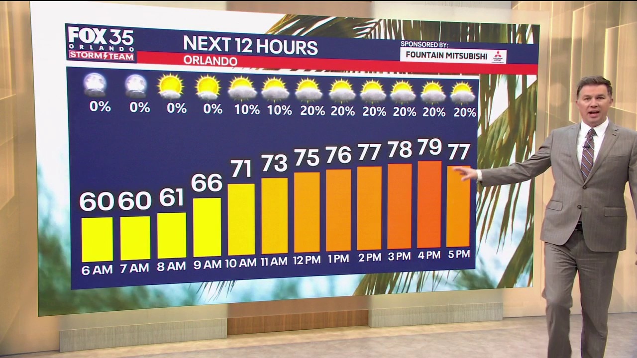
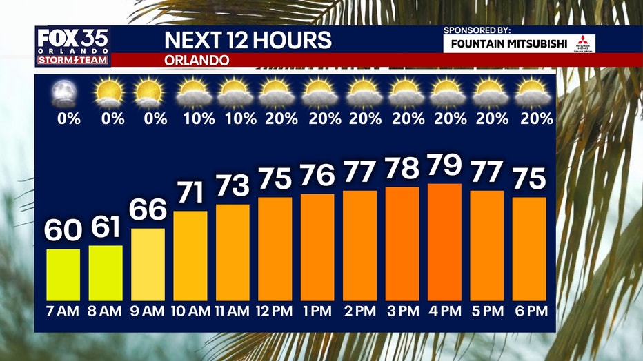
We’ll dry out overnight with partly to mostly clear skies overhead. Temperatures will cool off into the upper 50s and low 60s for Saturday morning lows.
We finally will dry out as sunshine returns and carries us into the weekend.
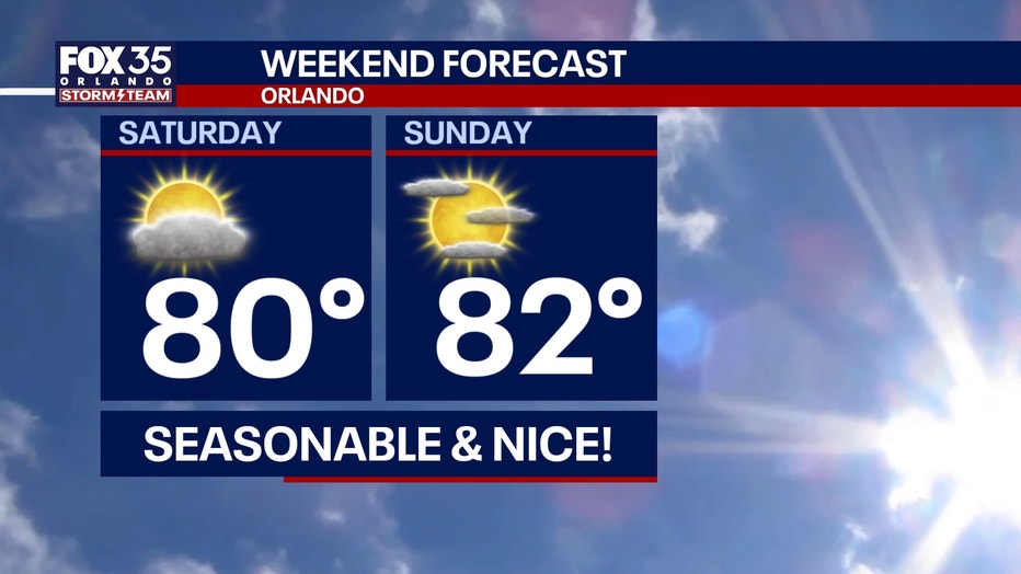
It will be a beautiful stretch with sunshine and plenty of dry time that lasts into early next week. High temperatures will steadily bounce back into the low and mid 80s for much of next week.
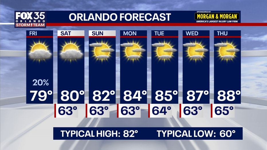
We’ll even approach the upper 80s by the end of the work week.
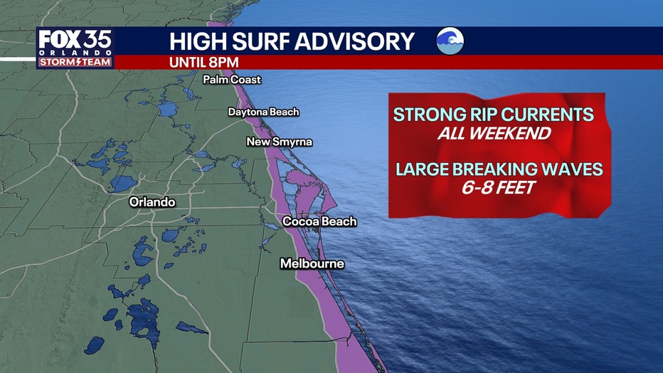
At the beaches, the threat of dangerous and strong rip currents will last through at least this weekend. Local officials urge beachgoers to stay out of the water, even if you’re a strong swimmer.
The Source: This story was written with information from the FOX 35 Storm Team.