

ORLANDO, Fla. – Hurricane Melissa became a powerful Category 5 hurricane in the Caribbean on Monday. It was mostly stationary and about 150 miles from Kingston, Jamaica, the National Hurricane Center said.
Melissa had sustained winds of 175 mph – increasing from 165 a few hours prior. It is moving west-northwest at 2 mph, the National Hurricane Center said.
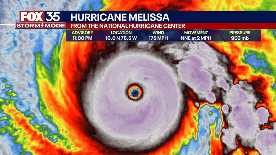
“Tropical storm conditions are occurring in Jamaica, and catastrophic and life-threatening hurricane-force wind conditions are expected to begin tonight and continue into early Tuesday,” the NHC said in its 2 p.m. advisory.
 Hurricane Melissa tracker: Cone, path, spaghetti models
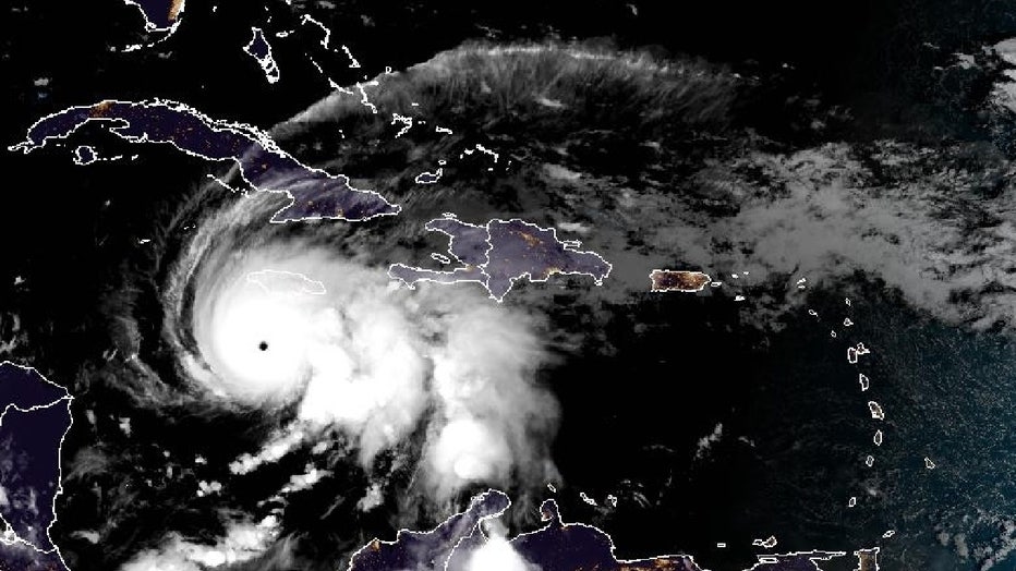
The core of Melissa is expected to move over Jamaica Monday night and early Tuesday, and move across Cuba Tuesday night and across the Bahamas Wednesday, NHC said.
Melissa became a Cat. 5 storm on Monday morning and is expected to maintain intensity at landfall, FOX 35 meteorologists confirmed Monday afternoon.
Additional strengthening is possible, though a Cat. 5 is the highest level on the Saffir-Simpson Wind Scale – which is used to rate hurricane levels.
Hurricane Melissa impacts Rainfall totals of 15–30 inches in Jamaica through WednesdayAn additional 8–16 inches of rain in southern Hispaniola on Wednesday; 15–20 inches of rain for Cuba; 4–8 inches of rain for the Bahamas.”Catastrophic” flash flooding and numerous landslides are likely in Jamaica and Cuba. Catastrophic and life-threatening hurricane-force wind conditions are expected to begin Monday night and continue into early Tuesday in Jamaica, the NHC said. Flash flooding is the major threat in the Bahamas, the NHC said.
The Source: The information is from the National Hurricane Center.